Where Is the Geographic Center of North America?
North Dakota is home to two cities which both claim to be the geographical center of North America. For years the cities of Center and Rugby have contested which is the actual geographical center of North America. Different scientists have used various methods to determine the geographical center of the continent, however, changes in sea level due to glacial melt have resulted in a shifting in its position. The lack of a clear definition of what constitutes a geographic center also contributes to the problem of its identification. More recently, the debate between the two North Dakota cities ended with the accurate calculation of the exact geographic center of North America by University of Buffalo professor Peter Rogerson.
Center, North Dakota
Located in Oliver County, North Dakota, Center is the new geographical center of North America. Coincidentally, Center is also the geographical center of Olive County. Center replaced Rugby after calculations by Peter Rogerson, professor of geography from the University of Buffalo. Rogerson used the azimuthal equidistant projection method to determine the geographical center. Based on his calculations, Rogerson concluded that the geographical center was located in the middle of the city of Center, 145 miles from the previous geographical center. The findings are considered to be more accurate given that the azimuthal equidistant projection method takes into account the Earth’s curvature.
Rugby, North Dakota
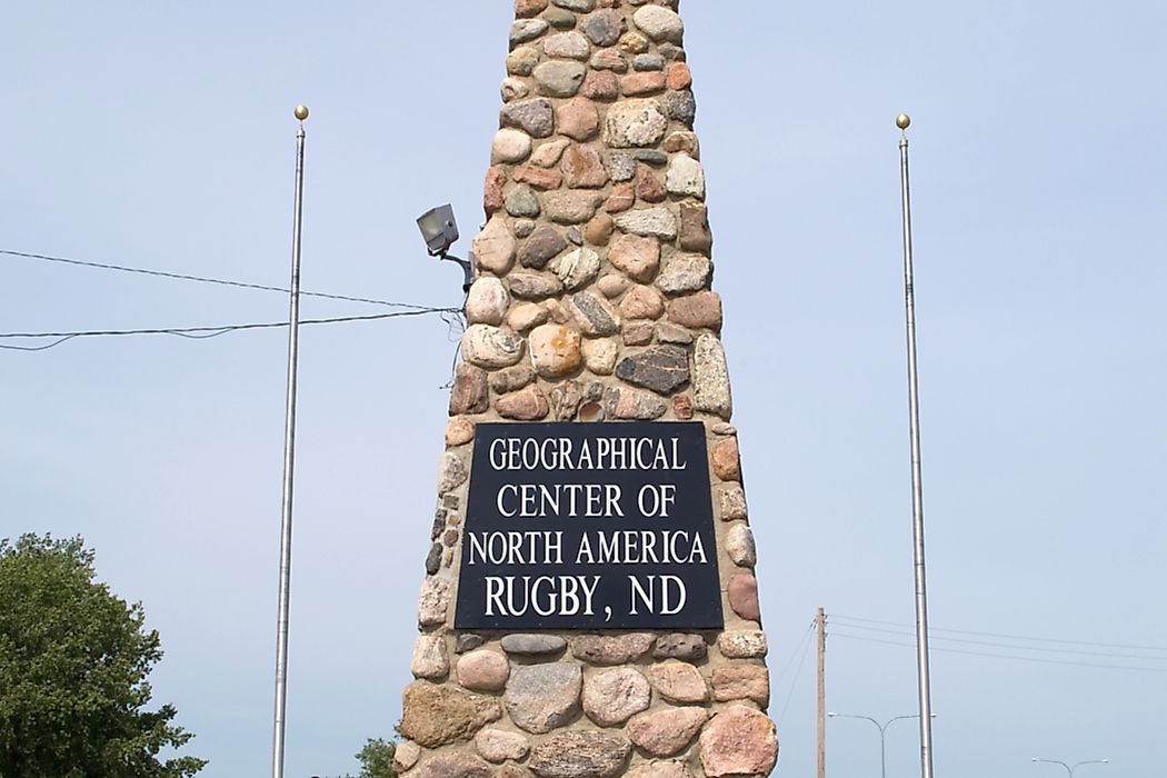
The United States Geological Survey (USGS) designated a point 15 miles southwest of Rugby, North Dakota in 1928 as North America’s geographical center. To mark the center, the people of Rugby erected a 15 ft obelisk in 1931 made from the rock as a monument to mark North America's geographical center. When erecting the obelisk, Rugby did not have official status as the geographical center, but the town went ahead in claiming the title, which it maintained for 90 years until a different calculation method placed the geographical center more than 100 miles from Rugby. However, the obelisk remains a famous tourist attraction for Rugby. The USGS used the suspended cardboard method to determine the center of North America.
Azimuthal Equidistant
The azimuthal equidistant projection is a method of projecting maps onto a flat surface using a central point. The method projects a 3D surface on a 2D dimension, taking into consideration the curvature of the Earth. This method produces more reliable results, as the exact distance on the ground is presented. Using this projection, it is possible to calculate the central point accurately. Rogerson used digital records of US boundaries alongside his own computer program to calculate the exact center of North America. Previously, Rogerson had used his formula to recalculate some geographical centers, and for most findings, previous measures were highly accurate considering the methods used to estimate them.
Accuracy
The United States Geological Survey used the cardboard method to determine the geographical center of North America. This method places a rough estimate of the geographical center. In this case, the geographical center fell in North Dakota. Professor Rogerson, using the mathematical calculations, found the accurate location of North America's geographical center. His method of measuring geographical centers is more reliable.


