Where is the Geographic Center of the US?
The geographical center of the US lies in South Dakota in the town of Belle Fourche. About 20 miles to the north of Belle Fourche at latitude 44 58 02.07622N and longitude 103 46.60283W lies the exact geographical center location of the 50 states of the US. The US Coast and Geodetic survey designated the center of the nation in South Dakota in 1959 resulting from the inclusion of Alaska and Hawaii as states of the US. Before the move in 1959, Lebanon, Kansas was the geographic center of the nation. The exact location of the center is in a private pasture field. However, a monument marking the geographical center of the US was constructed in the city.
Center Of The Nation Monument
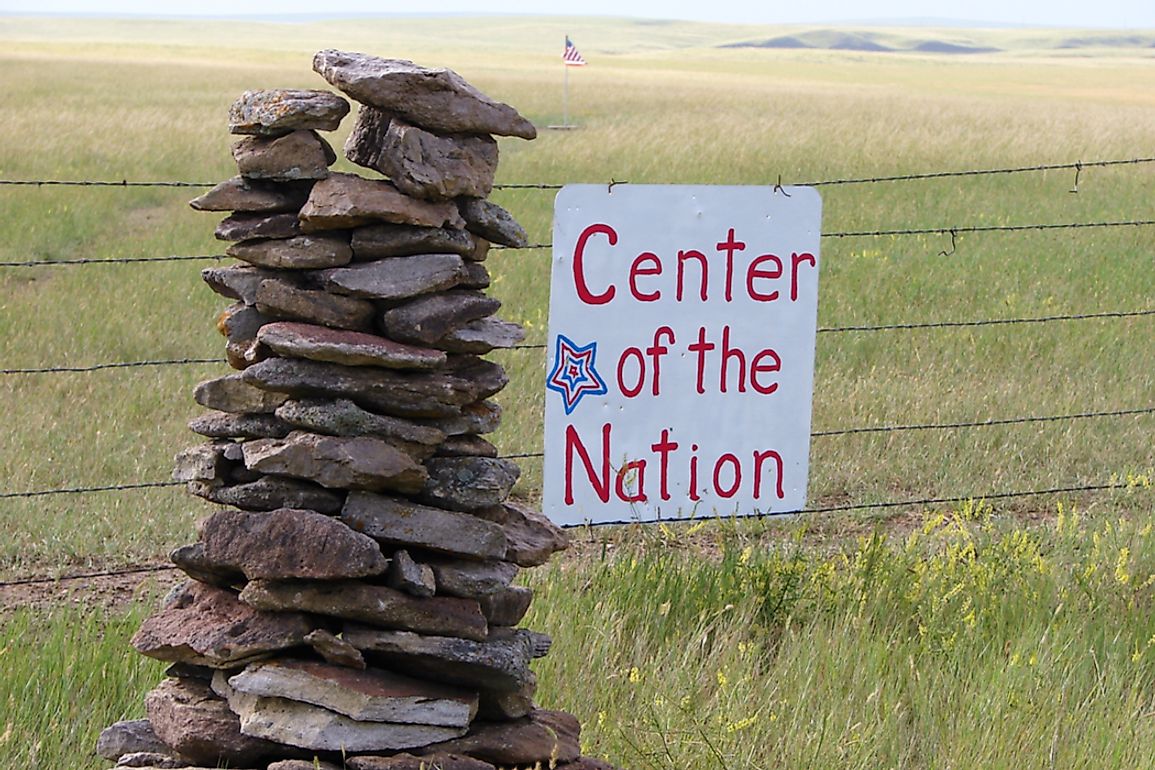
Located at the Tri-State museum and the Visitor Centre, the Centre of the Nation Monument is a designator marker indicating the location of the geographical center of the US in Belle Fourche. The monument has a 21-foot diameter made from granite. The monument is built in the shape of a compass with a map of the US. Belle Fourche is marked at its center with a metallic disc, just like a geographical marker. The Belle Fourche Chamber of Commerce unveiled the monument in 2007. While the monument is located at least 20 miles away from the actual center, it provides a more memorable and accessible point of reference to locals and tourists of being in the city where the center of the US lies. The need to place monument away from its exact location arose since the owner of the field in which the actual center does not desire to develop his land. However, at the actual center are a free-flying American flag and a sign indicating the center of the US. The owner, however, allows tourists to see and experience the actual center of the US.
Determining The Center Of The US
To get the geographical area of a country is a complicated task that presents many challenges due to factors such as changing coastlines and the irregularity of the density of a country. However, to create a reference point for cartographers and researchers, the US National Geodetic Survey estimated the center of the nation to be in Belle Fourche. To determine this center, they drew a map of the US on cardboard and traced it out then suspended the map using a pin. This method, called the center of gravity method assumes that the point at which the map balances is the actual center of the landmass. After the addition of Alaska and Hawaii, the new center of the US was determined as private land in Belle Fourche. Due to the problems of inaccuracy in estimating the center of a landmass, the NGS includes the area on a 20-mile radius as part of the center.
Changes To The Geographic Center
The geographic center of the US has changed several times during the history of the US due to the expansion of the state. While no modifications have been made to the US boundaries since 1959, the question of how long Belle Fourche remains as the geographic center of the US depends on whether any physical expansion will be made to the US.