Arctic Ocean
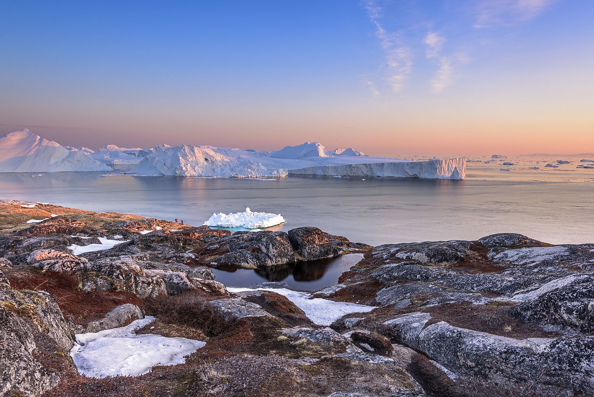
The Arctic Ocean is a small, shallow ocean on the North Pole. It encompasses an area of approximately 5.427 million square miles, slightly smaller than Russia but larger than the Antarctica continent. Although it is recognized widely as an ocean, some oceanographers consider the Arctic as the Arctic Mediterranean Sea or the Atlantic Ocean’s estuary. The Arctic Ocean is the world’s coldest ocean. It is covered by three different ice types, including fast ice, polar ice, and pack ice. The ocean is surrounded by North America and Eurasia. The Arctic Ocean is covered by sea ice most parts of the year.
Contents:
- Geography
- Oceanography
- Climate
- Ocean Floor Topography
- Brief History
- Marine Life
- Environmental Concerns

Geography
The Arctic Ocean is a circular basin, spanning 5.427 million square miles. It is almost 1.5 times the United States of America's size, but slightly smaller than Russia. The Ocean is 18,210 feet deep at the deepest point (Mollow Hole), with an average depth of 3,406 feet below the sea surface. It is the shallowest ocean partly because of the wide surrounding continental shelf. The Ocean’s mean volume is approximately 5.5 million cubic miles. The Arctic Ocean is bounded to the northeast, east, and southeast by Russian Federation, northwest by the US, west by Canada, southwest by Greenland, and south by Iceland and Norway.
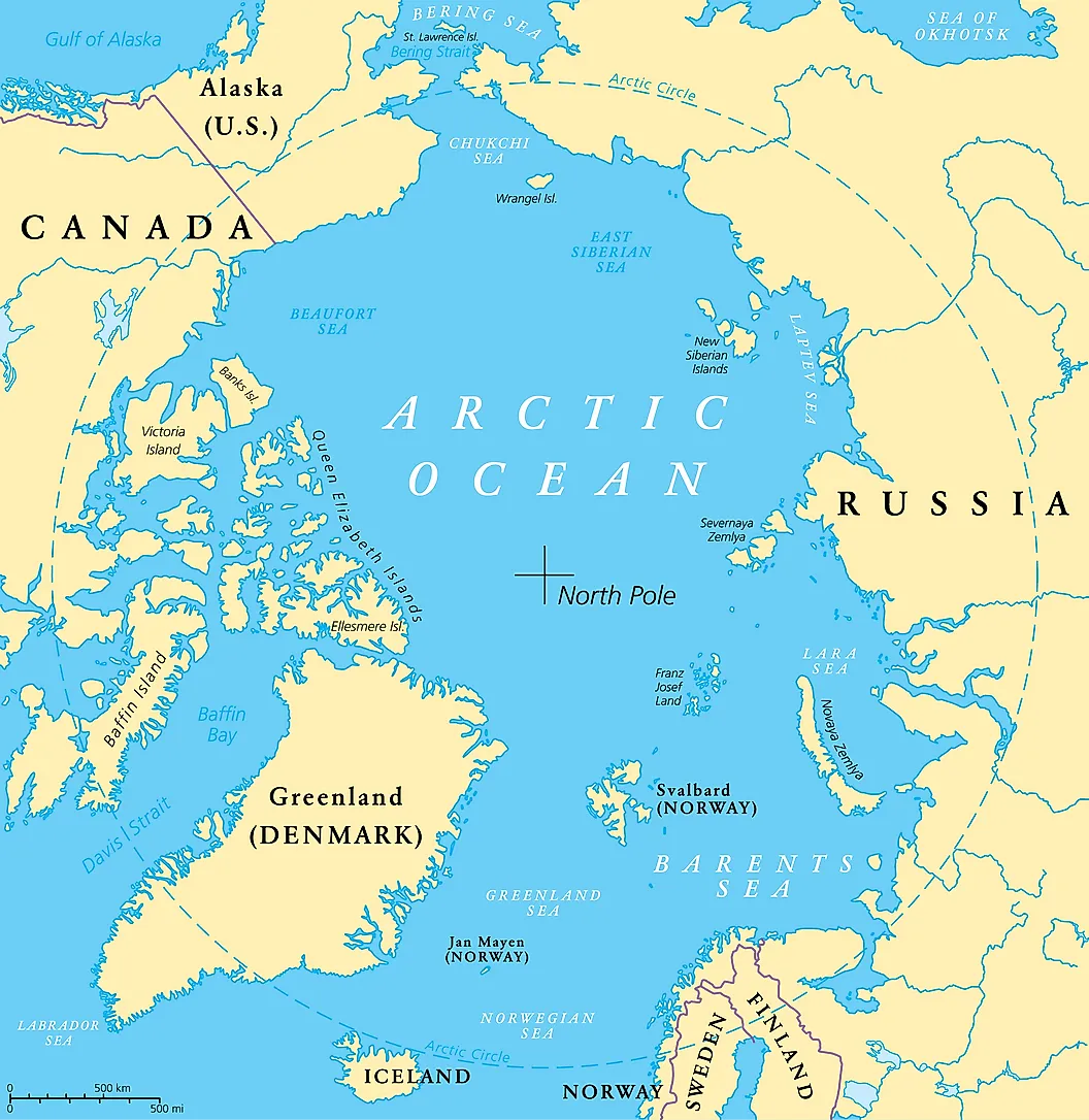
The Arctic Ocean includes numerous marginal seas, bays, and straits, including Barents Sea, Baffin Bay, Beaufort Sea, Greenland Sea, Norwegian Sea, Iceland Sea, Chukchi Sea, Hudson Bay, and East Siberia Sea. The Bering Strait connects the Arctic Ocean to the Pacific Ocean, while the Labrador Sea and the Greenland Sea connect it to the Atlantic Ocean.
Oceanography

The Arctic Ocean can be distinguished from other oceans by its chemical, physical, and biological processes. Most notable are the ice pack and the sea ice, which reduce energy exchange between the ocean and the atmosphere. The ice also reduces the amount of light penetration needed by the marine plant for their photosynthetic process. However, the Arctic ice has been decreasing in recent years at a 12.85% rate every decade, from 6.02 million square miles in winter in 1980. Currently, the seasonal variation is about 2.7 million square miles, with maximum ice cover in April and the least ice cover in September. In some zones, the sea ice compresses and piles up to form ice packs. Between October and June, the Arctic Ocean is almost entirely covered by ice.
The ocean has slightly lower salinity and temperature than the other oceans, especially on the top layer. The salinity affects the ocean’s density than the temperature does, making the Arctic Ocean relatively stable. The ocean’s lower saline level is attributed to frequent icing and melting, as well as the inflow of large quantity of fresh water from the Canadian and Siberian rivers, including Mackenzie River (Canada’s longest river), Ob River (world’s 7th longest river), Lena, and Yenisei. The freshwater from these rivers mostly floats on the denser, saltier ocean water.
Although the Arctic Ocean is relatively isolated from the rest of the world’s oceans, it still receives water from the Atlantic and Pacific Oceans. It is divided into three water masses. The Arctic Bottom Water, also known as deeper waters, begins from 3,000 feet to the lowest depth. It is composed of denser, saltier water and mainly fed by the Greenland Sea Deep Water and water from Arctic Shelf. The second water mass is the Arctic Water at a depth of 490 feet to 2,950 feet. This water has the same salinity as the deeper water, but it is much warmer. The final water mass is the Arctic Surface Water, at a depth range of 490 feet to 660 feet. This water mass contains mainly water from the Atlantic Ocean through the canyons.
Climate

The Arctic Ocean is dominated by the polar climate, characterized by lower temperatures. Winters are extremely cold, with frequent low temperatures, stable weather conditions, and polar nights. In summers, the region experiences continuous midnight sun, with air temperature rising slightly above 32 degrees Fahrenheit. Cyclones are frequently experienced on the Atlantic side and are common during summer, bringing snow or rain. The region is cloudy almost all year round, especially in summer.
The mean surface water temperature is about 28.8 degrees Fahrenheit. As the seawater nears freezing point, its density increases, causing it to sink below the freshwater. Currently, the Arctic region warms at least twice faster than the rest of the Earth’s regions.
Ocean Floor Topography
Between the late 19th century and the mid-20th century, geographers and oceanographers believed the Arctic Ocean was one large basin. However, explorations in 1950 and beyond revealed a complex ocean floor consisting of two deep ocean basins. The two ocean basins are divided into four smaller ocean basins by submarine ridges. The ridges run for about 1,100 miles between New Siberian Islands and Ellesmere Island. The mountain ridge was discovered in 1948 by Russian scientists, who named it Lomonosov Ridge.
The Arctic Ocean is divided into two basins-Eurasian Basin and Amerasia Basin-by the Lomonosov Ridge. The ridge is 40-120 miles wide, with a mean relief of 10 thousand feet. The Mid-Atlantic Ridge’s extension divides the Eurasia Basin into two small basins (Fram and Nansen Basins). The North Pole is located in the Fram Basin. The Amerasia Basin is divided into two basins by the Alpha Ridge (Makarov and Canada Basin). Canada Basin is the Arctic Ocean’s largest sub-basin.
Brief History

The American polar region was first inhabited at least 50 thousand years ago. At this time, the sea level was falling, allowing people to move between Alaska and Siberia across the Bering land bridge. However, the North Polar Region remained largely unexplored for much of European history. It was only described as a region where the sun sets for just three hours and water turns into a solid substance on which people can neither sail nor walk.
The Arctic Ocean was not crossed until the 20th century. The explorers who came closest to the North Pole reported that the region was covered by a thick polar cap all year round. In 1969, Wally Herbert became the first person to cross the ocean’s surface, from Alaska to Svalbard. Nautical transits have been made over the Arctic Ocean since 1958.
Marine Life

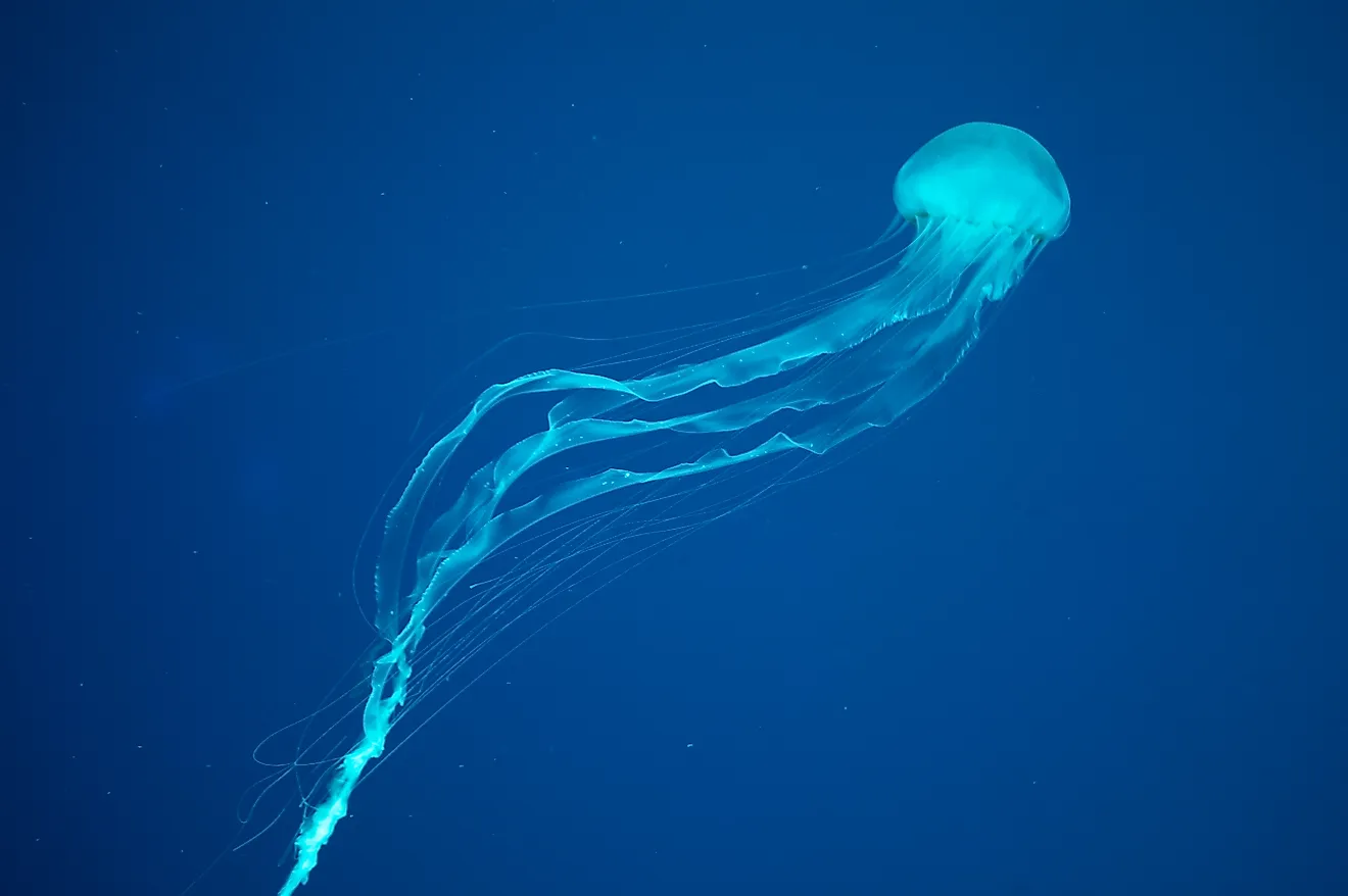
The extreme climate of the Arctic Ocean and the 2-6 months of polar night and midnight sun that prevails in the Arctic region limits the growth of primary producers like algae and phytoplanktons to the short period of spring and summer. Primary consumers like zooplankton depend on the former for nutrition. The secondary consumers in the Arctic Sea ecosystem include various species of fish like herring, capelin, and cod. The apex predators or tertiary consumers include polar bears, whales, seals, etc.
Environmental Concerns

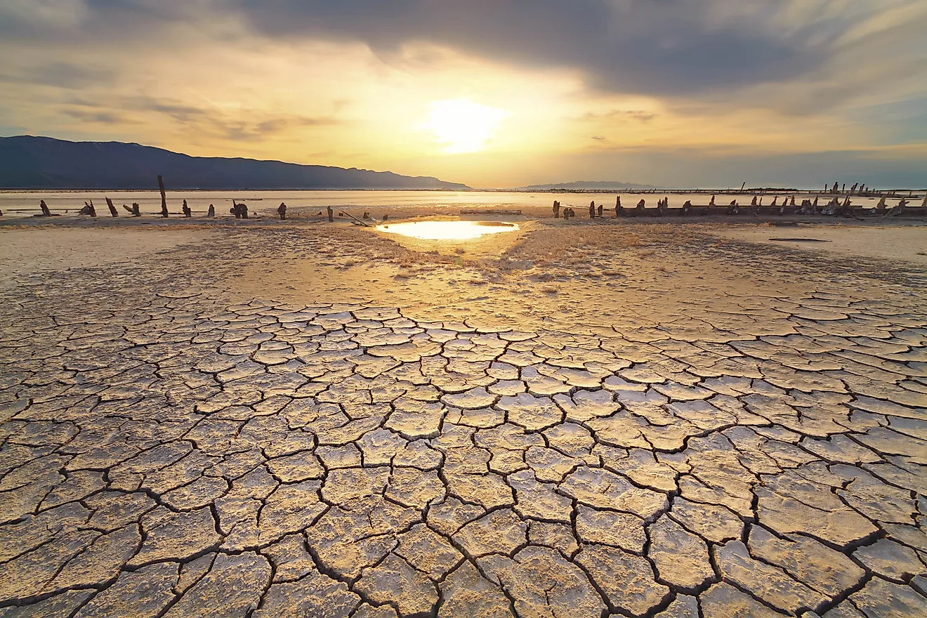
Arctic ice thinning is a major concern for environmentalists and countries around the ocean. The Arctic sea ice is reducing at the rate of 12.85% annually for the last 3-4 decades. According to recent research, the ocean might become ice-free in summer for the first time in 2040. As the sea ice decreases, the sea level and vegetation area damaged by a saltwater increase. The sea ice melting is also causing polar bears to extend their range towards human settlements. The Arctic Ocean’s contamination by radioactive substances is also a major environmental concern.