Where Are The Atlas Mountains Located?
The Atlas Mountains are a mountain range in Northwest Africa. The range spans a length of approximately 1,600 miles, stretching across Tunisia, Algeria, and Morocco, and separates the Atlantic and Mediterranean coasts from the Sahara Desert. The highest peak in the range is Toubkal, which is located in southwestern Morocco and has an elevation of 13,671 ft. The Atlas Mountains were formed 80 million years ago by the collision of the Eurasian and African plates. The mountainous region is rich in numerous minerals including iron ore, silver, copper, rock salt, phosphate, mercury, anthracite coal, natural gas, marble, and phosphate. The Atlas Mountain range has divided a series of subranges: Anti-Atlas, High Atlas, Middle Atlas, Saharan Atlas, Aurès Mountains, and Tell Atlas.
Anti-Atlas Range
The Anti-Atlas range covers a distance of 420 miles, beginning at the coast of the Atlantic Ocean in southwest Morocco, extending south to Ouarzazate, and then east to Tafilalt. The southernmost part of the range borders the Sahara, while the Jbel Saghro range forms the eastern boundary, and the High Atlas range flanks the northern section. The highest peak in the range is Jbel Sirwa, which has an elevation of 10,840 ft.
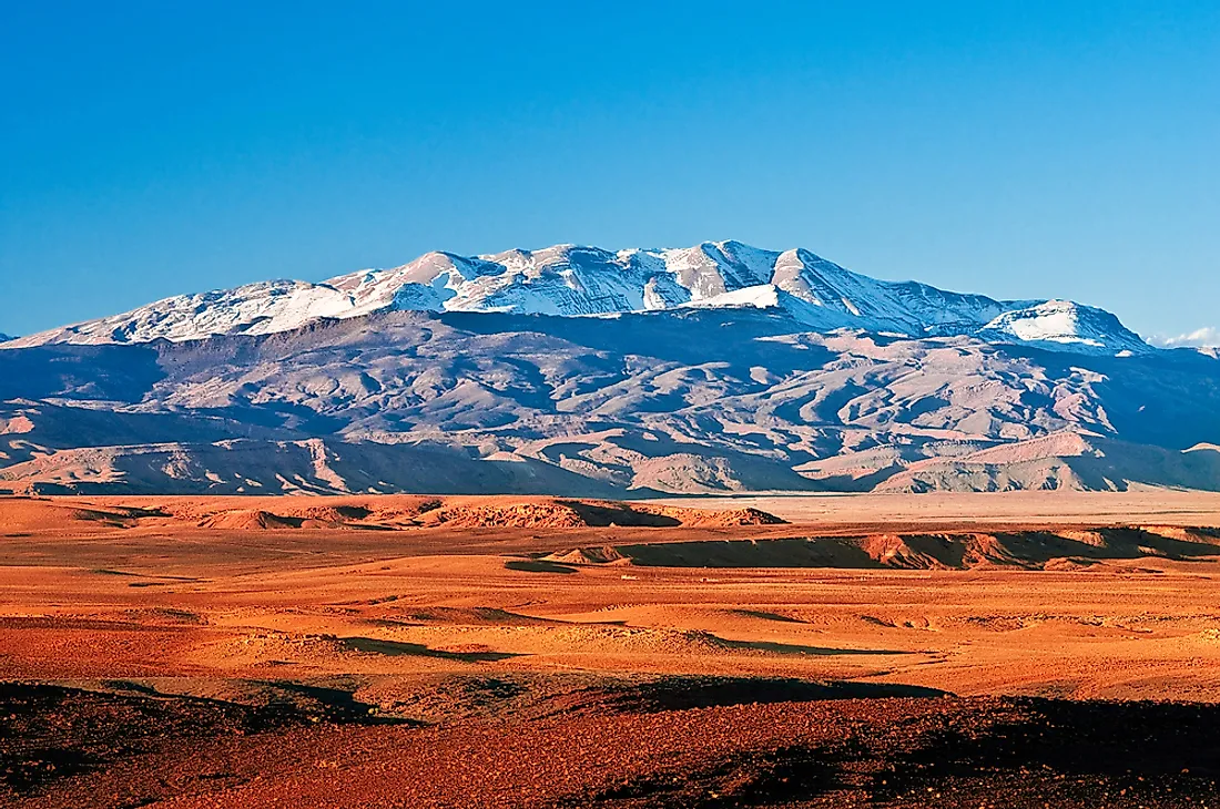
High Atlas Range
The High Atlas range is located in central Morocco. It rises from the coast of the Atlantic Ocean and then stretches east to Morocco's border with Algeria. The two highest peaks of the Atlas Mountains, Toubkal (13,671 ft) and m'Goun (13,356 ft), are located in the High Atlas range. The landscape of the range is characterized by green valleys, deep gorges, and rock outcroppings.
Middle Atlas Range
The Middle Atlas is located entirely within Morocco and is situated south of the Rif mountains and north of the High Atlas range. It receives more rainfall than the other subranges, making it an important water catchment area. The highest peak in the Middle Atlas range is Jbel Bou Naceur, which has an elevation of 10,960 ft. The slopes of the range are home to the world's largest population of Barbary macaque, also known as the Barbary ape.
Saharan Atlas Range
The Saharan Atlas range runs parallel the Tell Range, located to its north. The range is primarily situated in Algeria, but extends east into Tunisia. The average elevation of the Saharan Atlas range is less than the High Atlas. During the wet season, the southern slopes can sustain agriculture, although it remains dry for much of the year. Mount Chélia, which has an elevation of 7,638 ft, is the highest peak in the Saharan Atlas.
Tell Atlas Range
The Tell Atlas range is the longest section of the Atlas Mountains, covering a distance of about 930 miles, most of which is located within Morocco. The range runs parallel to the Mediterranean coast, and stretches across Morocco, Algeria, and Tunisia. The Moroccan capital, Algiers, as well as the city of Oran, are both located within the Tell Atlas range.
Aurès Mountain Range
The Aurès Mountains occupy the easternmost section of the Atlas Mountains. The mountains are located on the border between Tunisia and Algeria, and the slopes of the range support agricultural development during the wet season, except for the northern side, which is characterized by extremely rough cliffs. Additionally, the Chaoui people inhabit certain parts of the region.


