The Most Extreme Points of India
India is a country in the South Asia. It is bordered by the Indian Ocean to the south, the Arabian Sea to the southwest, and the Bay of Bengal to the southeast. Pakistan is their neighbor to the west, with China, Nepal, and Bhutan to the northeast, and Myanmar and Bangladesh to the east. Below are the most extreme points of India.
6. Northernmost Point in India
The northernmost point in India is Indira Col. It is located in the state of Jammu and Kashmir. Indira Col is a mountain pass on the Indira Ridge in the Siachen Glacier in Karakoram Mountains. It was named after Goddess Lakshmi by Bullock Workman in 1912.
The undisputed point of India is found in the Miyar Valley next to the Kang La pass.
5. Easternmost Point in India
The easternmost points of India are located in the state of Arunachal Pradesh. The state is bordered to the north by China and to the East by Myanmar. The easternmost undisputed point of the country is Vijaynagar in the district of Changlang.
The disputed easternmost point in India is found at Kibithu. Kibithu is a town in the district of Anjaw in Arunachal Pradesh state of India. It lies at the junction between India, Myanmar, and China. Its bordered to China in the north and by Myanmar in the east.
4. Southernmost Point in India
Indira Point, located in the Nicobar District of the Andaman and Nicobar Islands, is the southernmost point of India. Formerly known as Pygmalion Point, it was renamed after Indira Gandhi on October 10, 1985.
The southernmost Point in mainland India is Cape Comorin,. Also known as KanyaKumari, it is located in the KanyaKumari District of Tamil Nadu. It is nicknamed the “Evergreen Town of India” and is bordered to the south by the Laccadive Sea. It is an important trade center. Due to its rich history and architecture, KanyaKumari is a tourist attraction and well known for its art and religion, with many pilgrims making their way to the cape for prayers.
3. Westernmost Point in India
Sir Creek is the westernmost point of India. It is located in Kutch, near Guhar Moti village in the Indus Delta in the state of Gujarat. Sir Creek partitions the Indian state of Gujarat from the Pakistani Province of Sindh. The area is disputed with both India and Pakistan laying claims to the creek. The 96 km creek drains into the Arabian Sea and the area around it is rich in natural gas and oil, making it of great economic importance.
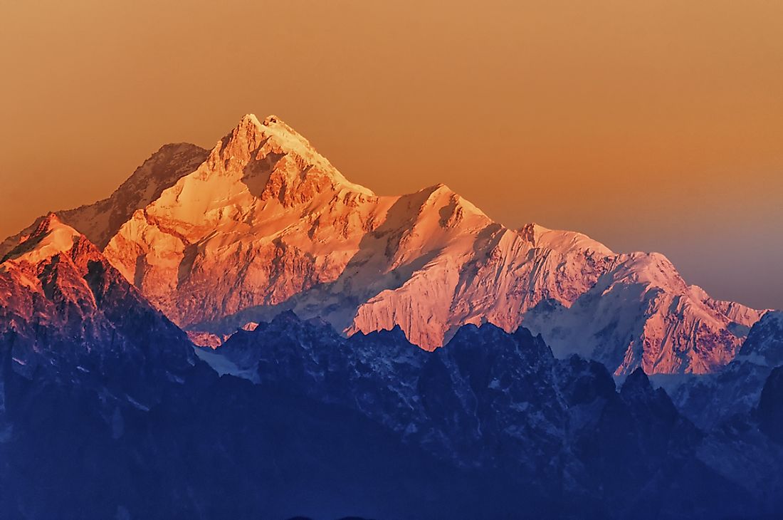
2. Highest Point in India
K2, also known as Mount Godwin-Austen/Chhogori is the second highest mountain on earth after Mount Everest. It stands at an altitude of 8,611 m above sea level. It is located at the Pakistan-China border, in the Pakistani state of Gilgit-Baltistan and Xianjiang state of China, in the Karakoram range. A European team of explorers first surveyed the mountain in 1856 and it as for a while considered the highest mountain on earth.
Kangchenjunga stand at an altitude of 8,586m above sea level, making it the third highest mountain on earth and the second in the Himalayas. It is the highest indisputed point in India. It is located in the Indian-Nepal border, and lies in the Taplejung district of Nepal and Sikkim in India.
1. Lowest Point in India
Kuttanad is the lowest point of India, lying at an elevation of 2.2 m below the sea level. It is situated in the state of Kerala, in the Alappuzha and Kottayam districts. The major economic practice is farming, especially rice farming done by paddy cultivation. The major rice farms were reclaimed from Lake Vembanad between the19th and 20th centuries to 1920. Official languages are Malayalam and English.


