The Most Extreme Points of Indonesia
Indonesia is a sovereign state that is primarily located in southeast Asia and some parts located in Oceania. Like any region, the nation has its extreme points. These points may be based on the four cardinal points, height, and other forms of criteria. Aside from the major extreme points of mainland Indonesia, each island also has its own extreme points as well. These major islands include Sumatra, Java, Kalimantan, and others.
6. Northernmost Point in Indonesia
The northernmost point is located at Rondo Island, which is in Sabang City’s Sukakarya Sub-district in the larger province of Aceh. The point lies at the point denoted by the coordinates 6°4′30″N 95°6′45″E. The bigger outlying island of Rondo is relatively small with an area of about 0.25 square miles. The island is described by some as a dead island since it has no clean water sources and has been overrun by animals such as snakes and rats. The island is bordered by India's Great Nicobar Island, which is some 101 miles to the north. Incidentally, Indira Point, which lies on India's Great Nicobar Island, is the southernmost land border of India.
5. Southernmost Point in Indonesia
Lying on the latitude 11°S, this point lies on the point denoted by the coordinates 11°0′27″S 122°52′29″E in Pamana Island. This island is a tiny one and lies in the East Nusa Tenggara province of Indonesia’s Lesser Sunda Islands. In addition to being the southernmost point of Indonesia, this point is also the southernmost point of the whole of Asia. On an administrative level, the island is under the jurisdiction of the Rote Ndao Regency and is bordered to the south by the Ashmore and Cartier Islands.
According to legend, the island was inhabited up until the 17th century when all the people there were murdered in an act of revenge. The bodies were dumped into the drinking water and the lake. Ever since then, no one has inhabited the island. However, animals living there include the likes of turtles, deer, and plenty of bird species.
4. Westernmost Point in Indonesia
This point lies on the point marked by the coordinates 5°47′32″N 94°58′22″E in an island known as Benggala Island. This island is extremely small and is made mainly of rocks and a narrow reef. On a larger scale, the island belongs to the Aceh Besar Regency, which has a total area of about 1146 square miles and a modest population of about 369,972. The Regency, and by extension the Benggala Island, is located in the northern side of the Sumatra Island.
3. Easternmost Point in Indonesia
The easternmost point of Indonesia is located on the point marked by the coordinates 9°7′42″S 141°1′10″E. This point is located at the Torasi Estuary, which lies at the southern end of the border between Indonesia and Papua New Guinea. The area is generally known for the production of things like cloves, palm oil, nutmeg, and rice. For tourist attractions, the area has several landmarks including museums, places of worship, as well as fortress and tombs. Among these landmarks, the more remarkable ones include Admiral Malahayati’s tomb, the Indra Puri Old Mosque, and the Museum dan Rumoh Aceh.
The estuary is fed by the Bensbach River, which finally ends up emptying its contents into the Arafura Sea. The control of the mouth is on the hands of the Indonesian authorities but ships from Papua New Guinea are free to use the passage. Nearby, at the west bank, there is an outpost of the Indonesia Navy in order to control the movement of people across the border.
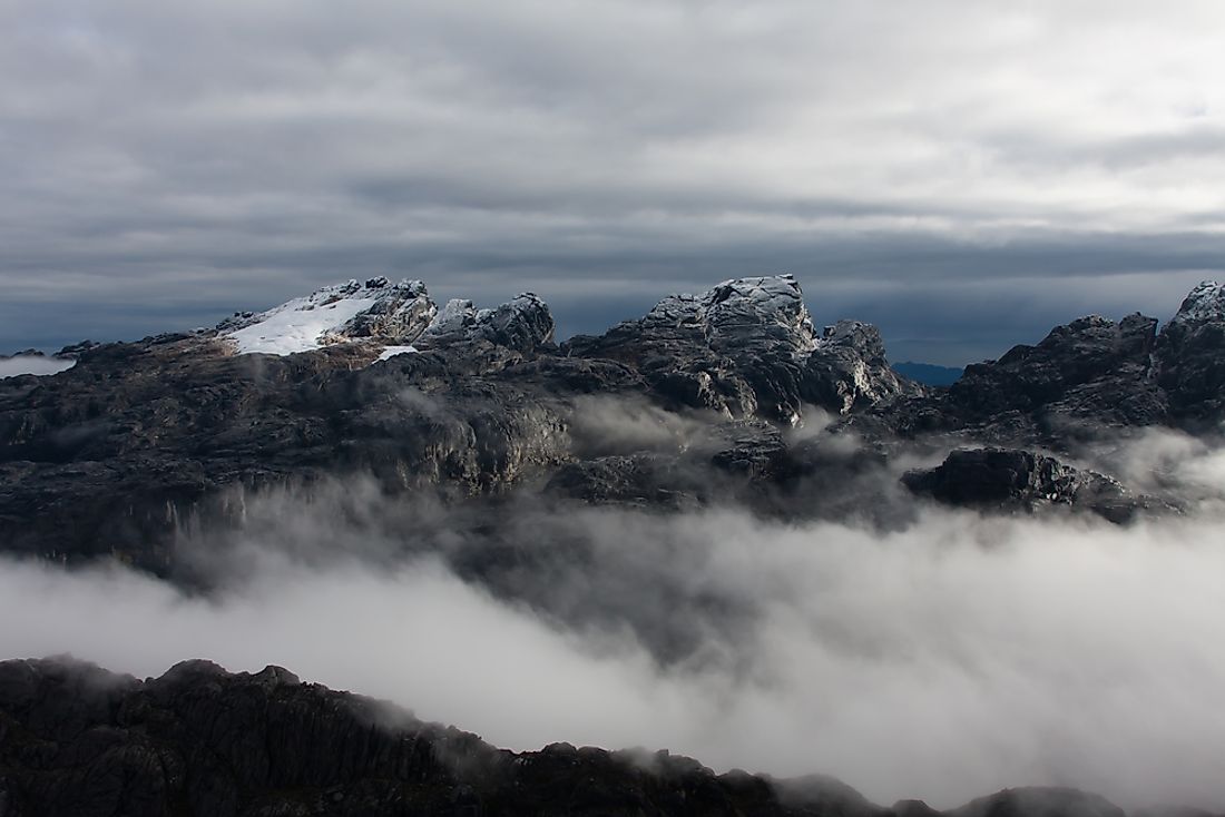
2. Highest Point in Indonesia
The highest point of Indonesia is located at one of the summits of Mount Jayawijaya or Mount Carstensz. The summit itself is known as Puncak Jaya or the Carstensz Pyramid and has an elevation of about 16,024 feet. Other names for the summit include Nemangkawi (as per the Amungkal language), Gunung Soekarno, and Carstensz Toppen. Mount Jayawijaya is located in the Sudirman Range of the western central moorlands of Indonesia’s Papua Province. In addition to being the highest point of Indonesia, the summit is also the highest point between the Andes and the Himalayas. Puncak Jaya lies on the coordinates 4°4′42″S 137°9′26″E.
The point was formed during the later stages of the Miocene Melanesian orogeny after the Pacific and the Australian plate collided at an oblique angle. Among the Seven Summits of the world, the peak is actually one of the more demanding ones to climb despite having the lowest height. Accessing the mountain peak requires a permit from the government. The peak was closed to the public (climbers and tourists) between 1995 and 2005.
1. Lowest Point in Indonesia
Also known as the Philippine Deep, the Mindanao Deep, or the Mindanao Trench, the Philippine Trench has the lowest point of Indonesia. This submarine trench lies on the eastern side of the Philippines in the Philippine Sea, has an approximate length of 820 miles, and a width of approximately 19 miles. To its immediate north is the East Luzon Trench. The lowest point of Indonesia lies within the southern region of the Philippine Trench, at the point marked by the coordinates 5°30′7″N 127°40′48″E with a depth of about 29,938 feet,
Globally, the depths of the trench are some of the highest. In fact, only the Tonga Trench and the Mariana Trench are deeper than the Philippine Trench. The deepest point of the trench in Indonesia is the aforementioned 29,938 feet. Hover, the Galathea Depth is the deepest point of the whole trench with a massive depth of 34,580 feet (5,760 fathoms). In terms of its age, the trench is estimated to have an age of fewer than nine million years.


