The States of Nigeria by Population
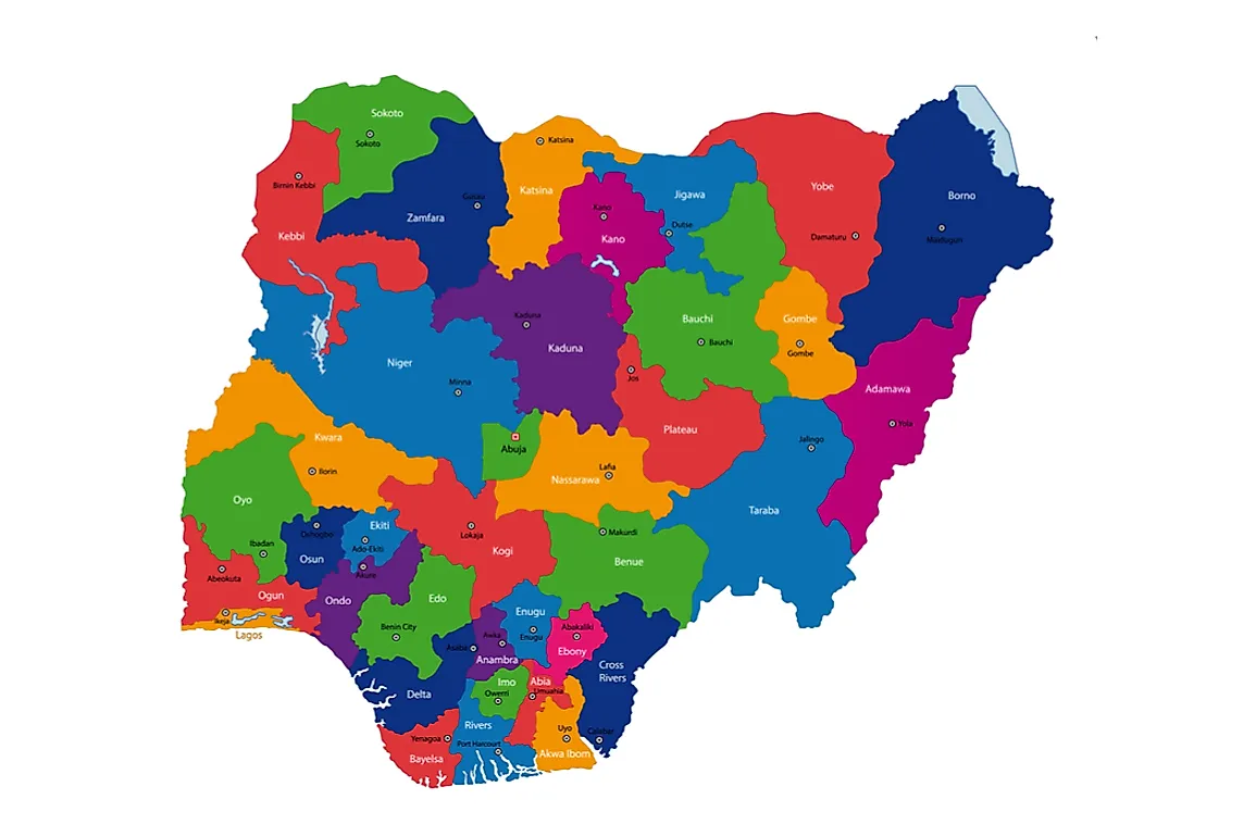
Nigeria, a country in Western Africa, is the most populous country in Africa. In total, Nigeria has 36 states that are held together by a federal government. A state in Nigeria refers to a political entity that holds parts of the sovereignty while the federal government holds the rest. Furthermore, the states have smaller local government subdivisions that add up to 774. One of the regions, the Federal Capital Territory, is not classified as a state since it is under the direct authority of the federal government.
States In Nigeria
The largest state in Nigeria is Niger with an area of around 29,484 square miles while Lagos is the smallest with an area of only 1,381 square miles. Lagos state is the most populated with a population of around 17,552,940 people while Bayelsa State is the least populated with a population of around 1,704,515 people. Aside from the 36 current states, Nigeria has older traditional states that are older than the current ones. The difference between the two is that traditional ones are not recognized by the constitution while modern ones have administrative authority as outlined by the constitution of Nigeria.
Lagos State
Sometimes referred to as Lagos, Lagos State is located in the southwestern region of Nigeria and was created on May 27, 1967. Not to be confused with the Lagos Metropolitan Area, the state is the most highly populated state of Nigeria with a population of around 17,552,940 people. These people are living inside a relatively small space of only 1,381 square miles, which translates to a high population density. The east and the north of Lagos are bounded by Ogun State while the Republic of Benin is to the west. The south of Lagos is bound by the Atlantic Ocean.
Kano State
Situated in Northern Nigeria, Kano State was formed on May 27, 1967. The state is bordered to the northwest by Katsian State while Jigawa State is located to the northeast. The southwest is bound by Bauchi State while Kaduna State binds the southwest. Prior to 1991, the current Jigawa State was part of Kano State. Even after Jigawa State became its own state, Kano State is still Nigeria’s second most populated state. Despite this high population, the state has a relatively small area of only 7,773 square miles, which places it in the twentieth position of the 36 states.
The Federal Capital Territory
Also known as FCT-Abuja, the Federal Capital Territory is a special federal territory and includes the capital city of Nigeria, Abuja. Created in 1976, the territory features parts from three states namely Niger, Kogi, and Nasarawa. Other states in the country have a governor as the head while the Federal Capital Territory Administration (FCTA) heads the FCT. The leader of this FCTA is a minister who gets his or her appointment from the President of Nigeria. As of 2006, the territory had a population of around 1,406,239 people living in an area of around 2,824 square miles. Located north of the meeting point of the Rivers Niger and Benue, the territory is bordered to the north and the west by Niger State while the northeast is bound by Kaduna. The east and the south are bound by Nasarawa State while Kogi State binds the southwest.
How Many States Does Nigeria Have?
| Rank | State | Population |
|---|---|---|
| 1 | Abia | 2,845,380 |
| 2 | Adamawa | 3,178,950 |
| 3 | Akwa Ibom | 5,450,758 |
| 4 | Anambra | 4,177,828 |
| 5 | Bauchi | 4,653,066 |
| 6 | Bayelsa | 1,704,515 |
| 7 | Benue | 4,253,641 |
| 8 | Borno | 4,171,104 |
| 9 | Cross River | 3,737,517 |
| 10 | Delta | 4,112,445 |
| 11 | Ebonyi | 2,176,947 |
| 12 | Enugu | 3,267,837 |
| 13 | Edo | 3,233,366 |
| 14 | Ekiti | 2,398,957 |
| 15 | Gombe | 2,365,040 |
| 16 | Imo | 3,927,563 |
| 17 | Jigawa | 4,361,002 |
| 18 | Kaduna | 6,113,503 |
| 19 | Kano | 9,401,288 |
| 20 | Katsina | 5,801,584 |
| 21 | Kebbi | 3,256,541 |
| 22 | Kogi | 3,314,043 |
| 23 | Kwara | 2,365,353 |
| 24 | Lagos | 17,552,940 |
| 25 | Nasarawa | 1,869,377 |
| 26 | Niger | 3,954,772 |
| 27 | Ogun | 3,751,140 |
| 28 | Ondo | 3,460,877 |
| 29 | Osun | 3,416,959 |
| 30 | Oyo | 5,580,894 |
| 31 | Plateau | 3,206,531 |
| 32 | Rivers | 5,198,716 |
| 33 | Sokoto | 3,702,676 |
| 34 | Taraba | 2,294,800 |
| 35 | Yobe | 2,321,339 |
| 36 | Zamfara | 3,278,873 |


