Maps of Chile

Covering an area of about 756,096 sq.km (291,930.4 sq mi) and with a toothy coastline of almost 4,000 miles, pencil-thin Chile is wedged between the Pacific Ocean and the rugged Andes, the world's longest mountain range; in southwestern part of South America. This land of incredible and unusual contrasts is also home to the numerous beaches, fjords, deep sea channels, glaciers and icebergs - and the Atacama Desert - a virtually rainless plateau made up of salt basins and lava flows.
As observed on the physical map of Chile above, most of the country's interior is covered by mountains. The snowcapped Andes cover almost all of its eastern border. Generally lower, non-Andean ranges dissect Chile (north to south) with the largest being the Cordillera de la Costa in the far south. Located along the Pacific Ring of Fire, the Andes are geologically a young mountain range that includes over 600 volcanoes (within Chile alone), many of them active, and almost 10% have erupted (at least once) within the last century. Throughout the country deep valleys and high plateaus front these mountains, most winding east to west; the central valley (or Pampas) runs to the Pacific Ocean shoreline. Chile's highest point (as marked on the map, as an upright yellow triangle) is Nevado Ojos del Salado. With an elevation of 22,572ft (6,880m) it is also the 2nd highest mountain in South America. The lowest point is at the Pacific Ocean.
The Lake Region of the South, is a group of mostly small, clear blue cold-water lakes; in this area, waterfalls are common. In the far-south, an almost uncountable group of mountainous islands (forming varied archipelagos) front the coastline, forming a series of winding channels and fjords. Cape Horn, directly south of the island of Tierra del Fuego, is the southern-most point in the world, next to Antarctica. Mixed into the stunning landscape are the Northern and Southern Patagonian Ice Fields that form the largest continental mass of ice in the world, outside of Greenland and Antarctica. Hundreds of glaciers branch off the ice fields, many extend all the way to sea level. Meltwater from the glaciers gather in lakes such as the General Carrera - the 2nd largest lake in South America. And as for rivers - dozens rise in the upper reaches of the Andes and flow either to the Pacific Ocean, or east through the neighboring Argentina.
Regions of Chile Map

Chile (officially, the Republic of Chile) is administratively divided into 16 regions (regiones, singular - region), 56 provinces (provincias) and 346 communes (comunas). In alphabetical order, the regions are: Aysen, Antofagasta, Araucania, Arica y Parinacota, Atacama, Biobio, Coquimbo, Libertador General Bernardo O'Higgins, Los Lagos, Los Rios, Magallanes y de la Antartica Chilena (Magallanes and Chilean Antarctica), Maule, Nuble, Region Metropolitana (Santiago), Tarapaca and Valparaiso.
Chile covers a total area of about 756,096 sq. km. Located in the heart of the Santiago Basin (valley) and the Santiago Metropolitan Region is, Santiago - the capital and the largest city of Chile. It is also one of the largest cities in the Americas. Santiago is the administrative, cultural, industrial and financial center of the country.
Where is Chile?

Chile is a country located in the southwestern part of South America. It is geographically positioned both in the Western and Southern hemispheres. Chile occupies a long, narrow coastal land strip wedged between the Andes Mountains to the east and the South Pacific Ocean to the west. It is bordered by Peru to the north; by Bolivia to the northeast; by Argentina to the east and by the Drake Passage to the south.
Chile Bordering Countries: Argentina, Bolivia, Peru.
Regional Maps: Map of South America
Outline Map of Chile

The above blank map represents Chile, a long, narrow country located in the southwestern part of South America. The above map can be downloaded, printed and used for geography education purposes like map-pointing and coloring activities.

The above outline map represents Chile, a long narrow country located in the southwestern part of South America. The country has an unusual, ribbon-like shape, with a long toothy coastline.
Key Facts
| Legal Name | Republic of Chile |
|---|---|
| Flag |
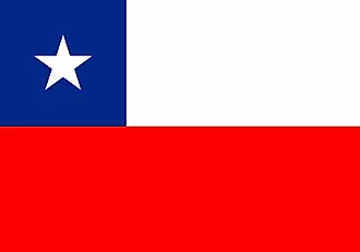
|
| Capital City | Santiago; note - Valparaiso is the seat of the national legislature |
| 33 27 S, 70 40 W | |
| Total Area | 756,102.00 km2 |
| Land Area | 743,812.00 km2 |
| Water Area | 12,290.00 km2 |
| Population | 18,952,038 |
| Major Cities |
|
| Currency | Chilean pesos (CLP) |
| GDP | $282.32 Billion |
| GDP Per Capita | $14,896.45 |
This page was last updated on December 28, 2023