Islands Of Hawaii
Covering a land area of 16,636.5 sq. km, the State of Hawaii (Hawaiian archipelago) is situated in the Pacific Ocean about 3,200km to the southwest of the contiguous United States. Nicknamed as the “Aloha State”, Hawaii is the only US state that is situated outside the continent of North America and is also the world’s largest island chain that is made up of 137 volcanic islands.
The Hawaiian Islands

The Hawaiian Islands are an archipelago that comprises 8 principal islands, several small islets, atolls, and seamounts spread over an area of 2,400km in the North Pacific Ocean. The Hawaiian Islands were formed by volcanic activity that originated from the Hawai'i hotspot in the earth’s mantle. The Hawaiian Islands enjoy a year-round tropical climate with summer temperatures around 31°C during the daytime and 24°C during the nighttime; and in winters, the daytime temperature remains around 28°C and the nighttime temperature around 18°C.
The Biggest Islands Of Hawaii
Also referred to as the Hawaiian Windward Islands, the eight principal islands of Hawaii are Hawai'i, Maui, Oahu, Kauai, Molokai, Lanai, Niihau, and Kahoolawe. Of these 8 main islands, only 7 islands have permanent settlements. These 8 islands are:
- Hawai'i Island
- Maui Island
- Oahu Island
- Kauai Island
- Molokai Island
- Lanai Island
- Niihau Island
- Kahoolawe Island
Hawai'i Island

Nicknamed as the “Big Island”, the island of Hawai'i which covers a land area of 10,432.5 sq. km is the largest island in the Hawaiian archipelago. It is also the largest island in the United States and the southeasternmost of the Hawaiian Windward Islands. As of the 2010 Census, the island of Hawai'i has a population of 185,079 residents that accounts for about 13% of state’s entire population. The island of Hawai'i was created from the eruption of five separate shield volcanoes namely Kohala, Mauna Kea, Hualalai, Mauna Loa, and Kilauea. Rising to an elevation of 4,207.3m, the dormant volcano of Mauna Kea is the highest point in the state of Hawaii.
Maui Island

Nicknamed as the “Valley Isle”, the island of Maui which covers a land area of 1,883.4 sq. km is the second-largest island in the Hawaiian archipelago. As of the 2010 Census, the island of Maui supports a population of 144,444 residents. The island is known for its world-famous beaches and views of the migrating humpback whales. The island is also home to a large rainforest that is located on the northeastern flanks of the East Maui Volcano.
Oahu Island

Nicknamed as the “Gathering Place”, the island of Oahu which covers a land area of 1,545.4 sq. km is the third-largest island in the Hawaiian archipelago. The Oahu Island supports a population of 974,563 residents and accounts for about 69% of the state’s total population. Situated on the southeastern coast of Oahu Island is Honolulu – the capital, the largest city, and the principal marine port of Hawaii. Honolulu serves as the state’s financial and economic hub and hosts the headquarters of several large Hawaiian companies.
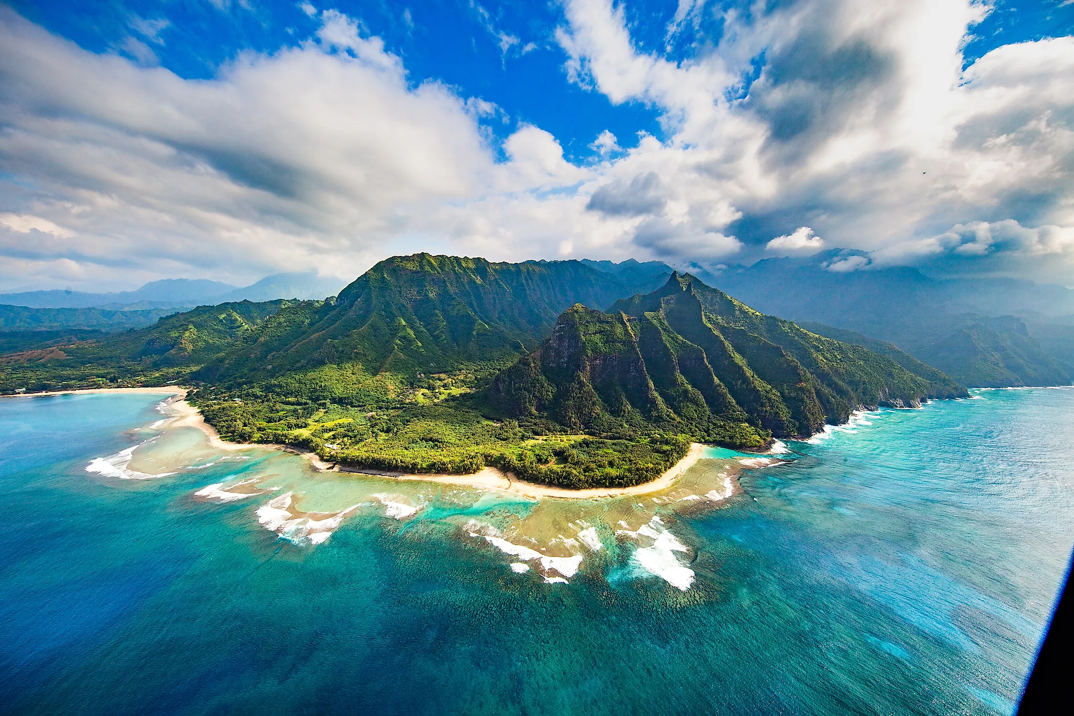
Kauai Island

Nicknamed as the “Garden Isle”, the island of Kauai which covers an area of 1,456.4 sq. km, is the fourth largest and the second oldest island in the Hawaiian archipelago. The island is located to the northwest of Oahu Island about 117km across the Kauai Channel. The Kauai Island consists of mountains, rainforests, scenic waterfalls, river valleys, and sugarcane farms. Tourism is the largest industry in Kauai and it has been recorded that as of 2017, more than 1,271,000 people have visited the island of Kauai.
Molokai Island

Nicknamed as the “Friendly Isle”, the island of Molokai which covers an area of 673.40 sq. km, is the fifth-largest island in the Hawaiian archipelago. The island is located to the southeast of Oahu Island across the 40km wide Kaiwi Channel. Molokai Island contains some of the world’s tallest sea cliffs and the longest fringing reef in the United States. The largest industry in Molokai Island is the production of Monsanto and Mycogen seeds including the GMO seeds.
Lanai Island

Nicknamed as the “Pineapple Isle”, the island of Lanai which covers an area of 363.9 sq. km, is the sixth-largest island in the Hawaiian archipelago. The roughly apostrophe-shaped Lanai Island is separated from the Molokai Island by the Kalohi Channel in the north and from the Maui Island by the Auau Channel in the east. As of the 2010 census, the island supports a population of 3,131 people and is considered the smallest publicly accessible inhabited island in the Hawaiian island chain.
Niihau Island
Nicknamed as the “Forbidden Isle”, the island of Niihau which covers an area of 180.0 sq. km, is the seventh-largest and the westernmost island in the Hawaiian archipelago. The island is situated about 28.2 km to the southwest of Kauai across the Kaulakahi Channel. The island’s numerous playa lakes provide critical wetland habitats for many endemic birds such as the Hawaiian coot, Hawaiian duck, and Hawaiian stilt. The island is privately owned by members of the Robinson family and only a limited number of hunting safaris and supervised activity tours are allowed for tourists.
Kahoolawe Island
Nicknamed as the “Target Isle”, the island of Kahoolawe which covers an area of only 115.5 sq. km is the smallest of the eight principal islands in the Hawaiian archipelago. The island lacks permanent residents due to the scarcity of fresh water. During the Second World War, the island of Kahoolawe served as a training ground and bombing range by the US Armed Forces. Currently, the island is used only by the native Hawaiian people for cultural and spiritual purposes.

As seen in the above discussion, tourism is the mainstay of the Hawaiian economy and it has been recorded that more than 7 million tourists annually visit the Hawaiian Islands. The pristine Hawaiian islands enjoy a year-round tropical climate attracting a large number of visitors who visit the island state throughout the year. For several decades, the Hawaiian Islands relied on the large number of Japanese tourists who used to visit the islands. But after the economic recession in Japan, there has been a fall in the number of Japanese tourists and an increase in the number of tourists from China and South Korea.


