Maps of Newfoundland and Labrador
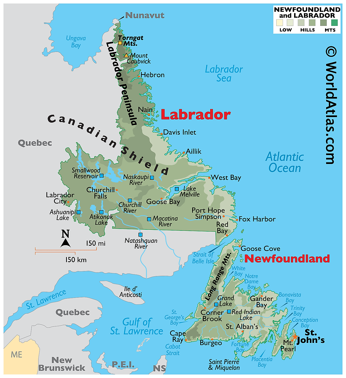
Newfoundland and Labrador is a province located in eastern Canada. It is the most easterly province in the country, and it shares its eastern and southern borders with the Atlantic Ocean. To the north, it is bordered by the Labrador Sea, while Quebec lies to the west. The province covers a total area of 156,453 square miles, making it one of the largest provinces in Canada.
Geographically, Newfoundland and Labrador can be divided into three main regions: the island of Newfoundland, the Labrador Peninsula, and the coastal region. The island of Newfoundland is the largest of the three regions, covering an area of approximately 42,031 square miles. It is characterized by rugged terrain and a jagged coastline, which includes many inlets and bays. The island's interior is dominated by a plateau, with numerous rivers and lakes dotting the landscape.
The Labrador Peninsula, which covers a total area of approximately 540,500 square miles, is much less populated than the island of Newfoundland. It is primarily a wilderness region, with rugged mountains and deep fjords dominating the landscape. The region is home to several large rivers, including the Churchill, the Naskaupi, and the Seal, which are important sources of hydroelectric power.
The coastal region of Newfoundland and Labrador, which stretches along the province's eastern and northern borders, is characterized by rocky cliffs and a rugged shoreline. The region includes several major bays and inlets, including the Strait of Belle Isle, which separates Newfoundland from Labrador, and the Bay of Islands, which is a popular tourist destination.
The province is also home to several major bodies of water, including the Gulf of St. Lawrence, which lies to the west of the island of Newfoundland, and the Grand Banks, which are located off the province's southeastern coast. The Grand Banks are an important fishing ground and have been a vital resource for the province's fishing industry for centuries.
In addition to the province's major bodies of water, Newfoundland and Labrador is also home to several significant rivers, including the Churchill River, which is the largest river in the province, and the Exploits River, which is one of the longest. These rivers are important sources of hydroelectric power and are also popular destinations for outdoor recreation.
Provinces Map
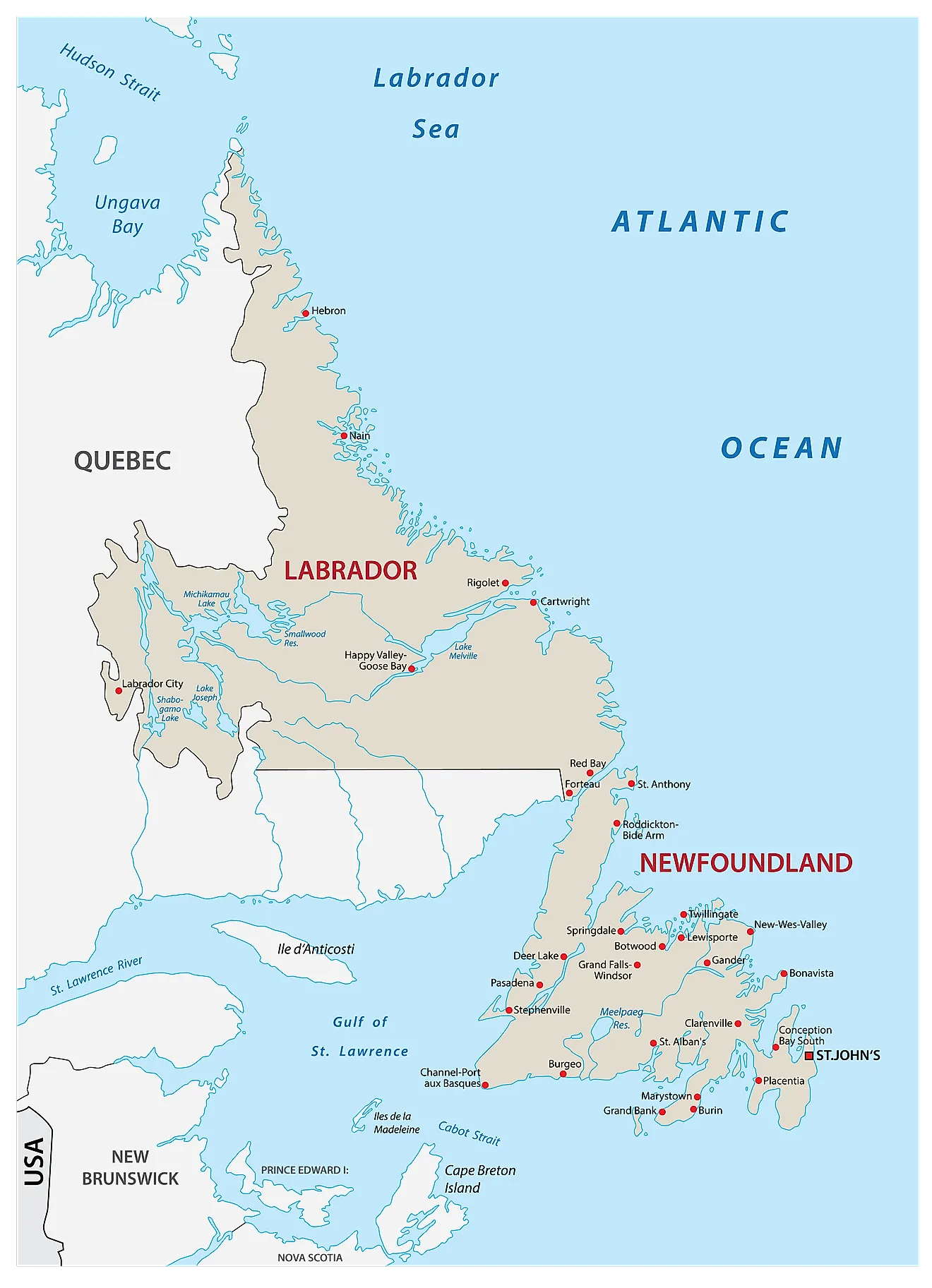
The Canadian Province of Newfoundland and Labrador is administratively divided into a total of 277 municipalities. Of these 277 municipalities, there are 3 cities, 269 towns, and 5 Inuit community governments.
With an area of 370,514 sq. km, Newfoundland and Labrador is the 7th largest and 9th most populous Canadian Province. Located in Newfoundland Island, on the eastern edge of the Avalon Peninsula is St. John’s – the capital, largest, and the most populous city of Newfoundland and Labrador. It serves as North America’s easternmost city.
Where is Newfoundland and Labrador?
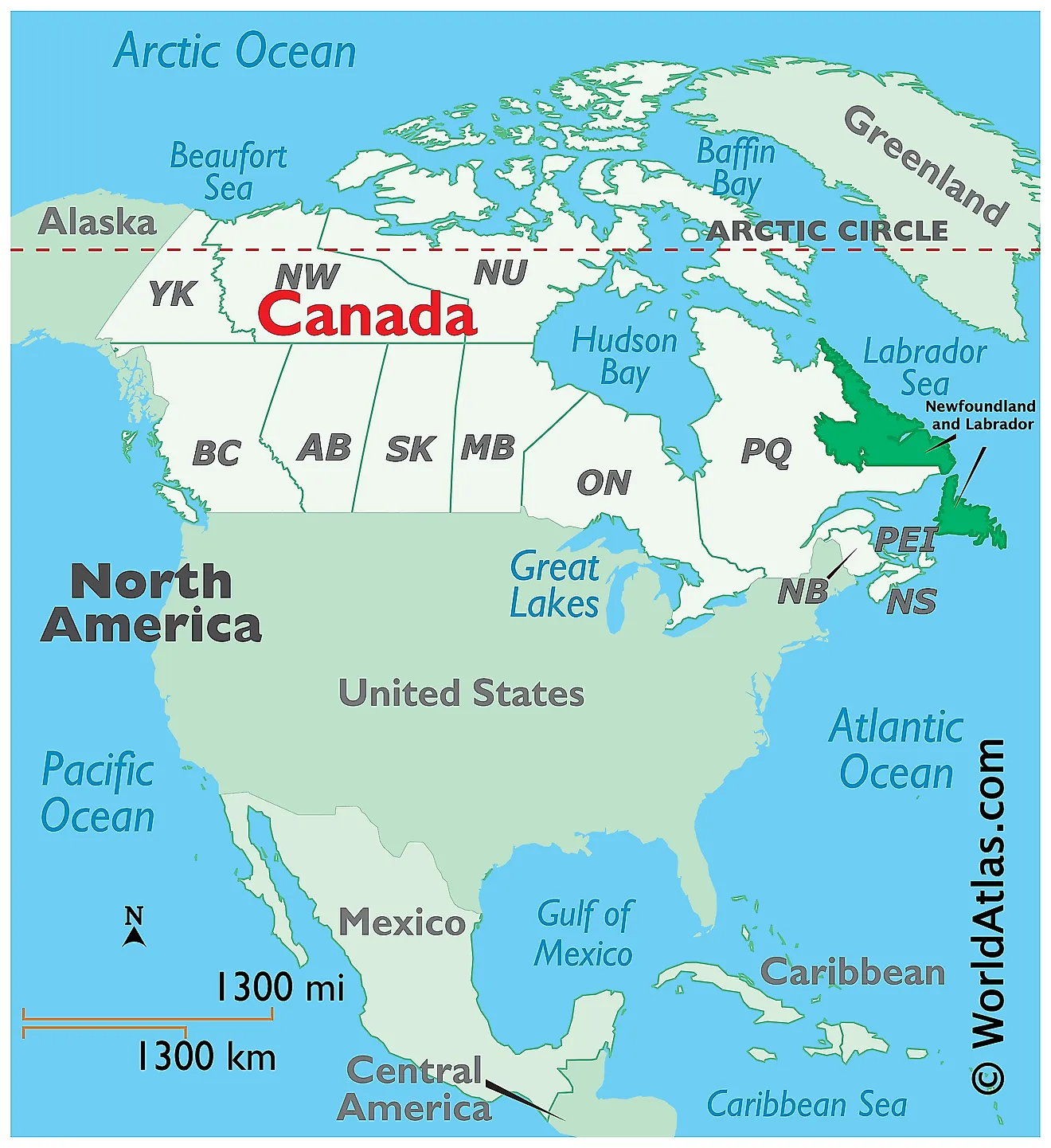
The Province of Newfoundland and Labrador is located in the extreme easternmost part of Canada, in the Continent of North America. It is geographically positioned in the Northern and Western hemispheres of the Earth. Situated in Canada’s Atlantic region, the province is composed of Labrador on the mainland and the island of Newfoundland in the Atlantic Ocean. The narrow Strait of Belle Isle separates Labrador from Newfoundland Island. The Cabot Strait separates Newfoundland Island from Nova Scotia in the southwest. Labrador is surrounded by the Labrador Sea in the north and east and by the Canadian Province of Quebec in the south and west.
Regional Maps: Map of North America
Outline Map of Newfoundland and Labrador
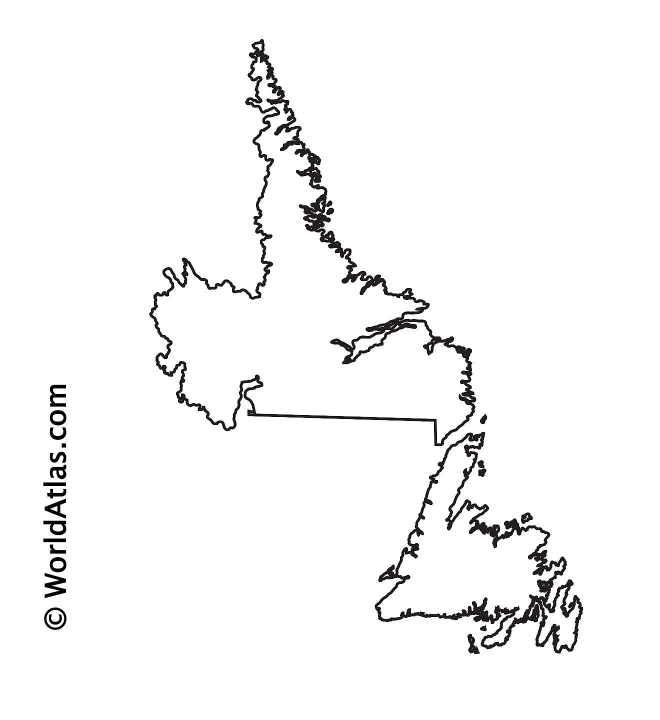
The above blank map represents the Province of Newfoundland and Labrador, located in the extreme easternmost part of Canada. The above map can be downloaded, printed, and used for geography education purposes like map-pointing and coloring activities.
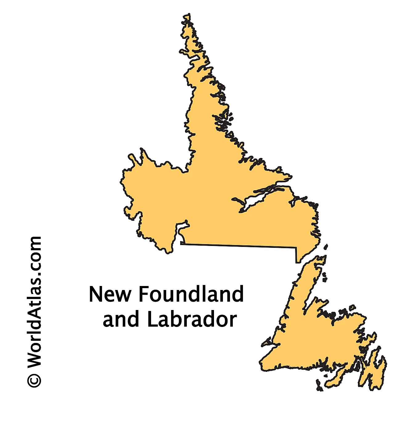
The above outline map represents the Province of Newfoundland and Labrador, located in the extreme easternmost part of Canada.
Key Facts
| Legal Name | Province of Newfoundland and Labrador |
|---|---|
| ISO 3166 Code | CA-nfz |
| Capital City | Saint John's |
This page was last updated on April 5, 2023

