Maps of Ukraine

Ukraine is the largest country that is entirely within Europe. The country sits on the southwestern part of the Russian Plain and is bordered by the Black Sea and the Sea of Azov to the south, Russia to the east and north, Belarus to the north, Poland, Slovakia, and Hungary to the west, and Romania and Moldova to the south.About 95% of the country is flat with an average elevation of the land is only 574 ft (175 m). As observed on the physical map of Ukraine above the northern reaches of the Carpathian Mountains stretch across western Ukraine. The country's highest point is located there, Hoverla Mountain, at 2061 m (6762 ft) tall. It has been marked on the map above by a yellow upright triangle.
The southern lowland of Ukraine continues into the Crimean Peninsula, a peninsula jutting into the sea from southern Ukraine via the Perekop Isthmus. It is a disputed territory. The Crimean Mountains front the southern edges of the Crimean Peninsula, and some lower, heavily-eroded mountains extend into Russia just north of the Sea of Azov.
Much of central Ukraine is covered by plateaus and fertile plains (steppes), somewhat hilly areas of grasslands and shrublands.
The Black Sea Coastal Lowlands cover the southern edges of the country.
Major rivers
Include the Desna, Dnieper, Dniester, Donets and the Southern Bug. Numerous waterfalls are found in both the Carpathian and Crimean Mountains.
The Dnieper River, one of the major rivers of Europe (fourth by length) flows from Russia, through Belarus and Ukraine, to the Black Sea. The river's total length is 2,285 km (1,420 mi).
Provinces of Ukraine Map

Ukraine is divided into 24 provinces (oblast), 1 autonomous republic (avtonomna respublika) and 2 municipalities (mista). In alphabetical order, these provinces are: Cherkasy, Chernihiv, Chernivtsi, Dnipropetrovs’k (Dnipro), Donets’k, Ivano-Frankivs’k, Kharkiv, Kherson, Khmel’nyts’kyy, Kirovohrad (Kropyvnyts’kyy), Kyiv, Luhans’k, L’viv, Mykolayiv, Odesa, Poltava, Rivne, Sumy, Ternopil’, Vinnytsya, Volyn’ (Luts’K), Zakarpattya (Uzhhorod), Zaporizhzhya and Zhytomyr. Crimea or Avtonomna Respublika Krym (Simferopol’) is an autonomous republic. Kyiv (Kiev) and Sevastopol’ are two municipalities of special status. The 24 oblasts and Crimea are further subdivided into 136 raions (district) and city municipalities.
With an area of 603,628 sq. km (which also includes the area covered by the Crimean Peninsula), Ukraine is the 2nd largest country by area in Europe and the 46th largest country in the world. With a population over 42 million people, Ukraine is the 7th/8th most populous county in Europe and the 32nd most populous country in the world. Located in the north-central part of the country, along the Dnieper River is Kiev (Kyiv) – the capital and the most populous city of Ukraine. Kiev is the chief cultural and industrial center of Eastern Europe.
Where is Ukraine?

Ukraine is an Eastern European country. It is situated both in the Northern and Eastern hemispheres of the earth. Ukraine is bordered by 7 European Nations: by Belarus in the north; by Hungary, Slovakia and Poland in the west; by Moldova and Romania in the southwest; and by Russia in the east and northeast. It is bounded by the Black Sea and the Sea of Azov in the south. The Autonomous Republic of Crimea borders Ukraine to the south.
Ukraine Bordering Countries: Russia, Hungary, Romania, Moldova, Slovakia, Belarus, Poland.
Regional Maps: Map of Europe
Outline Map of Ukraine

The above blank outline map is of Ukraine, a country in eastern Europe. The map can be downloaded, printed and used for education work or for coloring.

The above map represents Ukraine, a country in Eastern Europe.
Key Facts
| Legal Name | Ukraine |
|---|---|
| Flag |
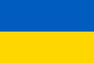
|
| Capital City | Kyiv (Kiev) |
| 50 26 N, 30 31 E | |
| Total Area | 603,550.00 km2 |
| Land Area | 579,330.00 km2 |
| Water Area | 24,220.00 km2 |
| Population | 44,385,155 |
| Major Cities |
|
| Currency | Hryvnia (UAH) |
| GDP | $153.78 Billion |
| GDP Per Capita | $3,659.03 |
This page was last updated on December 7, 2022