Maps of Saudi Arabia

With an area of 2,150,000 sq. km, Saudi Arabia is the largest sovereign country of Arabia. It occupies nearly 80% of the area of the Arabian Peninsula and has extensive coastlines on the Red Sea and the Persian Gulf.
Saudi Arabia is, for the most part, an uninhabited desert land. As observed on the physical map above, two main desert regions dominate the landscape of the country. These are the Rub' Al Khali Desert, the larges mass of sand in the world, and the An-Nafud Desert - where sand dunes often exceed 100 ft. in height.
The land (desert) rises into hills and mountains in the west and southwest, along the edges of the Red Sea. Mountain ranges include the Hejaz in the northwest, and the Azir in the southwest.
Saudi Arabia's highest point is Jabal Sawda' which peaks at 10,279 ft. (3,133 m). It has been marked on the map by a yellow upright triangle.
There are no perennial lakes or rivers but numerous wadis. The lowest point in the country is at 0 m or 0 ft in the Red Sea and Persian Gulf.
Emirates of Saudi Arabia Map

Saudi Arabia (officially, Kingdom of Saudi Arabia) is divided into 13 administrative provinces or emirates. In alphabetical order, these provinces are: Al Baha, Al Jawf, Al Madinah, Aseer, Eastern province, Ha’il province, Jazan, Makkah, Najran, Northern Border province, Qassim, Riyadh and Tabuk. These provinces are divided into 118 governorates which are further subdivided into sub-governorates.
Riyadh is the capital and largest city and is located in the center of an-Nafud desert, on the eastern region of the Najid Plateau. With a population of 7.6 million, it is the most populous city in Saudi Arabia.
Where is Saudi Arabia?

Saudi Arabia is a sovereign Western Asian Nation, occupying the central region of the Arabian Peninsula in Southwest Asia. It is located in the Northern and Eastern hemispheres of the Earth. Saudi Arabia is bordered by 8 nations: Jordan in the Northwest, Iraq in the North and Northeast, Kuwait, Qatar, Bahrain, and United Arab Emirates in the east, Oman in the Southeast and Yemen in the South. The Persian Gulf is in the northeast and Red Sea to the West of Saudi Arabia.
Saudi Arabia is often referred to as “The Land of the Two Holy Mosques” for Mecca and Medina – the two holy pilgrimages of the religion of Islam.
Saudi Arabia Bordering Countries: Yemen, Iraq, Jordan, Kuwait, The United Arab Emirates, Qatar, Oman.
Regional Maps: Map of Asia
Outline Map of Saudi Arabia


Key Facts
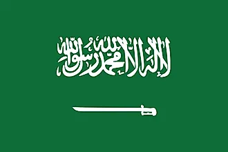
| Legal Name | Kingdom of Saudi Arabia |
|---|---|
| Flag |
|
| Capital City | Riyadh |
| 24 39 N, 46 42 E | |
| Total Area | 2,149,690.00 km2 |
| Land Area | 2,149,690.00 km2 |
| Water Area | N/A |
| Population | 34,268,528 |
| Major Cities |
|
| Currency | Saudi riyals (SAR) |
| GDP | $792.97 Billion |
| GDP Per Capita | $23,139.80 |
This page was last updated on December 7, 2022