Maps of Rwanda

Rwanda is a landlocked nation located in the African Great Lakes region of Central/Eastern Africa and covers an area of 26,338 sq. km. Surrounded on all sides by its neighbors, Rwanda shares a border with the four nations of Burundi, Tanzania, Uganda, and the Democratic Republic of the Congo. Rwanda has quite a diverse geological character. Sharp mountain ranges, rushing rivers, shallow flood plains, and enormous lakes can all be found here.
Mountains dominate the landscape of western Rwanda. The mountains found in the west are a part of the Albertine Rift range that runs from north to south. The Virunga Mountains to the northwest of the country host the highest peak of Rwanda, Mount Karisimbi (marked on the physical map above) which is 4,507 m tall.
Central Rwanda features rolling hills giving way to a much more typical African landscape of savanna, plains, and swamps eastwards. Here you can find much of the nation's wildlife reserves and national parks. Not to mention a spattering of impressive lakes and rivers.
Lakes are everywhere in Rwanda. Lake Kivu, located on the western border of the country with DRC, is the largest among them. It is one of the 20 deepest lakes in the world and has a maximum depth of 480 m. This magnificent body of water is split down the middle between the two nations. Other notable lakes include Burera, Cohana, Ruhondo, Muhazi, Rweru, and Ihema.
80% of Rwanda's rivers drain into the Nile through Lake Victoria while the remaining 20% drains into the Congo via the Rusizi River which also has the lowest elevation in Rwanda at 950 m. Rising in the southwest is the longest river in Rwanda - Nyabarongo. The river merges with the Ruvubu in the southeast, forming the Kagera River which ultimately enters Lake Victoria after crossing into Tanzania.
Provinces Map of Rwanda

Rwanda is divided into five provinces. These are Kigali, Northern, Eastern, Southern, and Western. These provinces were formed in 2006. Before this, the country had 12 provinces. The provinces are further divided into 30 districts.
With an area of 9,458 sq. km, the Eastern Province is the largest by area as well as the most populous one. The capital and largest city of Rwanda, Kigali City, is located in the Kigali Province.
Where is Rwanda?

The Central/Eastern African country of Rwanda is a landlocked nation that lie in the Southern (located a few degrees south of the Equator) and Eastern Hemispheres of the Earth. It is part of the Great Rift Valley region of Africa. Four African countries border Rwanda. These are Uganda, Tanzania, Burundi, and the Democratic Republic of the Congo to the north, east, south, and west respectively.
Rwanda Bordering Countries: Burundi, Uganda, Tanzania, The Democratic Republic Of The Congo.
Regional Maps: Map of Africa
Outline Map of Rwanda


Key Facts
| Legal Name | Republic of Rwanda |
|---|---|
| Flag |
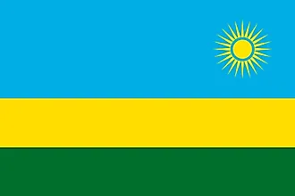
|
| Capital City | Kigali |
| 1 57 S, 30 03 E | |
| Total Area | 26,338.00 km2 |
| Land Area | 24,668.00 km2 |
| Water Area | 1,670.00 km2 |
| Population | 12,626,950 |
| Largest City |
Kigali (1,247,551) |
| Currency | Rwandan francs (RWF) |
| GDP | $10.12 Billion |
| GDP Per Capita | $801.66 |
This page was last updated on December 14, 2023