8 Most Walkable Town Centers In New South Wales
Grab a heritage map at the local museum, and a New South Wales main street reads like a timeline. In Berry, the rich historical heritage of the region unfolds in and around the town center, with museums, a post office, and a historic railway station. Kiama's thriving downtown gives way to its scenic waterfront and coastal attractions like a historic lighthouse and the world's largest blowhole. Sporting history dominates in Bowral, a town that remembers the legendary cricketer Sir Donald Bradman through many landmarks dedicated to him, including the Bradman Museum. These eight walkable town centers of New South Wales preserve the stories, traditions, and cultural identities of their vibrant and beloved communities.
Berry

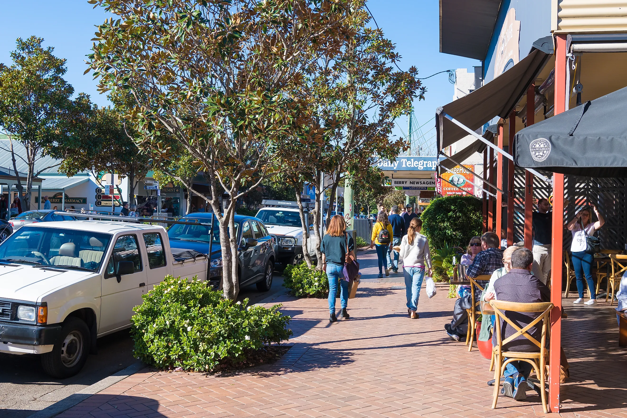
This town's compact commercial center makes it easy to combine independent shopping with a walk through the town's history. Begin at the Old Post and Telegraph Office on Queen Street, the official starting point of the Berry Heritage Walk. Follow Queen Street past heritage shopfronts and cafes, crossing the main road at the designated crossing points as the route switches sides. Continue toward Berry Museum on Queen Street to see exhibits about the district's past, then head south along Prince Alfred Street toward Railway Street, where the historic Berry Railway Station offers another view of the town's development. From there, follow the heritage trail through Alexandra, Victoria, and Princess streets to see older cottages and the Berry Courthouse. The town's official comprehensive trail links these streets, making it possible to explore several landmarks without driving between them.
The shorter commercial-center trail takes approximately 30 minutes, while the longer heritage route takes around two hours, depending on stops. That gives visitors the choice of a quick walk between shops and historic buildings or a more leisurely exploration of Berry's residential streets. Return to Queen Street for lunch or a bakery stop after completing the circuit. The longer route eventually extends beyond the central area toward Broughton Mill Creek and David Berry Hospital, so it is worth checking the official walking guide before committing to the full trail. Berry's appeal lies in the way its heritage sites are woven into everyday streets rather than isolated behind a separate attraction entrance.
Kiama

This town brings together a working harbor, a busy shopping street, and a dramatic stretch of coastline within walking distance of its central area. Start on Terralong Street, where cafes and local businesses make it a convenient place to grab breakfast before setting off. Walk toward Kiama Harbour, then follow the pedestrian route around the waterfront toward Blowhole Point. Once there, visit the Kiama Blowhole viewing area and continue a short distance to Kiama Lighthouse, which overlooks the ocean and harbor. The nearby Pilot's Cottage Museum adds a historical stop to the same outing. These attractions are clustered around the harbour and headland, so visitors can explore them on foot rather than returning to their cars after every stop.
After exploring Blowhole Point, retrace the pedestrian route toward the harbor and return to Terralong Street for lunch or more browsing. Allow around 45-60 minutes for the core harbor-to-headland outing, excluding time spent inside the museum or waiting to see the blowhole erupt; the exact duration depends on the route taken and conditions. Visitors wanting a longer coastal adventure can instead follow the signed Kiama Coast Walk, but its full sections extend well beyond the town center and should not be confused with this shorter itinerary. The appeal here is the easy transition from shops to salt air: within one outing, travelers can explore the town's commercial heart, watch fishing boats, and look out over the Pacific.
Bowral

This town's central streets offer a pleasant mix of shopping, gardens, and sporting history. Begin along Bong Bong Street, the main commercial strip, and browse its independent stores before walking toward Corbett Gardens on Wingecarribee Street. The gardens sit close to the town center, making them a convenient second stop, especially during the spring Tulip Time festival. From Corbett Gardens, follow the pedestrian streets toward St Jude Street and the Bradman Museum and International Cricket Hall of Fame. Finish at the adjoining Bradman Oval, where visitors can see the cricket ground associated with Sir Donald Bradman's early sporting career. The museum and oval sit beside one another, and the Bradman Walk provides a self-guided route linking the sporting precinct with other sites connected to Bradman's life.
For the most straightforward outing, explore Bong Bong Street and Corbett Gardens first, then allow more time to reach the cricket precinct. Once at the Bradman Museum, follow the marked 1.7-kilometer Bradman Walk, which takes approximately 45 minutes and ends at Bradman Oval; visitors can use the route to explore places associated with Bradman's childhood and early career. This makes the cricket section a defined walking experience rather than simply a museum visit. The overall outing will take longer if you tour the museum or stop for lunch. Bowral works particularly well for travelers who enjoy combining a little shopping with a cultural attraction, while the gardens provide an outdoor break between the two.
Berrima

This town is a strong choice for visitors who want to explore a historic village through its original streetscape. Start at Berrima District Museum, at the corner of Market Place and Bryan Street, where exhibits introduce the district's history. From the museum, walk toward Argyle Street, the main village street, and browse the traditional shopfronts before continuing to Berrima Courthouse at the corner of Argyle and Wilshire Streets. After exploring the courthouse exterior or visiting during opening hours, return to Argyle Street and walk along the main strip to the Surveyor General Inn, a historic pub dating to the 1830s. Visitors who want a fourth stop can continue toward Harper's Mansion on Wilkinson Street, a heritage house with gardens that offers a different perspective on colonial-era life.
The central village can be explored on foot, with Argyle Street providing the main link between the courthouse, historic businesses, and places to eat and relax. For a more structured outing, follow the numbered Berrima Historic Walk, which starts at the district museum and uses a map to guide visitors between heritage sites. Harper's Mansion adds a detour from the main commercial strip, so check the walking map and allow extra time if you plan to visit its grounds. The result is a walk with a clear theme: rather than viewing one isolated historic building, visitors can follow the village's development through its streets, civic landmarks, and surviving businesses.
Mudgee

The town center offers a practical walking route through regional history, independent businesses, and riverside green space. Begin along Market Street, where heritage buildings and local shops establish the character of the commercial district. Visit the Mudgee Museum and Historical Society on Market Street, which explores the area's past through photographs, objects, and displays. From the museum, continue through the central shopping streets toward the Mudgee Clock Tower, a recognizable local landmark and useful reference point as you explore. Then walk toward Lawson Park at Short Street, where paths and open lawns meet the Cudgegong River. This final stop provides a change of scenery after the built-up center and a place to rest before returning to the shops. Mudgee also has an official self-guided CBD heritage walk, which visitors can use to identify additional buildings and landmarks along the route.
To follow this itinerary, explore Market Street first, then use the adjoining commercial streets to reach the clock tower before continuing toward Short Street and Lawson Park. Allow additional time for the museum, whose opening hours should be checked before visiting. The park is a convenient endpoint because visitors can walk along the river, sit on the grass, or enjoy a picnic before retracing their steps to the center. Winery visits around the wider Mudgee region are a separate excursion, not part of this pedestrian route. The town's combination of heritage streets and riverside paths makes it possible to enjoy Mudgee's character without planning the day around a car.
Bellingen

This town's walkable center combines an independent shopping district with heritage buildings and access to the Bellinger River. Start on Hyde Street, the main commercial strip, and browse its galleries, boutiques, and cafes. Look for the Hammond and Wheatley Emporium, a prominent heritage building that reflects the town's commercial past. Continue along Hyde Street and the adjoining central streets to explore more shopfronts and local businesses, then head toward the Bellingen Museum for exhibits about the district's history. To finish outdoors, follow the pedestrian streets toward the Bellinger River and the nearby public spaces beside the water. This sequence allows visitors to experience the commercial center first before ending the walk in a quieter natural setting.
Hyde Street is the most practical starting point because the shops, cafes, and historic buildings are concentrated there. After exploring the main strip, follow the signed pedestrian routes toward the museum, then continue toward the river using a local map to identify the nearest public access point. The river section may add a longer leg to the outing, so check the route before setting off rather than assuming every stop is immediately adjacent. Check museum opening hours as well, particularly if it is a key reason for visiting. Bellingen's appeal comes from the variety packed into a relatively small center: a visitor can browse handsome goods, admire older architecture, and finish beside the river without needing to drive between every attraction.
Yass

This rural area offers a country-town walk that combines heritage architecture, local businesses, and a riverside trail. Begin at Coronation Park, on Comur Street, where the Yass Valley Visitor Information Centre provides maps and information about the town's heritage walk. From the park, follow Comur Street through the commercial center, browsing its traditional shopfronts before heading to Yass Courthouse at the corner of Comur Street and Rossi Street. After admiring the courthouse exterior, return to Comur Street and continue exploring the central shopping area. For the outdoor portion, follow local pedestrian routes toward the Yass River Town Trail, where interpretive signs explain the area's natural, cultural, and historical heritage. Pick up the official trail map at the visitor information center to identify the correct access points and walking route.
The most straightforward itinerary is to explore Coronation Park, walk along Comur Street, visit the courthouse, and then return toward the river trail. The park and courthouse are in the central area, while the riverside section requires a separate stretch of walking, so consult the town trail map before continuing. Early morning or late afternoon is particularly suitable for the river portion, when visitors may have better opportunities to observe local wildlife. This route suits travelers who enjoy a mix of architecture and nature rather than a day spent entirely in shops. Yass's quieter pace encourages visitors to pause at historic buildings, read the trail's interpretive signs, and enjoy the landscape around the river.
Morpeth

This town's historic commercial strip and riverside paths make it an appealing destination for a walk through one of the Hunter Region's former river ports. Start along Swan Street, where independent shops, cafes, and heritage facades line the village's main commercial area. Browse the shopfronts before heading toward the historic Morpeth Courthouse and other heritage buildings along the village streets. From the central area, continue toward Morpeth Bridge and Illalaung Park, where the bridge and Hunter River provide a scenic backdrop. The riverside walk is the natural next stop: its shared pathway follows the riverbank, includes a 70-meter boardwalk, and passes beneath the bridge. It connects Robert Street and Illalaung Park, giving visitors a defined pedestrian route rather than simply a place to stop for photographs.
To follow this route, explore Swan Street first, then use the village's pedestrian streets to reach the bridge and Illalaung Park. From the park, join the riverside path and follow it along the water, passing under the bridge on the boardwalk section before continuing toward the Robert Street connection. You can then retrace the route to the village center for lunch or more shopping. The riverside section is a separate extension of the heritage-street walk, so allow time for both rather than trying to rush through the stops. Morpeth's combination of historic shopfronts and a dedicated waterfront path makes it possible to experience the village's trading past and its present-day river landscape in one outing.
New South Wales offers plenty of reasons to leave the car behind and explore at street level. From Kiama's oceanfront paths to Berrima's sandstone buildings and Morpeth's riverside boardwalk, these small-town centers bring together local history, independent businesses, and outdoor spaces within reach of a leisurely walk. Some routes take only half an hour, while others invite visitors to spend an afternoon following heritage trails and stopping wherever something catches their eye. The best way to experience these towns is to slow down, follow the streets beyond the main attractions, and discover the character that makes each one worth exploring.