10 Great Road Trips to Take in Idaho
Idaho has some of the most scenic routes one can take by car. Those routes offer sights and sounds just as breathtaking as any but a little less crowded. By planning a few of these trips you can see timber-lined byways, mountain passes, and lofty reservoirs. A handful of memorable towns wait along the way. Here are ten of these potential trips, as well as a number of things to do along the way.
Bliss to Twin Falls on the Thousand Springs Scenic Byway

Route: Bliss to Twin Falls and back toward I-84 via U.S. 30, Idaho 50, and U.S. 93, about 65 miles.
By taking this route, you will see the watery heart of Idaho. There are springs coming out of canyon walls, irrigation canals with great spots for trout fishing, and several parks. To emphasize this aspect, stops at Box Canyon, Hagerman Valley, Perrine Bridge, Malad Gorge, Ritter Island, and Shoshone Falls are recommended. This is all between Bliss and the Snake River Canyon, which also gives a convenient overview of the south-central area. Be on the lookout, too, for the string of small towns along the way, like Hagerman, Buhl, Filer, and Kimberly, before you reach Twin Falls. That last stop shares its name with the waterfall nearby, and the whole route shows how interconnected this Snake River watershed is.
Timmerman Junction to Challis on Peaks to Craters

Route: Idaho 75/U.S. 20 junction to Challis via U.S. 20 and U.S. 93, about 143 miles.
If you want a little bit of everything geographical in Idaho, then consider this drive. It also connects with the previous entry since it takes you from the Snake River Plain to the Lost River Range. Do not let the word "plain" fool you. Not too far east of Timmerman Junction is the Craters of the Moon National Monument, which lives up to its name. As you continue and rise in elevation, you will find more water features, like Mackay Reservoir and Silver Creek. The city of Arco can be a brief respite for your travels, sitting in a valley surrounded by peaks in every shade. For best effect, try to aim to make this trip between April and November.
Lewiston to Lolo Pass on the Northwest Passage Scenic Byway

Route: Lewiston to the Idaho-Montana border on U.S. 12, with Idaho 13 to Grangeville as the connected leg, about 202 miles.
Historically speaking, when presented with the Northwestern corner of the United States, the name "Northwest Passage" looms large. This particular trip takes you down some of the same trails blazed by Lewis and Clark as they made their way in that direction to the Pacific Ocean. This is not something meant to be rushed, especially while taking the Clearwater-Lochsa corridor. It is a slow drive with plenty of places to turn off that will provide history, scenic views, fishing, and ranger stations for extra guidance. While going down Idaho 13, you will experience more prairie-like terrain, not the typical terrain for the state. It is quite the divergence after climbing up through Lolo Pass and after passing through towns like Kamiah, Orofino, and Spalding dotted along the Clearwater River.
Stanley to the Mountain Line on the Salmon River Scenic Byway

Route: Stanley to the Montana border via Idaho 75 and U.S. 93, about 163 miles.
The Salmon River is one of the more important waterways of the Pacific Northwest, and some of its wildest parts can be found in Idaho. Still, there is some civilization on this route, like Clayton, Gibbonsville, and Sunbeam. This will give you plenty of fuel to enjoy the landscape as it goes from mining operations to forested peaks. All of this is available to you as you trace the path of the river. There is some history here, too. Yankee Fork is a stop, which was the center for the state's gold rush, but is now more of a ghost town. The Land of the Yankee Fork State Park provides the opportunity to explore these haunting ruins. Because of the remoteness here, be prepared for a few unpaved roads.
Ashton to Island Park on the Mesa Falls Scenic Byway

Route: Ashton to U.S. 20 near Island Park via Idaho 47 and Forest Service Road, about 28 miles.
This is a short jaunt, but its brevity belies its beauty as it gives access to Lower and Upper Mesa Falls, some of the most impressive in the state. Take advantage of the visitor center in order to get a sense of the history of the area. There are some forested back roads, too, which means it will be just you, your car, and the woods for long stretches. Your trek will also take you through the Caribou-Targhee National Forest, which is also idyllic. Be warned, though, about the seasons. During winter, these roads are impassable, but U.S. 20 is an alternative if you are blocked.
Shoshone to Stanley on the Sawtooth Scenic Byway

Route: Shoshone to Stanley via Idaho 75, about 116 miles.
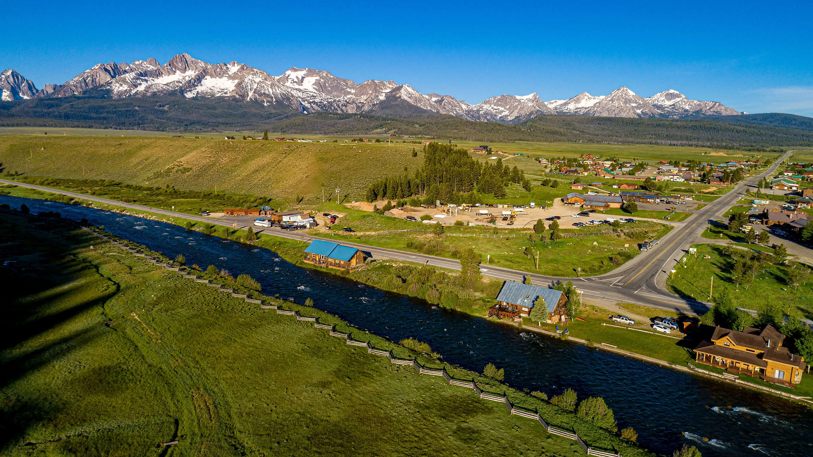
Like many of the options on this list, this one is important to do in order, starting in Shoshone and going through all the towns between it and Stanley, including little stops like Ketchum. It is another that follows a rise in the terrain, going from the relatively flat Wood River Valley up into the Boulder Mountains. Hence, thematically speaking, this is a trek that builds. The Galena Summit is a good stop for the views, and Redfish Lake near the end sits at the foot of the Sawtooth Mountains. This is Idaho wild country at its finest, and the landscape speaks for itself. The state seems to have understood this since these parts are considered an open national recreation area.
Swan Valley to Ashton on the Teton Scenic Byway

Route: Swan Valley to Ashton via Idaho 31, Idaho 33, Idaho 32, and Idaho 47, about 68 miles.
Remember the mention of the word "byway" in the introduction? The word typically refers to a less often traveled road that can also have historical significance. We have seen some of these already, but like those others, this one is primarily just about the scenery. Thus, be sure to pause at the South Fork corridor to take in the expanse of the agricultural land in the Teton Valley. The same can be said once you pass Driggs and Tetonia, quiet farm towns on the valley floor. Be sure, too, to take in the sights from the Tetons north of Driggs. Between the geography and the slow pace of life here, this one is unforgettable.
Boise to Stanley on the Ponderosa Pine Scenic Byway

Route: Boise/Eagle to Stanley via Idaho 21, about 131 miles.
This one starts in the state capital, Boise, which is the one thing that keeps it from feeling like the wildest option on the list. It has everything one would want of a Rocky Mountains jaunt, but the beginning point does not reflect the wilder side of the area. Heading down Idaho 21, you will pass through Lucky Peak and Lowman before getting to the South Fork Payette River corridor. Then it is up to Banner Summit, and the route's terminus at Stanley. The drive will treat you to a little of everything there is to offer in Idaho, but with the added bonus of seeing some hot springs. Finally, despite where you commence, you need to be wary of weather conditions, particularly as they pertain to avalanches or rock slides depending on the season.
Cambridge to Hells Canyon Dam

Route: Cambridge to Hells Canyon Dam via Idaho 71, Oxbow Bridge, and the Idaho side of the Snake River, about 62 miles.
This is arguably the roughest of any of these rides, with civilization becoming more distant the farther you travel along the Snake River. At points, you are skirting the edge of Hells Canyon, or having it as a wall on one side, on your way to the dam, which is among the few reminders of man in the area. Cambridge is about the only reliable service point within reach of any of these sites, so plan accordingly. With access to the Brownlee Reservoir and different pull offs along the Snake River, this one is definitely worth roughing it a little.
Coeur d'Alene to Idaho 3 on the Lake Coeur d'Alene Scenic Byway

Route: I-90/Idaho 97 junction to Idaho 3 near Harrison, about 25 miles.
This is the shortest of the treks on this list, but the drive along the east side of Lake Coeur d'Alene is worth the brevity. On this body of water sits Beauty Bay, which says almost all you need to know about the area. In other villages like Carlin Bay and Mineral Ridge, you can take a moment to look out for the eagles that patrol the nearby skies. The road also hugs the coast line, featuring many stretches with nothing but water on one side and the forest on the other. Once you get to Harrison, you can get food or carry on to the Trail of the Coeur d'Alenes, which offers further adventures. If only this one could be longer!
The Wild Side Of The Drive
With these ten Idaho road trips, you will wish that you could spend longer on each one, especially if you love the wild nature to be found in the state. It is that nature that this list highlights, but it is not all just mountains. Idaho does have the soaring peaks, but it has lava flows and hot springs as well. Any of these trips are highly recommended.