Bolivar Peninsula, Texas
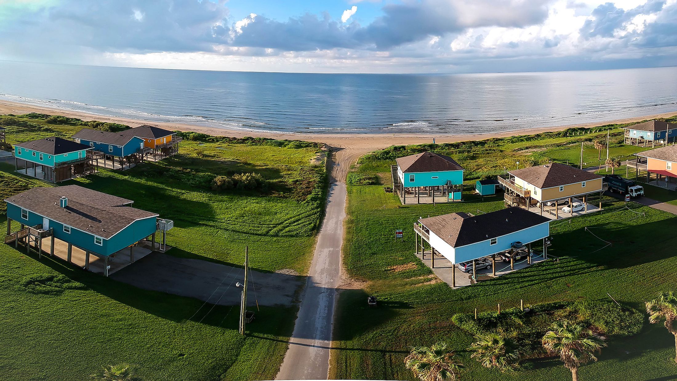
The Bolivar Peninsula is a narrow strip of land that is situated in the Galveston County of Texas, United States. This strip of land separates the Gulf of Mexico from the eastern part of Galveston Bay, stretching in the northeastern direction along the Texas Gulf Coast. Extending approximately 44 kilometers, the Bolivar Peninsula houses several unincorporated communities such as Caplen, Gilchrist, Port Bolivar, High Island, and Crystal Beach. The US Census Bureau deems the Bolivar Peninsula as a census-designated place that covers a total area of 124.7 sq. km, of which 110.1 sq. km is occupied by land and 14.6 sq. km by water. The Peninsula is known for its touristic beaches and recreational activities, such as fishing and bird watching.
Geography Of Bolivar Peninsula

The Bolivar Peninsula is 5 kilometers wide between Crystal Beach and Caplen towns, making this point the widest on the peninsula. The narrowest point is 402 meters wide, situated where Rollover Pass divides the Gilchrist community. Less than 5 kilometers of water separate Galveston Island from the peninsula. The Gulf Intercoastal Waterway, which is designated to transport freight, extends along the peninsula’s length on the north side. Bolivar Roads, which forms a water passageway limited by the North and South jetties of the peninsula and Galveston Island, is designated as the marine entrance from the Gulf of Mexico to Galveston Bay. The Bolivar Peninsula is accessible only through the southern Chambers County of Texas from the Texas mainland.
Facilities And Recreation

There are several historic parks in the Bolivar Peninsula that house historically significant monuments in addition to being a popular location for celebrations by different communities. For example, the Joe Faggard Community Center at 1760 State Highway 87 in the Crystal Beach area is operated by the Galveston County Department of Parks and Senior Services. More importantly, the Department also operates the Fort Travis Seashore Park, which includes the historic Fort Travis. The Park offers several amenities such as camping areas, cabanas, picnic areas, and wetland overlooks.
Biodiversity In The Bolivar Peninsula

There are two important areas to birdwatchers on the Peninsula: the Houston Audubon Society’s Louis Smith Bird Sanctuary, located in High Island, and the Bolivar Flats near Port Bolivar, named Bolivar Flats Shorebird Sanctuary. These sanctuaries serve as the first landfall for migrating birds as they reach North America from Central and South America. In addition to migrating birds, the area is home to thousands of native shorebirds. The Bolivar Peninsula Nature Trail (BPNT) is an important nature conservation project implemented by Houston Audubon and other profit and non-profit partners. This Trail is a nature-based conservation and development initiative that connects 13 world-class sites on the Bolivar Peninsula and aims to enhance wildlife habitats while developing visitor facilities such as trails, boardwalks, and signage at locations across the Peninsula. This initiative offers fun recreational activities to attract visitors while raising awareness of the area’s natural resources.
History Of The Bolivar Peninsula

The Peninsula has a rich history associated with myths, the Native Americans, and some prominent figures. Archaeological digs at Caplen Mound indicate that the Native Americans have crossed the upper Gulf Coast. Excavations in 1932 by a team of archaeologists from the University of Texas revealed some artifacts in the Caplen Mound, also known as the “Indian Cemetery”. The Natives also used Caplen Mound as a burial ground for their dead. In 1528, it is postulated that Explorer Cabeza de Vaca came to the area and visited the peninsula, due to some evidence of his landing at High Island.
The name of the Peninsula is derived from Simon Bolivar, the famous Venezuelan political leader who was involved in the independence movements of several Latin American nations including Colombia, Bolivia, Peru, and others. The Peninsula was also part of the pirate kingdom headed by the French pirate and privateer Jean Laffite and Louis-Michel Aury. Nevertheless, several myths are associated with the Peninsula. One of them is that Jean Lafitte used to throw parties in a grove of Oak trees on the Peninsula. It is also believed that Lafitte left behind him buried treasure even though none have been discovered to date.
During the Runaway Scrape when Texans were fleeing their homes, the peninsula served as a refuge for Galveston Island settlers in 1836. The Galvestonians also moved eastward up the Peninsula when the provisional President David G. Burnet and his staff relocated to Galveston Island. Samuel D. Parr is presumed to be the first permanent settler on the Peninsula, arriving in 1838 and claiming a significant portion of land that began at Bolivar Point and extended 8 kilometers east. By 1850, fifteen families were living between Point Bolivar and High Island. By 1885, the peninsula’s population increased to 500. Two of the most prominent figures in the history of the Peninsula are General James Long and his wife, Jane Long. Jane is named “The Mother of Texas” as she gave birth to one of the first Anglo children in Texas. With the first establishment of the Bolivar Peninsula, James Long ran his operations on the peninsula in 1819.
Another symbol of the Peninsula is the Bolivar Lighthouse, which was built in 1852. The lighthouse is located on the western end of the peninsula near Fort Travis in Galveston. During the civil war, the lighthouse was dismantled by the Confederate troops to make cannonballs from the tower’s iron. Later on, in 1872, the tower was rebuilt and it guided ships through ship channels from the Gulf of Mexico into the port of Galveston, until more advanced navigational devices became available during the 1930s. Most importantly, the tower served as a refuge for Bolivar residents during the 1900 and 1915 hurricanes. Today, the lighthouse is privately owned.
The Bolivar Peninsula is historically known for farming and ranching. The peninsula was named the “Breadbasket of Galveston” and the ‘Watermelon Capital of Texas” between the late 1800s and the 1900s. The area also experienced a brief oil boom, mainly around the High Island area. Tourism also played a significant role in boosting the Peninsula’s economy, as more vacation-home owners and summer visitors flooded the Peninsula for the recreational activities it offered.