The National Parks You Can Reach Without A Car
Across the National Park System, a handful of parks can be reached and explored entirely by bus, train, or boat, with public transit carrying visitors to the entrance gates and even into the heart of the landscape, no private vehicle required. A shuttle in Montana routes through 50 miles of glacier-carved landscape. A ferry cuts through open Pacific waters for ninety minutes to reach an island rising out of the fog. A century-old steam train in Arizona rolls toward the rim of the longest canyon in the US.
Seven of these national parks stand out for their public transportation access. Five run on coordinated shuttle, bus, and rail networks, and two can only be reached by boat.
Zion National Park, Utah

In Zion National Park, public transit through Zion Canyon runs beneath 2,000-foot walls of Navajo sandstone, past the Great White Throne and the base of Angels Landing. From March through November, private vehicles are banned from Utah's Zion Canyon Scenic Drive, and the only way through is a free, propane-powered shuttle. During peak hours, those shuttles run every ten minutes, climbing 1,200 feet from the valley entrance to the Temple of Sinawava. They carry thousands of people a day past hanging gardens, red canyon, and sheer rock faces.
Most visitors fly into Las Vegas, 120 miles southwest, then connect via regional bus or shuttle service. A town shuttle in Springdale closes the last gap, carrying people directly to the park.
Grand Canyon National Park, Arizona

The Grand Canyon Railway still runs the way it has for over a century, departing Williams, Arizona, each morning and rolling straight into the South Rim depot. Amtrak's Southwest Chief stops at Flagstaff, roughly 30 miles east of Williams, and a shuttle bridges that gap by road in about 40 minutes. A traveler can therefore come by rail from Chicago and reach the South Rim of Grand Canyon National Park with a single short transfer in between. Once at the rim of the canyon, a free shuttle system takes over, running four routes between May and September out to viewpoints like Mather Point and permit-based trailheads including Bright Angel.
The Hermit Road route, closed to private cars year-round, is shuttle only. It threads nine overlooks across seven miles, with views straight down into the ancient Vishnu Schist at the canyon's base. From there, cyclists and hikers can follow the rim along a 14-mile paved Greenway Trail.
Glacier National Park, Montana

Glacier National Park in Montana contains about 25 active glaciers and some of the oldest exposed rock in North America. From July through September, a free hop-on, hop-off shuttle with connecting lines runs the length of the park's 50-mile Going-to-the-Sun Road. The route passes cascading falls, mountain overlooks, and climbs over the Continental Divide at Logan Pass, 6,646 feet up. Amtrak's Empire Builder stops within a few miles of the park at both East Glacier and West Glacier. A connecting park shuttle bridges the last stretch to the transit center where the Going-to-the-Sun buses depart.
Those buses link Apgar Village on the west side to St. Mary on the east, crossing entirely different ecosystems and landscapes along the way. The shuttle isn't just a convenience here: parking at Logan Pass routinely fills by 6 a.m., which makes the bus close to the only reliable way to reach the alpine meadows where mountain goats graze through beargrass in July.
Acadia National Park, Maine
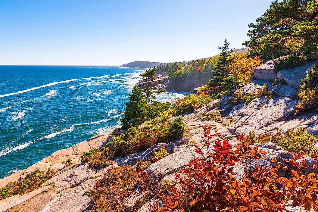
Maine's Acadia's Island Explorer runs entirely free from late May through mid-October, a propane-powered network that connects the park's granite peaks and spruce-fir forest. One route reaches Jordan Pond, where the clear water sits still enough to mirror the twin summits called the Bubbles. Another reaches Sand Beach, the park's only major stretch of sand, formed from crushed shell and mineral fragments rather than the usual quartz.
A private, fare-based Cadillac Mountain Shuttle also climbs 3.5 miles to Cadillac Mountain, which at 1,530 feet is the highest point along the North Atlantic seaboard. To reach the park without a car, most visitors either first fly into Bangor International Airport and then connect directly to Bar Harbor via bus or take multiple bus transfers to arrive in Bar Harbor from major connectors like Boston. From Bar Harbor, the Island Explorer picks up visitors on the Bar Harbor Village Green route.
Channel Islands National Park, California

Sometimes called the "Galapagos of North America", no bridge or roadway of any kind connects the Channel Islands National Park in California to the US mainland, but a seasonal ferry carries the public across. The Island Packers ferry runs daily from Ventura Harbor to Santa Cruz and Anacapa Islands from April through early November. These crossings take an hour to ninety minutes, depending on weather conditions. During the crossing, visitors might spot blue whales, humpbacks, dolphins, and sea lions.
Santa Cruz, the largest of the five islands, has sea caves like Painted Cave along its coast. It's also home to the Channel Islands fox (Urocyon littoralis), an endemic species found nowhere else on Earth. Off Anacapa Island are a 40-foot natural stone bridge and Anacapa Island Lighthouse built in 1932.
Getting to the Island Packers ferry itself is relatively simple: the Ventura Amtrak stop on the Pacific Surfliner line sits about five miles away, but closing the last leg of the trip without a car requires either walking, biking, or taking a cab.
Dry Tortugas National Park, Florida

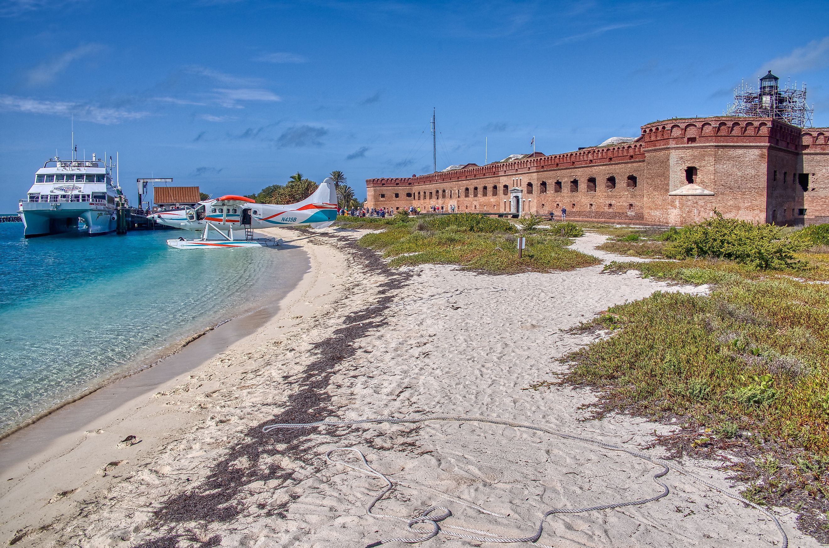
Seventy miles of open Gulf of Mexico water separate Key West, Florida, from Dry Tortugas's Fort Jefferson, an unfinished 19th-century fortress that sits surrounded by a large sea moat on Garden Key.
The Yankee Freedom III ferry is the public route out to the remote Dry Tortugas National Park, leaving the Key West terminal at 8 a.m. daily. Reaching Key West itself without a car just requires a FlixBus or Greyhound ride from the mainland. From there, travelers can catch the ferry to one of the most physically isolated national parks in the country. The ferry crosses in about two and a half hours to reach the fort and the 100 square miles of protected land and water around it.
These coastal waters hold some of the best snorkeling in the Florida Keys, within the third-largest barrier reef system in the world. The park's waters are home to dozens of species of tropical fish, coral, and sea turtles. While the health of the coral reefs has been in significant decline in recent decades from record-breaking high water temperatures and increased hurricane damage, there are still pockets near the park of resilient coral heads, sea fans, and nursery-grown corals. The ferry heads back to the mainland at 3 p.m. each day, leaving about four and a half hours for visitors to explore the fortress walls, beaches, and reef.
Yosemite National Park, California

Granite walls rise sharply out of the valley floor of Yosemite National Park at El Capitan and Half Dome, and for more than 25 years there has been public transportation access into that valley. California's Yosemite Area Regional Transportation System, YARTS, runs buses year-round along Highway 140 from Merced through Mariposa and into the park. There is no reservation required to enter. A seasonal second route runs Highway 120 from Sonora, and in summer a third comes in from Mammoth Lakes over Tioga Pass, one of the highest crossings in California. Visitors can also hop on the YARTS in the city of Fresno on Highway 41 to reach Yosemite Valley.
Merced's Amtrak station, served by the San Joaquins line, connects directly to the YARTS terminal, so the trip from the Central Valley into Yosemite Valley can run entirely on rail and bus. Once inside the park, the free Valley Shuttle takes over on approximately 10 to 20-minute rotations, looping past Yosemite Falls, El Capitan Meadow, and the trailheads for Half Dome and Mist Trail. A second free shuttle serves Tuolumne Meadows each summer, carrying hikers into the high country beneath Cathedral Peak.
Visiting National Parks Without a Car
When accessing these national parks, there's a trade-off for leaving the car behind. Zion's shuttles and Yosemite's YARTS buses run on fixed schedules, and a visit has to be built around them. Acadia's Island Explorer and Glacier's Going-to-the-Sun shuttle only operate in certain months. The Yankee Freedom III out of Key West leaves sharply for the park at 8 a.m. and always departs back at exactly 3 p.m. That trade means careful planning, and giving up a bit of spontaneity for a more communal and less congested experience of arriving to and traversing these unique landscapes.