Where is Monongalia County, West Virginia?
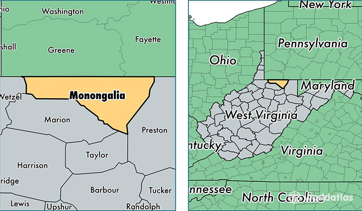
Monongalia County is a county equivalent area found in West Virginia, USA. The county government of Monongalia is found in the county seat of Morgantown.
With a total 947.62 sq. km of land and water area, Monongalia County, West Virginia is the 2693rd largest county equivalent area in the United States. Home to 103,463 people, Monongalia County has a total 44197 households earning 44173 on average per year.
Monongalia County, West Virginia - Quick Facts
| FIPS Code | 54061 |
| Area Codes | 304 |
| Time Zone | EST |
| Major Cities | Morgantown (population: 91,327), Maidsville (population: 2,737), Wana (population: 825), Granville (population: 822), Blacksville (population: 360), Osage (population: 262), Pentress (population: 174), Dellslow (population: 110) |
| Land Area | 39,947 sq miles |
| Water Area | 360 sq miles |
| Household Income | $44,173 |
| Housing Units | 44,197 |
| Median Home Value | $161,800 |
| High School Grads | 91% of population |
| Holders of Bachelors Degrees | 38% of population |
| Retail Spending | $14,727 per capita |
| Food & Accomodation Sales | $192,832 per capita |
| Universities and Colleges | West Virginia University Hospital Departments of Rad Tech and Nutrition, West Virginia Junior College, West Virginia University |
This page was last updated on June 30, 2016.