Where is Russell County, Virginia?
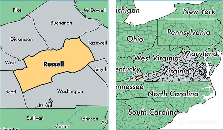
Russell County is a county equivalent area found in Virginia, USA. The county government of Russell is found in the county seat of Lebanon.
With a total 1,234.79 sq. km of land and water area, Russell County, Virginia is the 2255th largest county equivalent area in the United States. Home to 28,023 people, Russell County has a total 13338 households earning 33872 on average per year.
Russell County, Virginia - Quick Facts
| FIPS Code | 51167 |
| Area Codes | 276 |
| Time Zone | EST |
| Major Cities | Lebanon (population: 9,372), Castlewood (population: 6,628), Honaker (population: 5,650), Swords Creek (population: 2,716), Cleveland (population: 1,670), Rosedale (population: 810) |
| Land Area | 10,820 sq miles |
| Water Area | 474 sq miles |
| Household Income | $33,872 |
| Housing Units | 13,338 |
| Median Home Value | $91,100 |
| High School Grads | 75% of population |
| Holders of Bachelors Degrees | 11% of population |
| Retail Spending | $8,806 per capita |
| Food & Accomodation Sales | $15,571 per capita |
This page was last updated on June 30, 2016.