Where is Union County, Tennessee?
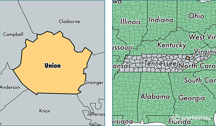
Union County is a county equivalent area found in Tennessee, USA. The county government of Union is found in the county seat of Maynardville.
With a total 640.08 sq. km of land and water area, Union County, Tennessee is the 2958th largest county equivalent area in the United States. Home to 19,113 people, Union County has a total 8997 households earning 34399 on average per year.
Union County, Tennessee - Quick Facts
| FIPS Code | 47173 |
| Area Codes | 865 |
| Time Zone | EST |
| Major Cities | Maynardville (population: 9,936), Luttrell (population: 3,985), Sharps Chapel (population: 1,700), Powder Springs (population: 246) |
| Land Area | 7,380 sq miles |
| Water Area | 224 sq miles |
| Household Income | $34,399 |
| Housing Units | 8,997 |
| Median Home Value | $95,800 |
| High School Grads | 73% of population |
| Holders of Bachelors Degrees | 8% of population |
| Retail Spending | $3,198 per capita |
| Food & Accomodation Sales | $5,737 per capita |
This page was last updated on June 30, 2016.