Where is Stewart County, Tennessee?
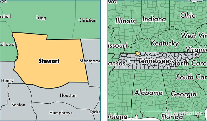
Stewart County is a county equivalent area found in Tennessee, USA. The county government of Stewart is found in the county seat of Dover.
With a total 1,276.9 sq. km of land and water area, Stewart County, Tennessee is the 2209th largest county equivalent area in the United States. Home to 13,279 people, Stewart County has a total 6719 households earning 39781 on average per year.
Stewart County, Tennessee offers the following attractions to visitors: Fort Donelson National Cemetery, Fort Donelson NB
Stewart County, Tennessee - Quick Facts
| FIPS Code | 47161 |
| Area Codes | 931 |
| Time Zone | CST |
| Major Cities | Dover (population: 7,066), Indian Mound (population: 2,608), Big Rock (population: 1,807), Cumberland City (population: 1,716), Bumpus Mills (population: 674) |
| Land Area | 5,127 sq miles |
| Water Area | 459 sq miles |
| Household Income | $39,781 |
| Housing Units | 6,719 |
| Median Home Value | $118,900 |
| High School Grads | 84% of population |
| Holders of Bachelors Degrees | 12% of population |
| Retail Spending | $4,889 per capita |
| Food & Accomodation Sales | $6,112 per capita |
This page was last updated on June 30, 2016.