Where is Christian County, Kentucky?
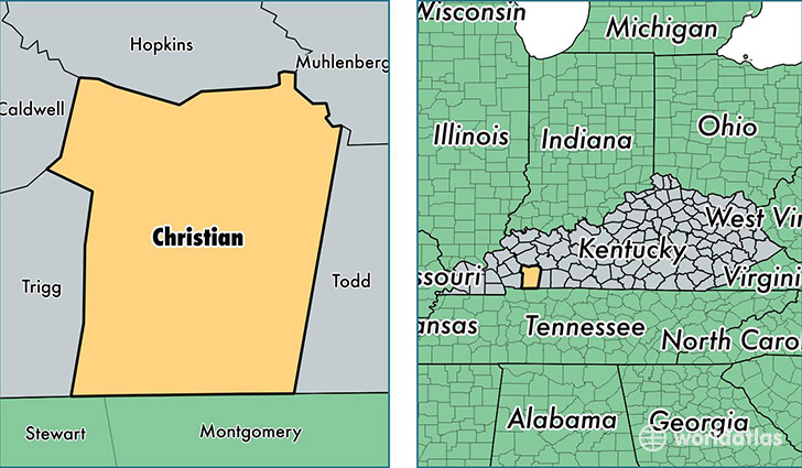
Christian County is a county equivalent area found in Kentucky, USA. The county government of Christian is found in the county seat of Hopkinsville.
With a total 1,875.26 sq. km of land and water area, Christian County, Kentucky is the 1344th largest county equivalent area in the United States. Home to 74,250 people, Christian County has a total 29611 households earning 38904 on average per year.
Christian County, Kentucky - Quick Facts
| FIPS Code | 21047 |
| Area Codes | 270 |
| Time Zone | CST |
| Major Cities | Hopkinsville (population: 43,324), Fort Campbell (population: 20,542), Oak Grove (population: 8,563), Crofton (population: 4,198), Pembroke (population: 2,640), Cerulean (population: 1,318), Herndon (population: 945), Gracey (population: 825), La Fayette (population: 213) |
| Land Area | 28,668 sq miles |
| Water Area | 717 sq miles |
| Household Income | $38,904 |
| Housing Units | 29,611 |
| Median Home Value | $101,700 |
| High School Grads | 85% of population |
| Holders of Bachelors Degrees | 15% of population |
| Retail Spending | $11,565 per capita |
| Food & Accomodation Sales | $80,082 per capita |
This page was last updated on June 30, 2016.