Where is Herkimer County, New York?
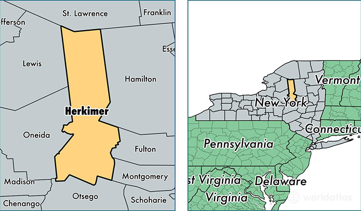
Herkimer County is a county equivalent area found in New York, USA. The county government of Herkimer is found in the county seat of Herkimer.
With a total 3,776.22 sq. km of land and water area, Herkimer County, New York is the 462nd largest county equivalent area in the United States. Home to 63,744 people, Herkimer County has a total 33227 households earning 45047 on average per year.
Herkimer County, New York - Quick Facts
| FIPS Code | 36043 |
| Area Codes | 315 |
| Time Zone | EST |
| Major Cities | Ilion (population: 11,093), Herkimer (population: 10,091), Little Falls (population: 8,904), Frankfort (population: 8,203), Mohawk (population: 5,452), Dolgeville (population: 3,877), West Winfield (population: 3,625), Newport (population: 2,270), Cold Brook (population: 2,148), Old Forge (population: 1,265) |
| Land Area | 24,612 sq miles |
| Water Area | 1,412 sq miles |
| Household Income | $45,047 |
| Housing Units | 33,227 |
| Median Home Value | $92,500 |
| High School Grads | 89% of population |
| Holders of Bachelors Degrees | 21% of population |
| Retail Spending | $8,058 per capita |
| Food & Accomodation Sales | $54,239 per capita |
This page was last updated on June 30, 2016.