Where is Lincoln County, Missouri?
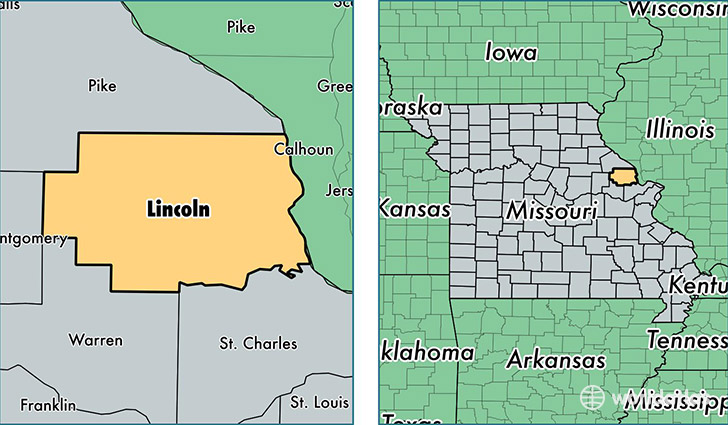
Lincoln County is a county equivalent area found in Missouri, USA. The county government of Lincoln is found in the county seat of Troy.
With a total 1,658.79 sq. km of land and water area, Lincoln County, Missouri is the 1608th largest county equivalent area in the United States. Home to 54,249 people, Lincoln County has a total 20963 households earning 52835 on average per year.
Lincoln County, Missouri - Quick Facts
| FIPS Code | 29113 |
| Area Codes | 573,636 |
| Time Zone | CST |
| Major Cities | Troy (population: 23,698), Moscow Mills (population: 6,445), Winfield (population: 6,430), Elsberry (population: 4,613), Foley (population: 3,124), Silex (population: 2,498), Old Monroe (population: 2,291), Hawk Point (population: 1,962), Whiteside (population: 74), Olney (population: 33) |
| Land Area | 20,946 sq miles |
| Water Area | 627 sq miles |
| Household Income | $52,835 |
| Housing Units | 20,963 |
| Median Home Value | $149,400 |
| High School Grads | 85% of population |
| Holders of Bachelors Degrees | 14% of population |
| Retail Spending | $8,413 per capita |
| Food & Accomodation Sales | $31,065 per capita |
This page was last updated on June 30, 2016.