Where is Jefferson County, Missouri?
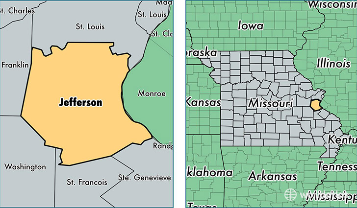
Jefferson County is a county equivalent area found in Missouri, USA. The county government of Jefferson is found in the county seat of Hillsboro.
With a total 1,720.49 sq. km of land and water area, Jefferson County, Missouri is the 1528th largest county equivalent area in the United States. Home to 222,716 people, Jefferson County has a total 88134 households earning 54845 on average per year.
Jefferson County, Missouri - Quick Facts
| FIPS Code | 29099 |
| Area Codes | 636 |
| Time Zone | CST |
| Major Cities | Arnold (population: 35,678), Imperial (population: 26,609), Festus (population: 26,572), De Soto (population: 20,853), High Ridge (population: 16,002), Hillsboro (population: 15,822), House Springs (population: 14,592), Barnhart (population: 10,040), Cedar Hill (population: 7,633), Pevely (population: 7,488) |
| Land Area | 85,991 sq miles |
| Water Area | 657 sq miles |
| Household Income | $54,845 |
| Housing Units | 88,134 |
| Median Home Value | $152,100 |
| High School Grads | 87% of population |
| Holders of Bachelors Degrees | 17% of population |
| Retail Spending | $7,919 per capita |
| Food & Accomodation Sales | $203,297 per capita |
This page was last updated on June 30, 2016.