Where is Otsego County, Michigan?
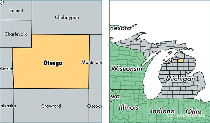
Otsego County is a county equivalent area found in Michigan, USA. The county government of Otsego is found in the county seat of Gaylord.
With a total 1,362.82 sq. km of land and water area, Otsego County, Michigan is the 2085th largest county equivalent area in the United States. Home to 24,158 people, Otsego County has a total 14746 households earning 47584 on average per year.
Otsego County, Michigan - Quick Facts
| FIPS Code | 26137 |
| Area Codes | 989 |
| Time Zone | EST |
| Major Cities | Gaylord (population: 19,398), Vanderbilt (population: 2,084), Johannesburg (population: 2,068) |
| Land Area | 9,327 sq miles |
| Water Area | 515 sq miles |
| Household Income | $47,584 |
| Housing Units | 14,746 |
| Median Home Value | $116,600 |
| High School Grads | 91% of population |
| Holders of Bachelors Degrees | 20% of population |
| Retail Spending | $20,761 per capita |
| Food & Accomodation Sales | $58,833 per capita |
This page was last updated on June 30, 2016.