Where is Charlevoix County, Michigan?
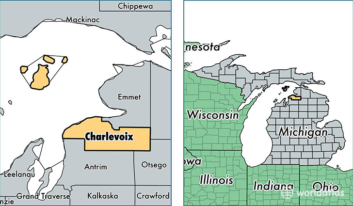
Charlevoix County is a county equivalent area found in Michigan, USA. The county government of Charlevoix is found in the county seat of Charlevoix.
With a total 3,601.28 sq. km of land and water area, Charlevoix County, Michigan is the 489th largest county equivalent area in the United States. Home to 26,121 people, Charlevoix County has a total 17287 households earning 45949 on average per year.
Charlevoix County, Michigan - Quick Facts
| FIPS Code | 26029 |
| Area Codes | 231 |
| Time Zone | EST |
| Major Cities | Charlevoix (population: 9,195), Boyne City (population: 7,911), East Jordan (population: 7,148), Boyne Falls (population: 1,869), Beaver Island (population: 658), Walloon Lake (population: 320) |
| Land Area | 10,085 sq miles |
| Water Area | 416 sq miles |
| Household Income | $45,949 |
| Housing Units | 17,287 |
| Median Home Value | $151,400 |
| High School Grads | 92% of population |
| Holders of Bachelors Degrees | 27% of population |
| Retail Spending | $8,437 per capita |
| Food & Accomodation Sales | $60,229 per capita |
This page was last updated on June 30, 2016.