Where is Midland County, Michigan?
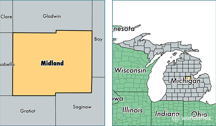
Midland County is a county equivalent area found in Michigan, USA. The county government of Midland is found in the county seat of Midland.
With a total 1,367.69 sq. km of land and water area, Midland County, Michigan is the 2077th largest county equivalent area in the United States. Home to 83,427 people, Midland County has a total 36029 households earning 53076 on average per year.
Midland County, Michigan - Quick Facts
| FIPS Code | 26111 |
| Area Codes | 989 |
| Time Zone | EST |
| Major Cities | Midland (population: 65,096), Sanford (population: 7,999), Coleman (population: 5,405), Hope (population: 1,939), Edenville (population: 44) |
| Land Area | 32,211 sq miles |
| Water Area | 516 sq miles |
| Household Income | $53,076 |
| Housing Units | 36,029 |
| Median Home Value | $128,600 |
| High School Grads | 92% of population |
| Holders of Bachelors Degrees | 32% of population |
| Retail Spending | $10,524 per capita |
| Food & Accomodation Sales | $108,035 per capita |
This page was last updated on June 30, 2016.