Where is Hampshire County, Massachusetts?
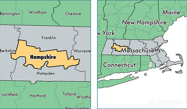
Hampshire County is a county equivalent area found in Massachusetts, USA. The county government of Hampshire is found in the county seat of Northampton.
With a total 1,412.09 sq. km of land and water area, Hampshire County, Massachusetts is the 2020th largest county equivalent area in the United States. Home to 160,939 people, Hampshire County has a total 62680 households earning 61227 on average per year.
Hampshire County, Massachusetts offers the following attraction to visitors: Calvin Coolidge Library
Hampshire County, Massachusetts - Quick Facts
| FIPS Code | 25015 |
| Area Codes | 413 |
| Time Zone | EST |
| Major Cities | Amherst (population: 39,845), Easthampton (population: 17,851), South Hadley (population: 17,717), Northampton (population: 15,883), Belchertown (population: 14,807), Florence (population: 11,270), Ware (population: 10,433), Granby (population: 6,294), Southampton (population: 5,854), Hadley (population: 5,306) |
| Land Area | 62,139 sq miles |
| Water Area | 527 sq miles |
| Household Income | $61,227 |
| Housing Units | 62,680 |
| Median Home Value | $262,600 |
| High School Grads | 93% of population |
| Holders of Bachelors Degrees | 42% of population |
| Retail Spending | $9,962 per capita |
| Food & Accomodation Sales | $225,453 per capita |
| Universities and Colleges | Amherst College, University of Massachusetts Amherst, Smith College |
This page was last updated on June 30, 2016.