Where is Black Hawk County, Iowa?
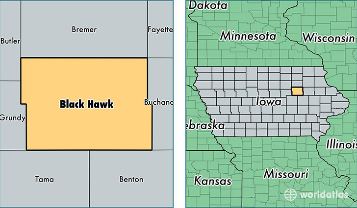
Black Hawk County is a county equivalent area found in Iowa, USA. The county government of Black Hawk is found in the county seat of Waterloo.
With a total 1,483.23 sq. km of land and water area, Black Hawk County, Iowa is the 1905th largest county equivalent area in the United States. Home to 132,897 people, Black Hawk County has a total 56508 households earning 45747 on average per year.
Black Hawk County, Iowa - Quick Facts
| FIPS Code | 19013 |
| Area Codes | 319 |
| Time Zone | CST |
| Major Cities | Waterloo (population: 70,546), Cedar Falls (population: 42,261), Evansdale (population: 8,556), La Porte City (population: 3,593), Hudson (population: 2,762), Dunkerton (population: 1,814), Raymond (population: 799), Gilbertville (population: 716), Dewar (population: 122) |
| Land Area | 51,312 sq miles |
| Water Area | 566 sq miles |
| Household Income | $45,747 |
| Housing Units | 56,508 |
| Median Home Value | $123,600 |
| High School Grads | 90% of population |
| Holders of Bachelors Degrees | 25% of population |
| Retail Spending | $15,224 per capita |
| Food & Accomodation Sales | $194,601 per capita |
This page was last updated on June 30, 2016.