Where is Rockdale County, Georgia?
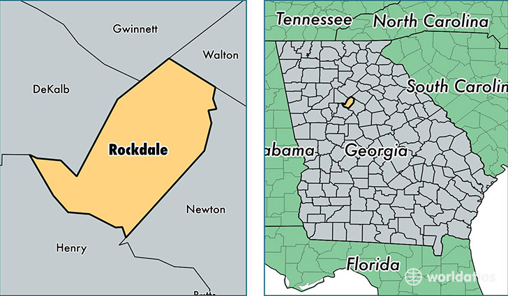
Rockdale County is a county equivalent area found in Georgia, USA. The county government of Rockdale is found in the county seat of Conyers.
With a total 342.13 sq. km of land and water area, Rockdale County, Georgia is the 3085th largest county equivalent area in the United States. Home to 87,754 people, Rockdale County has a total 33194 households earning 52579 on average per year.
Rockdale County, Georgia - Quick Facts
| FIPS Code | 13247 |
| Area Codes | 770 |
| Time Zone | EST |
| Major Cities | Conyers (population: 84,298) |
| Land Area | 33,882 sq miles |
| Water Area | 130 sq miles |
| Household Income | $52,579 |
| Housing Units | 33,194 |
| Median Home Value | $149,900 |
| High School Grads | 86% of population |
| Holders of Bachelors Degrees | 26% of population |
| Retail Spending | $17,720 per capita |
| Food & Accomodation Sales | $196,568 per capita |
This page was last updated on June 30, 2016.