Where is Livingston County, Michigan?
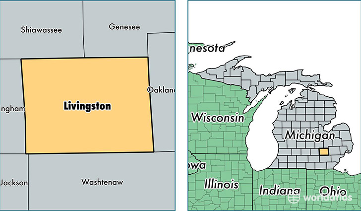
Livingston County is a county equivalent area found in Michigan, USA. The county government of Livingston is found in the county seat of Howell.
With a total 1,516.2 sq. km of land and water area, Livingston County, Michigan is the 1802nd largest county equivalent area in the United States. Home to 185,596 people, Livingston County has a total 73485 households earning 72359 on average per year.
Livingston County, Michigan - Quick Facts
| FIPS Code | 26093 |
| Area Codes | 810,734,517 |
| Time Zone | EST |
| Major Cities | Howell (population: 58,278), Brighton (population: 46,610), Pinckney (population: 21,035), Fowlerville (population: 13,649), Hartland (population: 6,548), Gregory (population: 4,855), Hamburg (population: 208), Cohoctah (population: 122), Lakeland (population: 32) |
| Land Area | 71,659 sq miles |
| Water Area | 565 sq miles |
| Household Income | $72,359 |
| Housing Units | 73,485 |
| Median Home Value | $183,100 |
| High School Grads | 94% of population |
| Holders of Bachelors Degrees | 33% of population |
| Retail Spending | $11,260 per capita |
| Food & Accomodation Sales | $180,995 per capita |
This page was last updated on June 30, 2016.