Maps of Pitcairn

Covering a combined land area of only 47 sq.km, Pitcairn Islands 18 sq mi) is a group of 4 volcanic islands and the only British Overseas Territory located in the Southern Pacific Ocean. The main island is a rugged volcanic formation and is girded by rocky coastal cliffs. Pitcairn is a volcanic island while Ducie and Oeno are coastal atolls. Henderson Island is the largest island and accounts for 67% of the total land area of the island territory. It is an uplifted coral island and is entirely untouched by humans. The highest point on the Pitcairn Islands is the Pawala Valley Ridge with an elevation of 1,138ft (347m). The lowest point is the Pacific Ocean (0m).
Political Map of Pitcairn Islands

Pitcairn Islands have no known administrative divisions. Covering a combined land area of only 47 sq.km, Pitcairn Islands is the only overseas territory of the United Kingdom located in the Southern Pacific Ocean. Pitcairn Islands comprises of a group of 4 small volcanic islands including Pitcairn proper, Henderson, Ducie and Oeno Islands encompassing several hundred miles in the Pacific Ocean. Out of these 4-island groups, Pitcairn is the 2nd largest and the archipelago’s only inhabited island.
Located on the central-north coast of Pitcairn Island close to the Bounty Bay is Adamstown – the capital of all 4 Pitcairn Islands and the only settlement on the island territory.
Where is Pitcairn?

Pitcairn Islands are a group of 4 volcanic islands and the only British Overseas Territory located in the Southern Pacific Ocean.It is geographically positioned in the Southern hemisphere of the Earth. Situated roughly halfway between New Zealand and Peru and to the southeast of Tahiti.
Regional Maps: Map of
Outline Map of Pitcairn

The above blank map represents Pitcairn Islands - a group of 4 volcanic islands and the only British Overseas Territory located in the Southern Pacific Ocean. The above map can be downloaded, printed and used for geography education purposes like map-pointing and coloring activities.

The above outline map represents Pitcairn Islands - a group of 4 volcanic islands and the only British Overseas Territory located in the Southern Pacific Ocean. It is the world’s most remote and the least populated island territory.
Key Facts
| Legal Name | Pitcairn, Henderson, Ducie, and Oeno Islands |
|---|---|
| Flag |
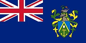
|
| Capital City | Adamstown |
| 25 04 S, 130 05 W | |
| Total Area | 47.00 km2 |
| Land Area | 47.00 km2 |
| Water Area | N/A |
| Population | 54 |
| Currency | New Zealand dollars (NZD) |
This page was last updated on November 23, 2020