The Most Dangerous Forests In America
In America's wilder forests, the danger rarely looks like much at the trailhead. A hiker in New Hampshire can walk out of comfortable woods and into alpine wind inside a couple of hours. In Arizona, the killer is heat and flash floods; in Alaska, it is avalanches and long distances between a hiker and any help. No federal agency ranks the country's "most dangerous" forests. The ten below were chosen for documented hazards, hard terrain, remoteness, and a steady history of rescue calls. None of that makes them places to skip. Each one has famous routes, remarkable wildlife, and scenery that is genuinely hard to find elsewhere, and knowing what makes a forest hazardous is part of knowing the place at all.
White Mountain National Forest, New Hampshire and Maine

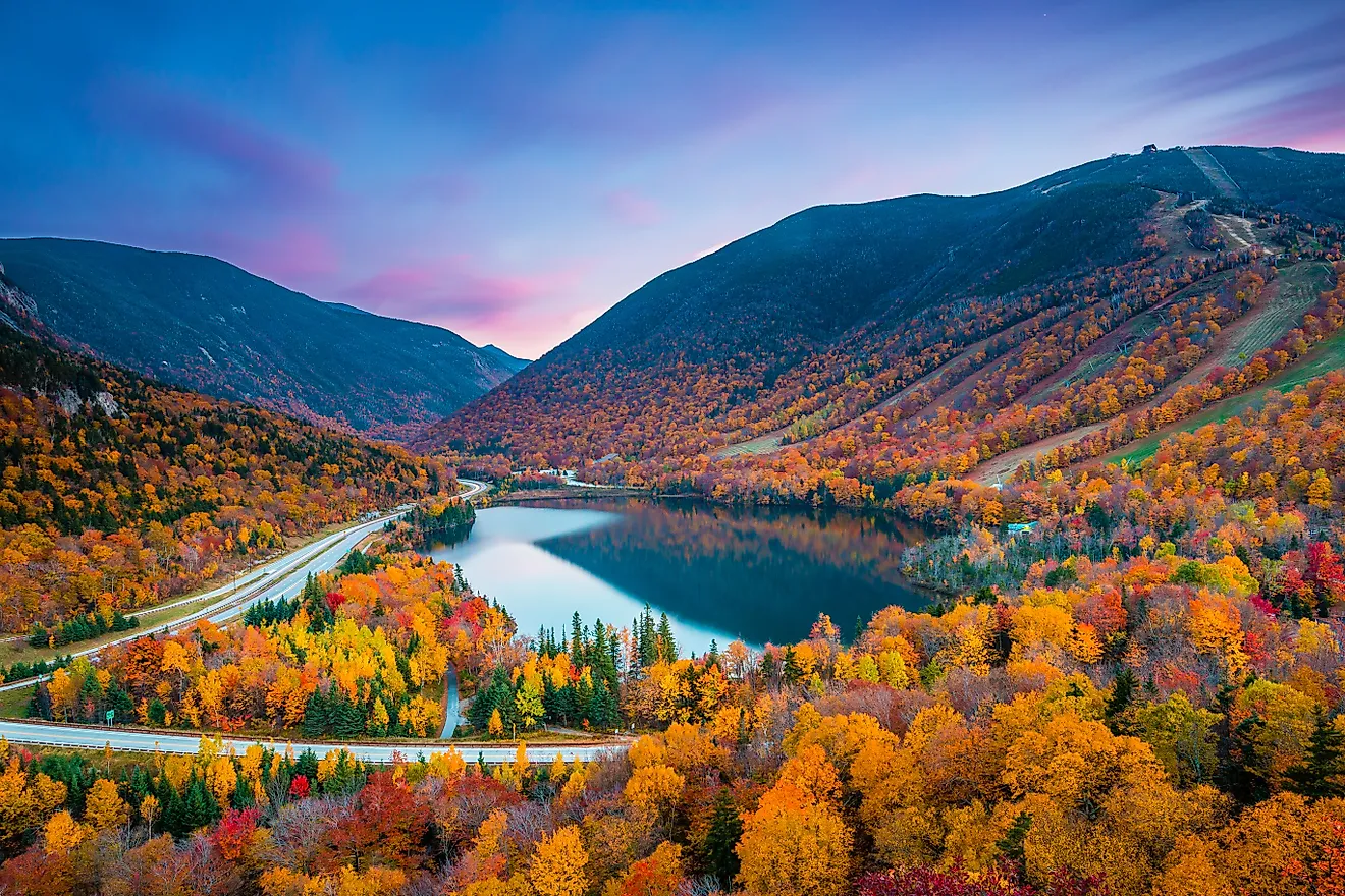
The first surprise in the White Mountains is how fast a pleasant woodland hike turns alpine. On the Presidential Range, hikers climb past the last trees and lose all shelter, and fierce wind or thick fog can close in even while the valleys below stay mild. Ice and sudden temperature drops leave the exposed ridges especially unforgiving. Mount Washington is the famous example, though the same brutal conditions are common across the neighboring summits, which is why search-and-rescue teams are called out across the region so often.
On a clear day the payoff is huge. The Kancamagus Highway runs past mountain overlooks and Sabbaday Falls, and Crawford Notch sits at the edge of some of the finest hiking country in New Hampshire. Snow fills the steep bowl of Tuckerman Ravine well into spring, a striking sight, and avalanche and fall danger persist there. Anyone heading up should pull a summit-specific forecast rather than assume trailhead weather will continue above the tree line.
Chugach National Forest, Alaska

The glaciers are the warning label. They give Chugach a cinematic look, and they are also a plain sign of the kind of country a visitor is walking into: steep snow that can slide, coastal storms thick enough to erase visibility, and routes that sit far past the nearest road. Portage Valley is the gentle introduction, a glacier-carved basin of lakes and wetlands just southeast of Anchorage. A short walk up toward Byron Glacier leads into an extraordinary icy valley, though unstable ice and avalanche paths make the old ice caves dangerous to approach. Farther on, around the Copper River Delta, the sharp mountain scenery gives way to broad wetlands where enormous numbers of migratory birds gather. Deeper backcountry trips can require a boat or a bush plane just to reach the starting line, and out there a shift in the weather can make the trip home as dangerous as the hike itself. Checking the forecast and leaving a detailed trip plan matters more the farther in a hiker goes.
Tonto National Forest, Arizona

At Bartlett Reservoir, big saguaros stand over blue water beneath dry desert mountains. By midday in the hot months that same shoreline turns into a bad place to underestimate the sun. Lower-elevation temperatures in the forest routinely pass 100 degrees Fahrenheit, and many exposed trails have no real shade. The opposite danger comes in the summer monsoon. Rain falling miles up a watershed can send a wall of water down a wash that ran bone-dry minutes earlier.
The Salt River is one of the forest's great days out, running between rocky slopes where hikers sometimes catch sight of the area's famous wild horses. Cooler air waits in the pine country up near the Mogollon Rim, while stretches of the Apache Trail corridor lay bare the battered volcanic geology of central Arizona. An early start earns its keep here. Once thunderheads start stacking up, narrow drainages and low crossings are the last places to linger, no matter how dry the ground underfoot looks.
Bridger-Teton National Forest, Wyoming

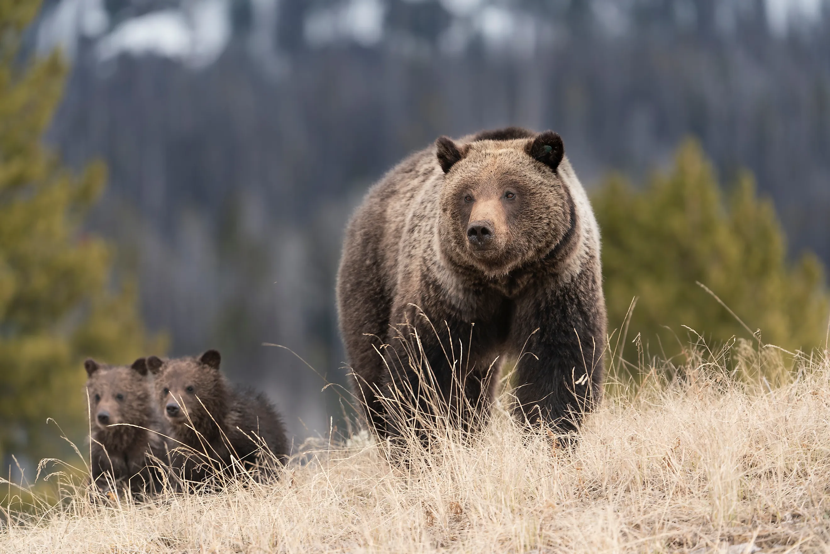
A summer drive out of Jackson drops travelers into genuine grizzly country almost at once. Bridger-Teton covers broad valleys and remote mountain slopes where careful food storage is not optional and bear spray belongs on a hip, not buried in a pack. Come winter, deep snow across steep terrain turns those same mountains into serious avalanche country. The good news is that the best scenery never demands the most technical ground. From Togwotee Pass, enormous views stretch toward the ranges of western Wyoming, and a float through the Snake River Canyon is a way to see the country from water level instead. The Gros Ventre area is another standout, with distinctive geology and strong odds of watching wildlife from a respectful distance. Planning here swings hard with the calendar. Warm months call for disciplined bear habits, while winter backcountry trips hinge on the daily avalanche forecast and the snowpack under each proposed route.
Inyo National Forest, California

A single trip through Inyo can run from scorching eastern-California valleys up to the highest summit in the contiguous United States. Mount Whitney tops out at 14,505 feet, and the thin air becomes a hazard well before most hikers reach the top. Altitude illness stops plenty of fit people, and the high slopes can still hold snow while lower trailheads feel like full summer. Afternoon thunderstorms make the exposed Sierra ridges a poor place to be caught late.
Whitney is the famous draw, but the Ancient Bristlecone Pine Forest may be the more remarkable stop. Gnarled trees thousands of years old cling to the high White Mountains against pale rock and open sky, some of the oldest living things on Earth. Convict Lake is a far gentler slice of the eastern Sierra, its towering peaks mirrored in the water barely past the parking area, and the June Lake Loop is the pick for anyone who would rather see it all from a car. Hikers set on the higher country do best to acclimatize first and treat a headache or nausea as a warning, not a nuisance to push through.
Shasta-Trinity National Forest, California

Mount Shasta climbs so abruptly out of northern California that its snowy cone looks borrowed from some other landscape. Above 14,000 feet the upper slopes are mountaineering terrain, and the popular Avalanche Gulch route can call for an ice axe, crampons, and the skill to use both under pressure. Unstable snow and rockfall raise the stakes further. Lower down, wildfire is the wild card that can shut access to whole districts of this enormous forest in a season.
A technical climb is not the price of a memorable visit. Castle Lake sits beneath a steep granite bowl, an easy place to spend an afternoon by the water. Along the McCloud River, a string of waterfalls waits under dense forest at the end of short trails. Backpackers can point instead toward the Trinity Alps, where clear lakes fill granite basins below jagged ridges. Before driving deep into any district, it is worth checking current fire closures and trailhead access, because one corner of the forest may look nothing like another.
Mount Baker-Snoqualmie National Forest, Washington

Snow is not seasonal decoration in Mount Baker-Snoqualmie. Moist Pacific storms drop an enormous snowpack across the western Cascades, which creates broad avalanche terrain and leaves some high routes buried long after lower ground has turned green. During the melt, the mountain streams run harder and lingering snowfields stay slick enough to turn an ordinary slope into a real fall hazard. Artist Point is the showpiece once the road opens, with Mount Shuksan and Mount Baker filling the horizon. The Mountain Loop Highway climbs into another superb stretch of the Cascades, with old-growth forest, waterfalls, and trailheads under rugged peaks along the way. The Big Four Ice Caves rank among the area's most striking formations, but the safe move is to view them from the designated area, since collapsing ice has killed people here. Mountain weather can differ sharply from conditions in the Puget Sound cities nearby, so an elevation-specific forecast earns its place before departure.
Angeles National Forest, California

Los Angeles falls away startlingly fast once the road starts climbing into the San Gabriel Mountains. Freeways and packed neighborhoods yield to chaparral slopes, pine forest, and deep canyons, all within an easy drive of millions of people. Because the forest sits so close, inexperienced visitors end up near terrain where summer heat and wildfire become serious threats in a hurry. Fire also leaves danger behind after the flames pass, in the form of unstable slopes and weakened trees, and heavy rain over a freshly burned canyon can drive debris downhill with startling force.
The Angeles Crest Highway is the great scenic primer, gaining elevation through several distinct vegetation zones on the way to broad mountain viewpoints. Mount Wilson is an unusual stop on a forest outing, since its historic observatory played an important role in modern astronomy and stands high above the Los Angeles Basin. Lower canyon routes lead to shaded streams and seasonal waterfalls. Winter deserves as much respect as summer, since snow and ice can close the high roads while the neighborhoods below stay warm and dry.
Coconino National Forest, Arizona

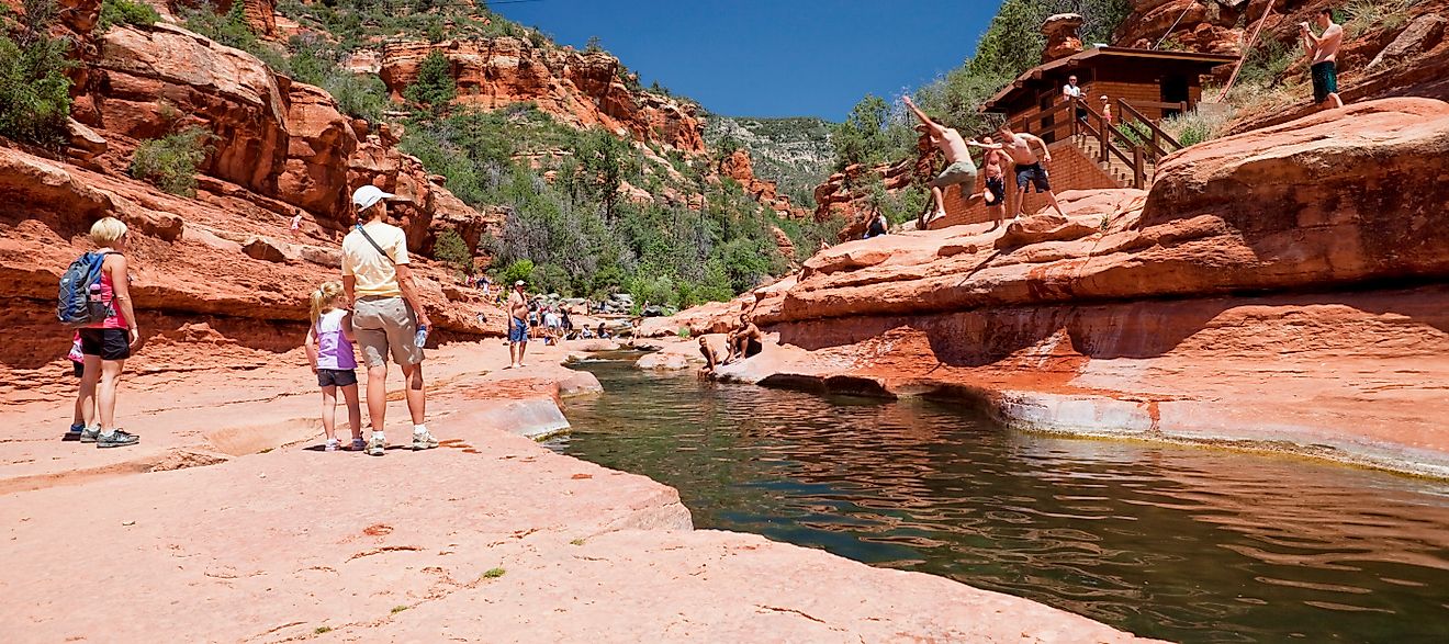
Few forests are as varied as Coconino, where a single trip can cross red-rock country, ponderosa pine, wooded canyon floors, and high mountains. Oak Creek Canyon is a superb place to watch that shift, especially along West Fork, where the trail crosses the creek again and again beneath towering walls. The San Francisco Peaks are a wholly different outing above Flagstaff, cooler and wide open across northern Arizona. Water, of all things, is one of the forest's most serious threats. Monsoon rain can pour into tight canyons fast, sometimes after falling well upstream from the hikers eventually caught by the flood. Burned watersheds are more sensitive still, because scorched ground no longer slows the runoff. The volcanic scenery around nearby Sunset Crater is another fascinating stop, but in summer anyone heading into a canyon should check for thunderstorms before committing to a route.
Salmon-Challis National Forest, Idaho

In parts of Salmon-Challis the map seems to hold more mountains than roads. Much of central Idaho stays extraordinarily remote, above all around the Frank Church-River of No Return Wilderness. In country that isolated, an ordinary backcountry mishap costs far more. A missed junction or a washed-out trail can eat hours, and rescue may mean a slow, complicated haul across ground that is hard going even in good weather. Wildfire and wind can also leave downed timber across a route long after the event that dropped it.
The Middle Fork of the Salmon River is the unforgettable centerpiece, carrying rafters through a deep wilderness canyon on one of the country's classic multi-day float trips. Travelers who want the scale without a full expedition can drive the Salmon River Scenic Byway, which follows the river through steep central-Idaho country. Backpackers pushing farther into the wilderness should lean on recent trail reports as well as solid navigation, particularly across recent burns, where an old route description may no longer match the ground.
Reading A Forest Before You Enter It
The common thread across these ten is simple: in each one, the landscape itself is what makes it dangerous. Alpine exposure is the danger in the White Mountains and the North Cascades, altitude and heat in Inyo and Tonto, remoteness in Chugach and Salmon-Challis, and fire followed by flood in Angeles and Coconino. That is useful, because it means the right preparation is legible from the map and the season rather than a matter of luck. A summit forecast in New Hampshire, an early start in the Arizona desert, an avalanche report in Wyoming, and a trip plan in Alaska are all versions of the same habit: matching caution to the specific thing that makes each forest dangerous.