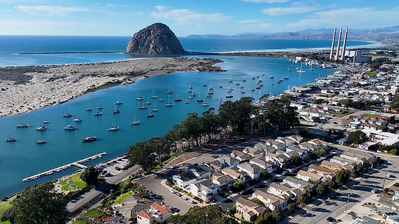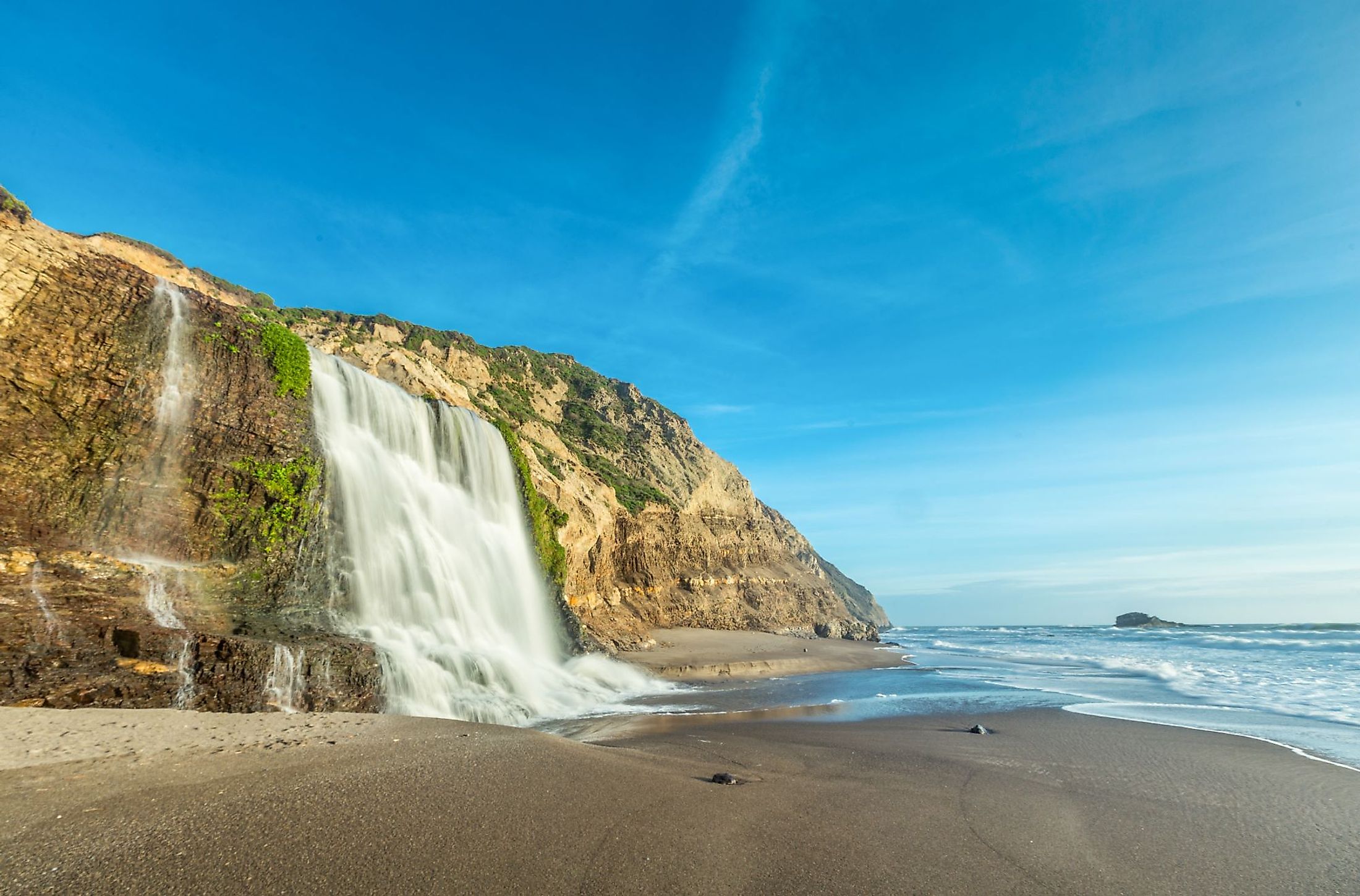
Alamere Falls, California
Only 34 waterfalls in the world run into an ocean, and only 4 of these waterfalls are situated in the United States. The Alamere Falls - the largest Bay Area waterfall, is located just a little more than an hour from San Francisco, making it the ideal day excursion for anyone looking to get away from the chaos of the city.
Geography Of Alamere Falls

A stunning location where Alamere Creek flows into a sandy beach is where Alamere Falls is located. It is situated in California's Marin County in the Point Reyes National Seashore, close to Bolinas, and is a tidefall waterfall that empties into the Pacific Ocean. There are only two tidefalls in this region, the other being McWay Falls. Water pours down a 12 m sheer cliff onto the south end of Wildcat Beach near a rocky peninsula called Double Point, creating a stunning spectacle at this hidden waterfall. The stream cuts a path through the sand to the ocean after winding its way through a green valley in the open environment and then tumbling over a black and green rock wall. While not a short hike—a minimum 20-kilometer round-trip journey is required to reach this breathtaking location that is a popular—and occasionally overcrowded—visitor lure.
Geology Of Alamere Falls

Alamere Falls, in addition to being incredibly beautiful, also has a unique and recognizable structure. It is referred to as a "tiered waterfall," yet it is not satisfiable to be a typical one. It is divided into two areas that are relatively far apart. Those not paying enough attention to the first section's nature frequently ignore it. The upper part continues to be the most intricate, while the bottom area gets most of the attention. The upper falls are situated further upstream from what is thought of as the main Alamere Falls. There are really three drops in this area. Unusually, each developed with about the same dimensions and a little dip equivalent to around 3.1 m. But the detached lower portion of this fantastic waterfall alone descends over 12.2 meters. This extra drop gives the entire cascade a total descent of around 21.3 m. Despite having little height, it has a remarkable appearance.
Alamere Falls Hike

A long hike is still necessary for the most direct access to Alamere Falls (4 miles each way). The strenuous hiking path leads to an overlook with sweeping views of the Pacific Ocean, Tomales Bay, and the mouth of San Francisco Bay. The trek travels through lovely coastal woodlands, coastal prairie, and along the edge of a bluff overlooking the shore. It begins at the Palomarin Trailhead and mostly follows the Coastal Trail. Pelican Lake and Bass Lake are located along the way. The going gets a little difficult after following the beach route, which diverges off the Coast Trail, and it may be necessary to use your hands for balance to reach the falls. Many hikers opt for an unapproved shortcut to take a quicker, more direct path. Following a steep, sometimes slick track through a heavily wooded environment is required for this, and informal direction markers made of sticks and stones are typically used to show it clearly. Due to the presence of hazardous plants, some hikers have given this path the nickname "Poison Oak Alley" since it is not without risks. There should be extreme caution and awareness since ticks can potentially be an issue.
Brief History
The first people to settle in the Point Reyes Peninsula are the Miwok Indians from North America. The first white person to visit Point Reyes was the Spanish adventurer Lieutenant Manuel de Oyarvido in 1815. Following this, Point Reyes saw a large inflow of European settlers who started farming and ranching. There were several dairy farms by 1968 that yearly generated around 15 million gallons of milk while owning around 400 cows. The first Alamere Falls path was built by the U.S. Army Corps of Engineers in 1939. An old dirt route that crossed a farm field and followed the coastal cliffs formerly led to the waterfall. The National Park Service started enhancing this path in 1990 by building a brand-new, 1.5-mile hiking trail to Alamere Falls. The Coastal Trail and other paths in Point Reyes National Seashore were also improved as part of this $8 million project, which Congress financed in 1984. One of the greatest waterfall hikes in the United States is undoubtedly at Alamere Falls. Its hiking trek is one of the most well-liked hiking locations in the Bay Area. The Palomarin trailhead sees a practically constant flow of hikers on a lovely weekend afternoon.