The Counties Cut Off From The Rest Of Their State
Leave Kentucky, drive into Tennessee, and you can turn north and find yourself back in Kentucky again, in a place no Kentucky road will take you. A resident of Point Roberts, Washington, clears customs twice to reach a doctor in her own county. Children on Knotts Island ride a school bus onto a ferry because the only paved route to their North Carolina classrooms runs through Virginia. These are not map errors so much as the lasting marks of shifting rivers, colonial charters, and surveys drawn before anyone could measure the ground precisely. Each county in this list holds territory with no direct road link to the rest of its state, cut off by water, by a neighboring state, or by an international border. Every case here has been recorded by a county government, a court, or a transportation agency, and every one can still be driven today.
Fulton County, Kentucky, Kentucky Bend

Fulton County splits into two non-contiguous pieces, a fact the county government states plainly. The smaller section, usually called Kentucky Bend or Madrid Bend, lies inside a broad loop of the Mississippi River at the far western edge of the state. Tennessee borders it to the south, and the river wraps the other three sides, separating it from the main body of Fulton County. Uncertainty over the river's course when Kentucky's southern boundary was surveyed left the odd shape behind.
A road trip into Kentucky Bend means leaving Kentucky first. Drivers approach on Tennessee State Route 22, cross the state line into the bend, and retrace the same route on the way out, because no Kentucky road links the exclave with the rest of the county. Across the Mississippi to the northwest lies Missouri, which adds a third state to the view over the water. The land is mostly cropland spread across the river floodplain, with a scattering of houses and a lone cemetery. Fulton County's own website notes both the split geography and the drive through Tennessee needed to reach Madrid Bend.
Whatcom County, Washington, Point Roberts

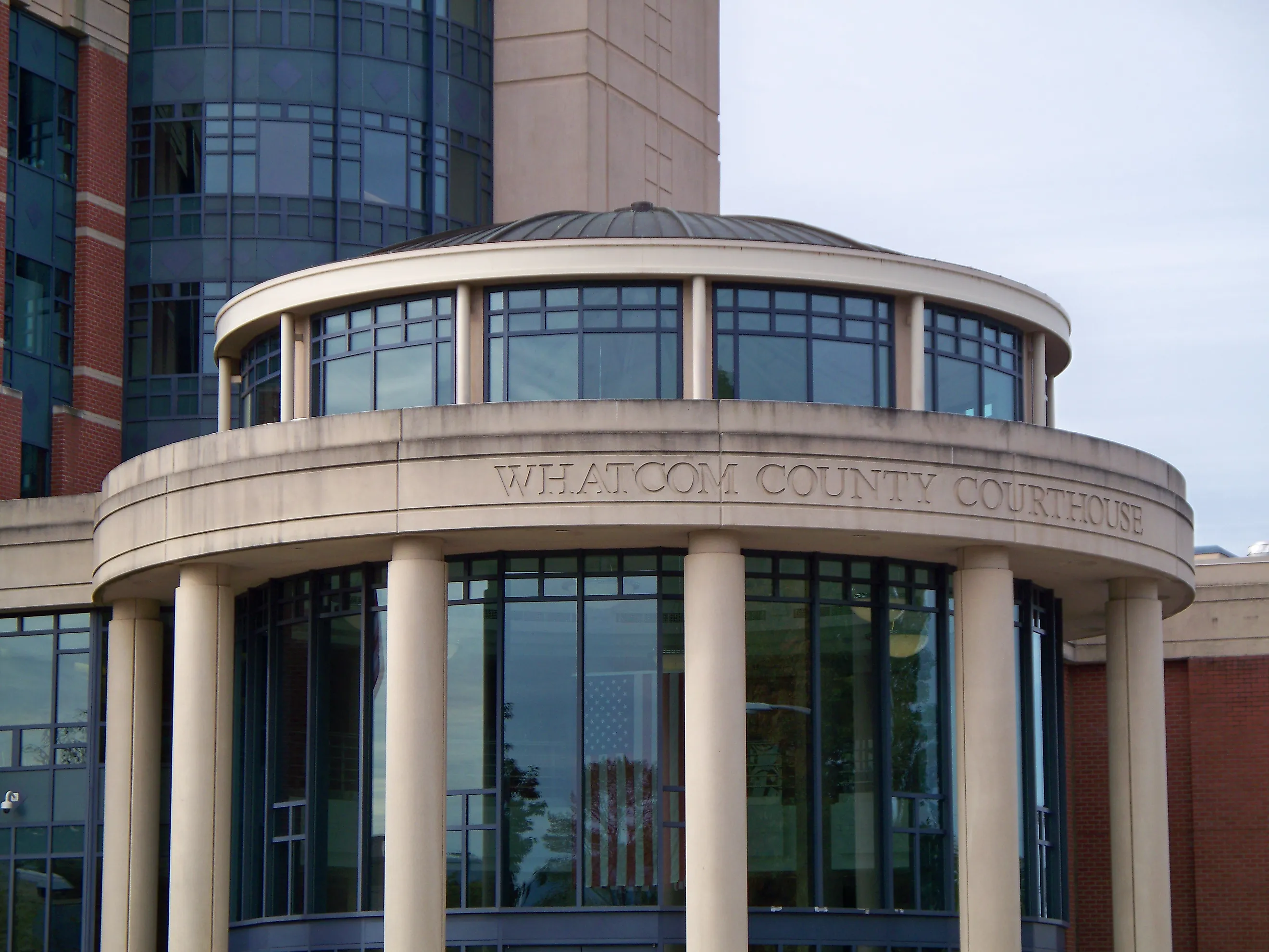
Point Roberts occupies the southern tip of the Tsawwassen Peninsula in Whatcom County, directly below the 49th parallel. When the boundary was fixed along that line in 1846, it clipped off roughly five square miles of American land whose only road connection is to British Columbia. Whatcom County's 2025 economic development strategy classifies Point Roberts as a pene-exclave and notes that reaching the rest of the county takes either a boat or two international border crossings, a drive of about 23 miles through Canada. Landsat imagery from NASA shows the border as a straight line across the peninsula just north of the community, with a golf course on the American side ending abruptly where Canada begins. Drivers leave on Tyee Drive, pass through the checkpoint into Delta, British Columbia, continue across the Canadian mainland, and re-enter Washington near Blaine. The community also has beaches, a marina, and shoreline along Boundary Bay. A routine trip to mainland Whatcom County still calls for the documents required to clear Canadian and American border control.
Lake of the Woods County, Minnesota, Northwest Angle

Lake of the Woods County contains the Northwest Angle, the only substantial part of the contiguous United States north of the 49th parallel. The position traces back to eighteenth-century boundary negotiations that relied on inaccurate maps of Lake of the Woods, which showed the Mississippi rising much farther north than it does. Surveyors then spent decades trying to pin down the lake's northwesternmost point, and the line they eventually ran left the Angle inside Minnesota.
Road access has to follow the shape of the lake. A county wildfire protection plan records that Lake of the Woods cuts the Angle off from the rest of the county and that highway travel runs mainly through Manitoba. Minnesota law even includes provisions for cooperating with Manitoba on the highway link that serves the area.
By the route through Warroad and Manitoba, Angle Inlet sits roughly 100 road miles from Baudette, according to the county plan. Resorts around the Angle cater heavily to anglers chasing walleye on Lake of the Woods, and winter draws crowds for ice fishing. Road travelers enter Canada, drive across Manitoba, and cross the international line a second time before reaching Minnesota's Northwest Angle.
Pottawattamie County, Iowa, Carter Lake

Carter Lake belongs to Pottawattamie County, Iowa, even though it sits on the Nebraska side of the Missouri River next to Omaha. The City of Carter Lake traces the arrangement to an 1877 flood, when an ice jam threw the Missouri into a new channel. Because the river shifted all at once rather than gradually, the legal state line stayed where it had been. The U.S. Supreme Court later treated the event as an avulsion and upheld Iowa's claim to the land.
Carter Lake's municipal history records that the community can be reached only by Nebraska roads. Omaha wraps around it, with the Missouri River and the oxbow lake accounting for the rest of its edges. After years of uncertainty over the area's political future, residents incorporated Carter Lake as an Iowa city in 1930. Abbott Drive and the streets near it now tie Carter Lake directly into Omaha's road network. A driver can leave central Omaha, stay west of the Missouri River the whole way, and pass into an incorporated Iowa city before ever reaching the river itself.
Monroe County, Michigan, Lost Peninsula

The Lost Peninsula in Monroe County belongs to Michigan, though its only land connection is to Ohio. The peninsula reaches into Maumee Bay near Toledo, and the Michigan-Ohio line runs across its base. During litigation over the Lost Peninsula Marina, a federal court laid out the geography directly, describing the peninsula as part of Michigan, attached at its base to Ohio, and reachable from the rest of Michigan only by traveling through Ohio. Erie Township administers the Michigan territory. The line dates to the settlement of the nineteenth-century Toledo boundary dispute, which fixed the modern border through this corner of Lake Erie. Edgewater Drive carries the practical route and runs south into Lucas County, Ohio. Homes, marina facilities, and shoreline lots fill the small Michigan pocket. Anyone leaving by car for Monroe, Detroit, or anywhere else in Michigan passes into Ohio before crossing back into Michigan elsewhere.
Currituck County, North Carolina, Knotts Island

Knotts Island belongs to Currituck County, North Carolina, yet the peninsula's road connection runs north into Virginia. In a 2025 resolution, Currituck County stated that Knotts Island is not connected to the county mainland and is physically attached to Virginia. A driver depending only on roads passes through Chesapeake and Virginia Beach before crossing back into North Carolina.
North Carolina runs the Currituck-Knotts Island Ferry across Currituck Sound. The NCDOT schedule lists a crossing of about 45 minutes and keeps the boat in service throughout the year. The ferry carries passenger vehicles and school transportation between the island and the Currituck mainland.
County and state planning records show how much local families depend on that route. Middle and high school students on Knotts Island attend school on the Currituck mainland, so their buses board the ferry instead of making the long road trip through Virginia. Just to the south, Mackay Island National Wildlife Refuge protects marshes, forests, and managed wetlands used by migratory waterfowl along the Atlantic Flyway. Visitors coming through North Carolina ride the same ferry that carries local commuters and students across the sound.
Bristol County, Massachusetts, Acoaxet

Acoaxet and the Westport Harbor area sit in a road-isolated corner of Westport in Bristol County, Massachusetts. The Westport Historical Society ties the arrangement to colonial boundary disputes between Massachusetts and Rhode Island. An eighteenth-century royal decree ran the state line through the area near Adamsville, leaving this section of Westport with Rhode Island along its only landward approach. The West Branch of the Westport River blocks a direct road connection with the rest of town.
That isolation became a political fight in the 1920s. Records kept by the Westport Historical Society describe attempts by Westport Harbor residents to break away and form a municipality called Acoaxet, with taxes and access to town services among the grievances. The bid failed, and the area stayed part of Westport. Modern driving routes still pass through Adamsville, Rhode Island, before returning to the Massachusetts roads that serve Acoaxet. Those roads run on toward coastal houses, beaches, and the mouth of the Westport River.
Pike County, Pennsylvania, Pond Eddy

Pond Eddy occupies a narrow strip of Pike County along the Delaware River, boxed in by steep wooded terrain that leaves no room for a useful Pennsylvania road to the rest of the state. The community's real road link is the Pond Eddy Bridge, which crosses the Delaware into Lumberland, New York. Federal transportation records name the bridge as the connection between Shohola Township in Pennsylvania and Lumberland and describe its role in reaching Pond Eddy. PennDOT maps mark State Route 1011 on the Pennsylvania side. A replacement bridge opened in 2018 and kept the tie to New York Route 97 across the river. Residents driving toward other Pennsylvania towns first cross into New York and follow the Upper Delaware corridor to another river crossing. Houses stand close to the Delaware, and the wooded slopes rising right behind them leave little room for a road to continue south through Pennsylvania.
Buchanan County, Missouri, Rosecrans Memorial Airport

Rosecrans Memorial Airport lies in Buchanan County, Missouri, on the west side of the Missouri River next to Kansas. St. Joseph owns and runs the airport, and the city's 2050 Metropolitan Transportation Plan states that the roughly 1,700-acre property has no direct Missouri road or bridge connection. Road access uses U.S. 36 and Route 238 through Elwood, Kansas.
The separation came out of changes to the Missouri River. St. Joseph planning documents explain that the Great Flood of 1951 was followed by a cutoff channel dredged east of the airport. The reshaped river course left Rosecrans on the far bank while the property stayed in unincorporated Buchanan County.
Rosecrans supports both civilian aviation and military flying. The Missouri Air National Guard's 139th Airlift Wing is based there and flies C-130 aircraft. Drivers leaving central St. Joseph cross the Missouri on U.S. 36, enter Kansas near Elwood, and turn back toward airport property that remains legally inside Missouri. The airport's position is a visible record of the river engineering that reshaped this stretch of the Missouri Valley during the twentieth century.
New Castle County, Delaware, Finns Point and Artificial Island

New Castle County reaches onto the New Jersey side of the Delaware River because of a boundary rule from the colonial period. Delaware's statutory description of the county follows the low-water mark on the New Jersey side of the river within the Twelve-Mile Circle drawn around New Castle. Filling, dredging, and shoreline change over the years produced dry land beyond that historic waterline, leaving small areas legally inside Delaware but physically joined to New Jersey.
Finns Point and the northern portion of Artificial Island are the best-known examples. A New Jersey legislative bill describes both as Delaware exclaves attached to New Jersey and proposes handing them over through a formal boundary adjustment. Artificial Island holds heavily engineered ground built from dredged material, along with major energy facilities on the Delaware River, while the Delaware slice of Finns Point takes in another small stretch of the New Jersey shoreline. Reaching these New Castle County parcels over land means approaching through New Jersey, with the main body of the county lying across the Delaware River.
Lines On A Map That The Ground Refused To Follow
Two forces recur across these ten cases. In Kentucky Bend, Carter Lake, and around Rosecrans, a river moved and a legal line stayed put, so a county woke up on the wrong bank. In Point Roberts, the Northwest Angle, the Lost Peninsula, and the Delaware exclaves, a border was drawn on paper before anyone had measured the land it crossed, and the paper won. Knotts Island and Acoaxet fall in between, where water and an old colonial line together stranded a corner of one state behind the roads of another. The practical result is the same each time: a resident who wants to stay within one state has to leave it, and a driver reads a welcome sign for a state they never technically left.