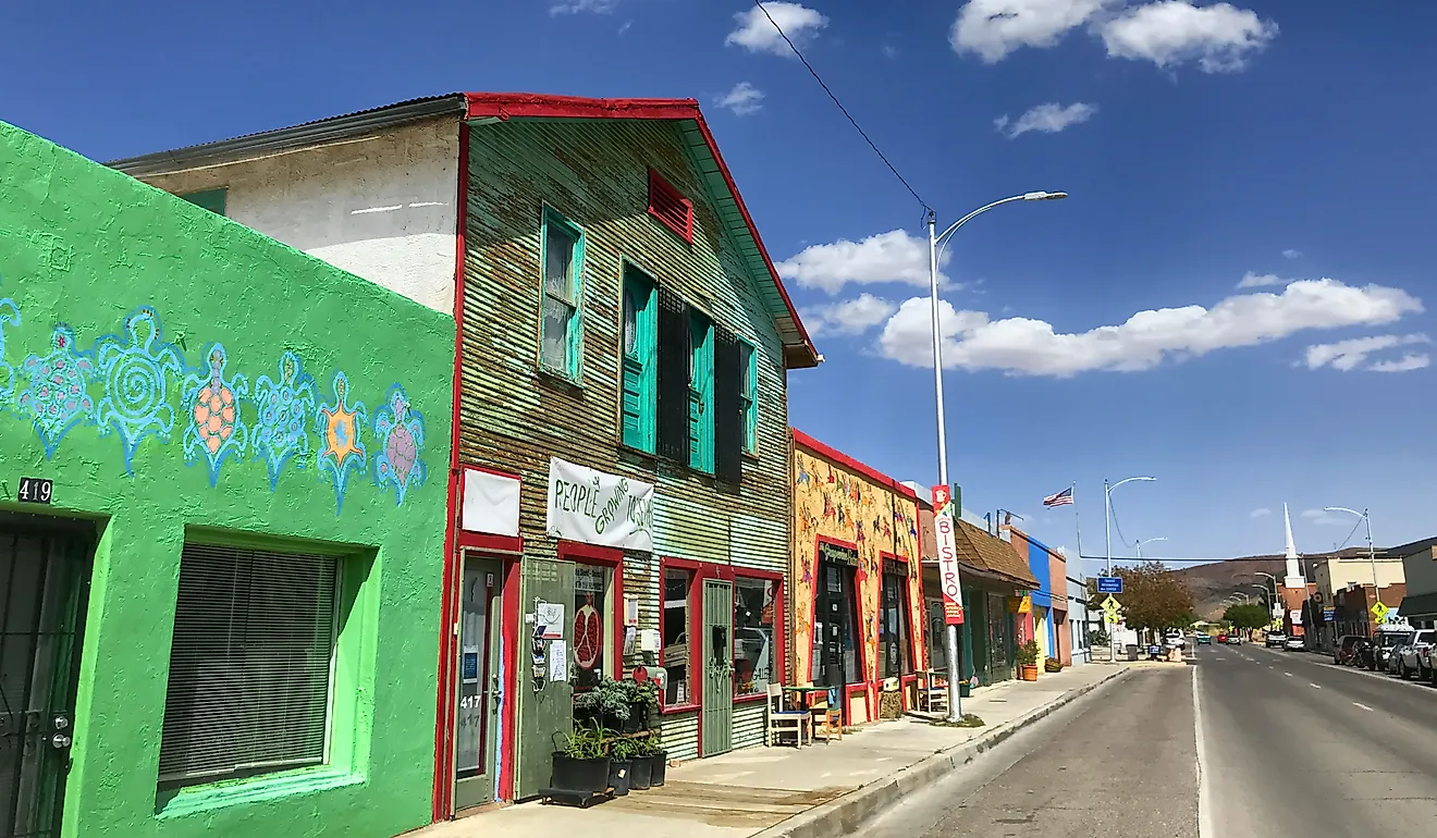
This Quiet Pacific Coast City Is An Underrated Gem For Nature Lovers
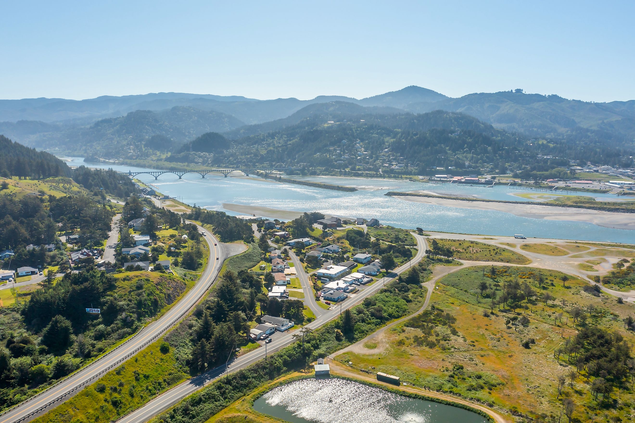
Gold Beach sits at the mouth of the Rogue on the southern Oregon shore with the Siskiyou Mountains rising east and the Pacific Ocean along the entire western edge. The town earned its name in the 1850s when miners pulled flake deposits from the river sands. That mining boom lasted only a few seasons. The local economy settled into a more durable mix of commercial fishing, sport angling, and outdoor tourism. The town today runs on the water and the headlands in roughly equal measure.
Why Gold Beach Stays Off The Tourist Track

Most of the heavy Oregon-coast tourist traffic concentrates between Cannon Beach in the north and Bandon in the south, with Gold Beach about 30 miles further down the highway. The remove keeps the crowds modest. The Rogue River drainage also runs through some of the most protective federal land designations on the West Coast. Congress designated the Rogue as one of the original eight rivers in the National Wild and Scenic Rivers System on October 2, 1968, alongside the Clearwater (Middle Fork), the Eleven Point, the Feather, the Rio Grande, the Saint Croix, the Salmon (Middle Fork), and the Wolf.

The Wild and Scenic designation covers the 84-mile stretch of the Rogue from Grave Creek down to the river mouth. Within that stretch the river holds 33 named rapids, three of them in the Class IV range. The federal designation has kept the corridor essentially free of permanent development since 1968. The river itself ranks among the most-photographed in the Pacific Northwest, and the town is the launching point for almost all commercial access to it.
The Best Outdoor Attractions In And Around Gold Beach
Cape Sebastian State Scenic Corridor

Cape Sebastian State Scenic Corridor covers about 1,100 acres of headland five miles south of Gold Beach. The Spanish explorer Sebastián Vizcaíno sighted the cape on January 20, 1603, the feast day of Saint Sebastian, and named the headland for the saint. The park sits with two parking lots above 200 feet of elevation and gives broad views south to Humbug Mountain and north along the cliffs back toward Gold Beach.
Sitka spruce shades most of the trail system. The Cape Sebastian Trail runs three miles out and back to a south-facing overlook and continues another half-mile down to a secluded beach at the base of the headland. Gray whale watching peaks twice a year, with the southbound migration between Christmas and the New Year and the northbound migration through the final week of March, per Oregon State Parks data on coastal whale-watching weeks.
Otter Point State Recreation Site

Otter Point State Recreation Site sits about nine miles north of the Cape on similar coastal-headland geology. The state acquired the property between 1960 and 1976 and has kept it as a day-use park ever since. No signs from US-101 direct visitors to the turnoff, which keeps it among the quietest Oregon coast headlands by visitor count.
The headland is built of sandstone rather than the basalt that shapes most of the Oregon coast, and the sandstone has eroded into the unusual rock forms the park is known for. A short trail leads to a clifftop overlook with a sea arch and a sea stack the park literature calls the gorilla's head. Two beaches sit on either side of the point, Agate Beach to the north and Bailey Beach to the south, reached by short footpaths down from the parking area.
The Rogue River

The Rogue runs 215 miles west across southern Oregon from the Crater Lake area to Gold Beach, making it the third-longest river entirely within the state per Oregon river data. The summer flow holds the water level high enough for paddleboards, kayaks, and jet boats through about September. South Coast Tours runs guided paddle trips on both the flatwater stretches and the lower whitewater. Adventure Gold Beach handles paddleboard rentals from a base near the Patterson Bridge.
Jerry's Rogue Jets

Jerry's Rogue Jets has run jet-boat tours up the Rogue from the Gold Beach harbor since 1958, making it the first commercial jet-boat operator in the United States. The fleet runs shallow-draft boats that can climb the river in as little as four inches of water, which lets the operators run guests well above the head of normal river navigation.
The season runs May 1 through October 15 with four standard tour options. The Historic Mail Route Tour covers the 64-mile run upriver to Agness, one of only two remaining rural mailboat routes in the United States and operating from Gold Beach since 1895. The Wilderness Whitewater Tour reaches the Class III and IV rapids of the lower Rogue gorge. The two-hour Bay Cruise covers the river-mouth estuary at the relaxed end of the lineup.
Prehistoric Gardens

Prehistoric Gardens sits about 15 miles north of Gold Beach on US-101 inside the temperate rainforest of the southern Oregon coast. Ernest V. "Ernie" Nelson, a sculptor and self-taught paleontology enthusiast, opened the attraction in 1955 and built all 23 of the concrete-and-steel-frame full-size dinosaur replicas himself over the following 30 years. The roadside attraction is family-owned and continues to operate under the second generation of the Nelson family.
The setting is the larger draw than the sculptures themselves. The Garden site occupies an old-growth coastal rainforest stand with Sitka spruce, Western hemlock, and Western red cedar canopy, plus the dense understory of sword fern, salmonberry, and salal that defines the southern Oregon temperate rainforest. The half-mile walking loop covers all 23 dinosaur stations within a remarkably preserved patch of pre-development Oregon coastal forest.
What Sets Gold Beach Apart For Nature Lovers

Gold Beach is the seat of Curry County, with about 2,300 city residents and a county population just over 22,000 across an area of about 1,627 square miles, roughly two-thirds the size of Delaware. The arithmetic favors the natural environment over the tourist economy. The Rogue's Wild and Scenic designation, the Cape Sebastian Scenic Corridor, the Otter Point Recreation Site, and the temperate rainforest cover most of the surrounding land. The city sits at the edge of the Curry County natural-area complex rather than at the center of a developed resort strip.
The Takeaway
Gold lasted only a few years as the local industry. The river and the coast have anchored the local economy and culture since. Whether the trip is for a half-day at Otter Point, a full-day on Jerry's Rogue Jets, or a quick stop at Prehistoric Gardens on the way through, Gold Beach gives nature visitors more than any single Oregon coast town its size has a right to offer.