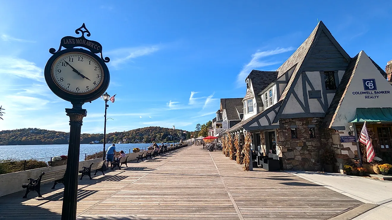
Nicest Small Towns To Visit Near Oakland
Oakland sits within easy reach of a long list of smaller towns that locals visit on weekends. The day-trip menu covers wine country tasting rooms, working harbor towns, and Gold Rush-era street grids that have survived to the present. The nine towns ahead each cover a different direction. Each one fits a different type of day trip and a different kind of weekend mood. None sits more than about 90 minutes away under normal traffic.
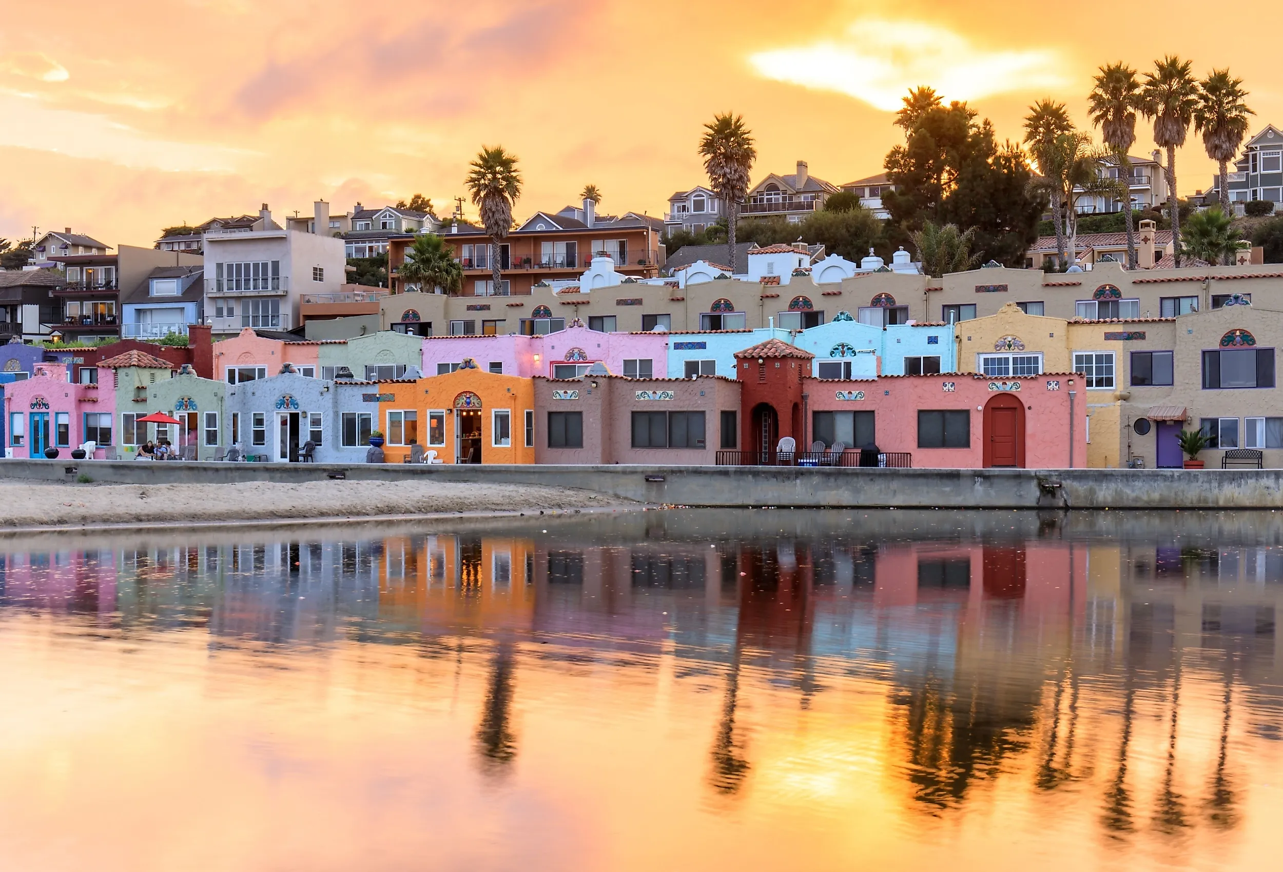
Capitola

A seaside town on the northern side of Monterey Bay, Capitola has a distinct visual signature in the Venetian Court, a row of brightly painted Mediterranean-style cottages built in 1924 as one of the first beachfront resort condominium developments in California. The strip sits next to the Capitola Wharf, which dates to 1857 and is one of the oldest fishing piers on the West Coast. From the wharf, walkers occasionally spot dolphins and seasonal migrating gray whales in the Pacific Ocean beyond.
About 90 minutes south of Oakland under typical traffic, Capitola makes a workable day trip. New Brighton State Beach, just east of town, runs 95 acres of bluff-top campsites and beach access. Esplanade Park on Capitola Beach hosts the Twilight Concerts series every Wednesday evening in summer. The downtown is small but dense with boutique shops, surf rentals, and seafood restaurants set above the lagoon at Soquel Creek's mouth.
Diablo

The unincorporated community of Diablo, about one hour east of Oakland in Contra Costa County, organized in 1912 as a private resort built around the Diablo Country Club. The club's 18-hole course was designed by Jack Neville and Robert Hunter (the same Jack Neville who later co-designed Pebble Beach in 1919), and the surrounding residential plat is still organized around the course.
Mount Diablo State Park is the local landmark and the reason most non-residents come. The park covers about 20,000 acres around the 3,849-foot summit. A clear day from the summit produces one of the longest unobstructed views in the contiguous United States. Sightlines can stretch across the Pacific in one direction, the Sierra Nevada in another, Mount Lassen to the north, and the southern Coast Ranges below. The Amphitheater, a strange geological bowl on the mountain's western flank, draws geology students from San Francisco Bay Area universities.
Emeryville

Emeryville sits about 10 minutes north of Oakland on the eastern shore of the San Francisco Bay and runs about 12,500 residents. The waterfront includes Emeryville Marina Park, McLaughlin Eastshore State Park, and the small Point Emery peninsula, all connected by paved paths suitable for cycling or walking. The marina point offers one of the closest open-water views of the Bay Bridge and Treasure Island from the East Bay.
Pixar Animation Studios has been headquartered in Emeryville since 2000, occupying a 22-acre campus designed by the late Steve Jobs. The city's commercial district mixes Bay Street outdoor shopping with a higher concentration of biotech and animation employment than most cities its size, including Lucasfilm offices and Novartis research facilities. The Amtrak Emeryville station serves the California Zephyr to Chicago and the Coast Starlight to Seattle, making the city an unusual departure point for long-distance rail.
Martinez

Martinez is the seat of Contra Costa County and runs about 37,500 residents. It sits on the south side of the Carquinez Strait, the narrow water passage where the Sacramento and San Joaquin rivers drain into the San Francisco Bay, about 45 minutes north of Oakland under normal traffic. The town's waterfront includes the Radke Martinez Regional Shoreline, with bay views and access to the Benicia-Martinez Bridge.
John Muir National Historic Site, on the east edge of town, preserves the 17-room Italianate Victorian mansion where the naturalist lived from 1890 until his death in 1914. The site also includes the Mount Wanda area, a 326-acre open space named for one of Muir's daughters and offering oak woodland trails. The Alhambra Pioneer Cemetery, founded in 1851 and historically tied to the pioneer settlement of the area, includes graves of early Spanish and Mexican-era settlers along with John Muir himself.
Mill Valley

Mill Valley sits at the head of Richardson Bay in Marin County, about an hour north of Oakland depending on traffic. The town runs about 14,000 residents and is one of the most expensive ZIP codes in the country, with median home prices well over $2 million. The downtown plaza is small and walkable, with a Lytton Square farmers market on Sundays.
Muir Woods National Monument, about a 15-minute drive west, protects 554 acres of old-growth coast redwood forest, including trees over 250 feet tall and more than 1,000 years old. The monument was established in 1908 by Theodore Roosevelt at the urging of William Kent, who donated the land to prevent it from being logged for a planned dam reservoir. Mount Tamalpais State Park, accessed by the Panoramic Highway above town, covers 6,300 acres and includes the 2,571-foot East Peak summit with a fire lookout. The Dipsea Trail, a 7.4-mile route from Mill Valley to Stinson Beach, hosts the country's second-oldest footrace, run annually since 1905.
Moraga

Moraga, about 30 minutes east of Oakland in the East Bay hills, takes its name from Joaquín Moraga, a Mexican-era ranchero who received the Rancho Laguna de los Palos Colorados land grant in 1835. His original 1841 adobe, the Joaquín Moraga Adobe, is the oldest building in Contra Costa County and operates as a museum with limited public tours.
Saint Mary's College of California, founded by the Christian Brothers in San Francisco in 1863 and relocated to Moraga in 1928, draws about 4,000 students to its 420-acre campus and gives the town its college-town character. The Lafayette-Moraga Regional Trail, a 7.7-mile paved rail-trail along the former Sacramento Northern Railway right-of-way, runs through town. The EBMUD Valle Vista Staging Area opens up the East Bay watershed trail network on the south side of the community.
Rio Vista

Rio Vista sits about 75 minutes northeast of Oakland on the Sacramento River at the western edge of the Sacramento-San Joaquin Delta. The town runs about 10,400 residents and serves as the main waterfront for boat traffic through the Delta's network of sloughs and channels. The 1944 Rio Vista Bridge, a vertical-lift drawbridge spanning the Sacramento, opens regularly for shipping traffic.
Sandy Beach County Park, immediately south of town, offers RV camping and one of the few natural sand swimming beaches along the lower Sacramento. The Western Railway Museum, about 12 miles east in Suisun City, runs operating heritage streetcars on weekends. Local landmarks in town include the Foster's Big Horn restaurant on Main Street, which displays the world's largest collection of hunting trophies under one roof, with over 300 mounted heads collected by William Foster between 1922 and 1945.
Sonoma

Sonoma sits about one hour north of Oakland in the southern end of the Sonoma Valley wine region, about 11,000 residents. The town plaza, laid out in 1835 by General Mariano Vallejo, is the largest in California at eight acres and is bordered by the Mission San Francisco Solano (founded 1823, the northernmost of the California missions) and the Sonoma State Historic Park complex.
The Bear Flag Revolt of June 14, 1846, when American settlers raised the original Bear Flag over the Sonoma plaza and declared the short-lived California Republic, took place on this square. The flagpole site is marked with a monument. Beyond the plaza, the surrounding valley holds over 425 wineries within a 20-minute drive, including Buena Vista Winery (founded 1857, the oldest premium winery in California still in operation) and Gundlach Bundschu (founded 1858 and still family-owned).
Tiburon

Tiburon sits on a peninsula extending into Richardson Bay, about one hour from Oakland under normal traffic. The town runs about 9,500 residents and is one of the wealthiest communities in Marin County. The Tiburon Ferry Terminal runs scheduled service to San Francisco's Ferry Building, taking 25 minutes each way and providing the easiest commute option for residents working in the city.
Old St. Hilary's Preserve, a 122-acre wildflower preserve on the hillside above town, protects 217 native plant species, including the Tiburon mariposa lily and the Marin dwarf flax, both endemic to this peninsula and found nowhere else on Earth. The 1888 Old St. Hilary's Church on the preserve grounds is a National Historic Landmark. The Tiburon Railroad and Ferry Depot Museum on Paradise Drive preserves the 1884 depot building from the San Francisco and North Pacific Railroad era, when Tiburon served as the railroad's southern Marin terminus before the Northwestern Pacific consolidation in 1907.
What These Nine Towns Share
The nine towns each cover a different cardinal direction from Oakland and run on a different industry or attraction, but they share a useful proximity for residents of the East Bay. Day trips work without overnight planning. Most are reachable by public transit (BART, ferry, or Amtrak) without a car. The combination of accessibility and distinct local character is what makes the nine towns a working weekend rotation rather than a list of one-time destinations.