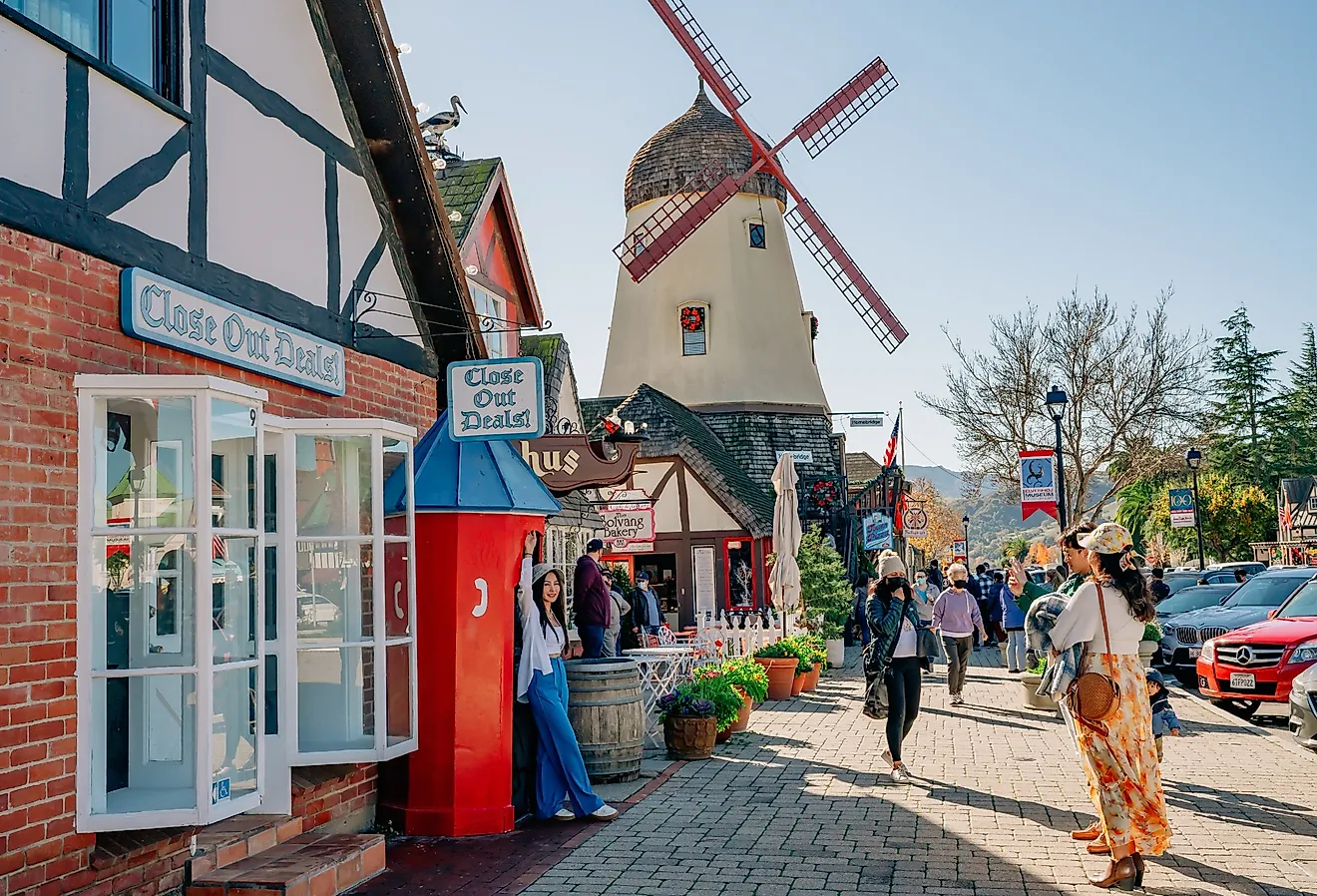
12 Off-The-Beaten-Path Towns In Wisconsin
Some of Wisconsin’s most interesting towns are easy to miss on a map. Cornucopia sits on Lake Superior with access to nearby waterfalls and a harbor that supports fishing activity. Gays Mills is shaped by the Kickapoo River and apple orchards that drive its fall economy. Blue Moundsthe highest point in southern Wisconsin, where hiking trails matter more than retail strips. Stockholm, with fewer than 100 residents, is known for a pie shop that earned national attention through USA TODAY’s 10Best readers’ poll. These communities are not built around high-volume tourism. These Wisconsin towns reflect parts of the state that remain lightly visited and locally driven.
Cornucopia

Located 22 miles north of Bayfield, Cornucopia is Wisconsin's northernmost point on Lake Superior's shore. One of the area’s longest maintained hikes is Lost Creek Falls, reached by a 3-mile out-and-back trail that includes boardwalk sections and two wooden bridges over Lost Creek. The waterfall drops roughly eight feet, but the feature extends above and below the main fall, where water moves across exposed sandstone shelves. The viewing area at the base allows visitors to walk behind the falling water, offering a close view of how the creek cuts through the rock. Less than a quarter mile from Siskiwit Falls Road, Siskiwit Falls provides immediate access to the Siskiwit River as it moves over smooth sandstone in a series of short cascades and natural slides. Informal trails totaling about 0.8 miles follow the creek upstream and downstream from the bridge.
Along the lake, Cornucopia Beach provides direct shoreline access within Siskiwit Bay, where the protected water and gradual entry make it one of the few places in the area suitable for wading and launching small watercraft. Nearby, the Green Shed Museum, located in the original harbor fish house, displays nets, tools, and photographs that document more than a century of commercial fishing on Siskiwit Bay. The museum is open seasonally from June through October.
Niagara

Niagara sits beside one of Wisconsin’s most active whitewater stretches on the Menominee River. At the river’s sharp bends, the Menominee River’s Piers Gorge whitewater section is a standout expanse of Class III-IV rapids where guided raft trips run roughly 3-4 hours through rocky narrows and over frothy cascades. Outfitters such as Wildman Adventure Resort operate launches just outside the city limits, using access points along the river corridor near Niagara. The route frames walls of sedimentary rock and shifts from placid pools into powerful drops that define this segment of the river. A few blocks inland, Morgan County Park spreads across Timms Lake and wooded slopes with over 2.5 miles of signed walking trails, a swimming beach, boat landing, playground, and rock outcroppings alongside both lake and river for fishing or shoreline viewing. The park’s campground offers 45 campsites with electric hookups and picnic spaces.
Meanwhile, the Niagara Historical Museum preserves tools, photographs, and local archives that trace town life from river industry to railroad days, with displays catalogued by decade. One standout is “The Museum Without Walls,” also known as Serenity Woods, which guides visitors through preserved structures such as a 1900s gray shed in an open-air setting. Rounding out the city’s outdoor access, Menominee River State Recreation Area encompasses roughly 7,600 acres featuring more than 17 miles of primitive hiking routes, including the Pemene Falls Trail. The area also supports canoe launches, kayaking, hunting, whitewater rafting, and fishing.
Necedah

Set at the edge of a 43,700-acre federal wildlife refuge, Necedah directly borders one of Wisconsin’s most expansive managed wetland landscapes. Necedah National Wildlife Refuge contains marsh, prairie, oak barrens, and savanna, with designated public access through a network of clearly signed trails. The 1-mile Observation Tower Trail leads to a two-story viewing platform overlooking Rynearson Pool, a primary habitat for migrating waterfowl. Additional routes, including Meadow Beauty and Tamarack trails, bring the total maintained trail system to more than six miles, using boardwalks and packed paths to cross seasonal wetlands. These corridors support frequent sightings of trumpeter swans, sandhill cranes, and bald eagles.
About 10 minutes south, Buckhorn State Park occupies a peninsular reach of Castle Rock Lake where the Wisconsin and Yellow Rivers converge. The park’s shoreline trails and boat landings let visitors fish for walleye, launch small watercraft, and hike wooded loops that rise above the reservoir’s edge. Within a few miles east, the Cranberry Creek Archaeological District contains more than 300 prehistoric effigy and burial mounds from the Woodland period. The protected 675-acre site preserves conical and animal-shaped earthworks that are among the largest mound groups in Wisconsin, offering unmarked paths through oak-jack pine forest and glimpses into indigenous cultural landscapes.
Gays Mills

Along one of Wisconsin’s slowest rivers, Gays Mills occupies a narrow Driftless valley that concentrates river access and valley roads into a small settlement. The Kickapoo River canoe landing at Highway 171 provides direct entry into a slow, meandering stretch of water classified as Class I, where the current averages just over one mile per hour. This section is frequently used for half-day paddles because it combines long, uninterrupted bends with wide sandbars that appear during normal summer water levels. North of the village center, the Kickapoo Bottoms Nature Preserve conserves an 85-acre public conservation tract. The bottomland forest, sloughs, and wet prairie here support breeding populations of birds and a range of native plants, including the state-threatened snowy campion, which typically blooms in June and July. The preserve’s open ground and river frontage provide accessible opportunities for birdwatching, shoreline fishing, and seasonal nature walks along informal grass corridors that edge the river floodplain
Gays Mills’ Main Street remains closely tied to the valley’s orchard economy, particularly during apple season from late summer through October. Orchards such as Sunrise Orchards, Kickapoo Orchard, and West Ridge Orchard operate seasonally, opening farm stands during harvest months rather than year-round retail. That cycle peaks during the Gays Mills Apple Festival, held annually in late September, when orchards from the surrounding Kickapoo Valley sell fresh apples, cider, and baked goods while events take place along Main Street and nearby park areas.
Washburn

This Chequamegon Bay town is between Bayfield and Ashland on Highway 13, far enough from both to maintain its small fishing village character. The Houghton Falls State Natural Area protects 76 acres of pre-Cambrian sandstone cliffs and ravine forest. A 1.3-mile out-and-back trail leads through the woods into Echo Dells, an area of water-carved rock walls and small caves, and continues to where the seasonal waterfall drops approximately 60 feet over exposed stone into a sandy cove above Lake Superior’s clear waters. Along the lakefront in town, the Washburn Lakeshore Parkway and Walking Trail runs approximately 1.34 miles on a packed limestone surface, connecting a sequence of small sandy beaches, overlooks, and historical interpretation close to the waterfront. Thompson’s West End Park, a 27-acre city park with a gradually sloping shoreline, provides direct lake access, a swimming beach, picnic areas, and an artesian well that flows year-round.
In downtown Washburn, the Washburn Cultural Center is in a magnificent brownstone building. There are rotating gallery exhibitions on the first floor and the Washburn Area Museum on the second floor, with photographs by local photojournalist Charles M. Sheridan and artifacts relating to Washburn’s regional history.
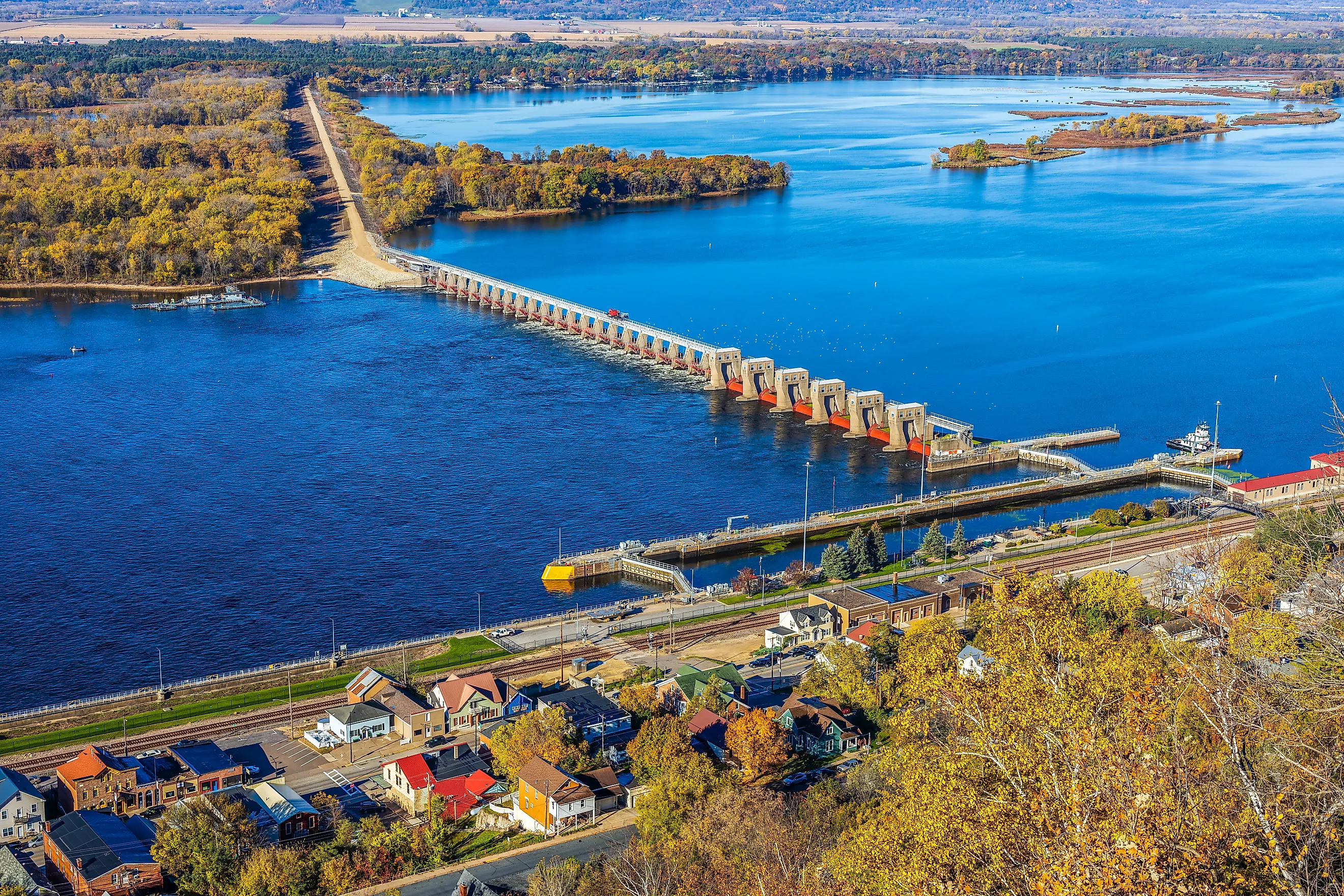
Prairie Du Sac

Prairie du Sac sits opposite Sauk City at the base of river bluffs and is defined by the Prairie du Sac Dam. Completed in 1914, the dam spans the Wisconsin River and creates Lake Wisconsin upstream. A public overlook near the dam provides close views of the spillway and power facilities, making it one of the few places in the area where visitors can directly observe how the river is controlled and redirected for hydroelectric generation. Just south of the village, Wollersheim Winery & Distillery traces its roots to the 1840s and operates as a working winery with a tasting room, guided vineyard access, and an on-site distillery added in 2009, making it one of the state’s longest continuously used wine sites.
Running through the village, the 11 miles of Great Sauk State Trail follows a former rail corridor, providing a flat, paved route that connects Prairie du Sac to Sauk City and continues south toward Devil’s Lake State Park. The trail is well suited for long, uninterrupted bike rides, stroller-friendly walks, and point-to-point trips without road crossings or elevation changes.
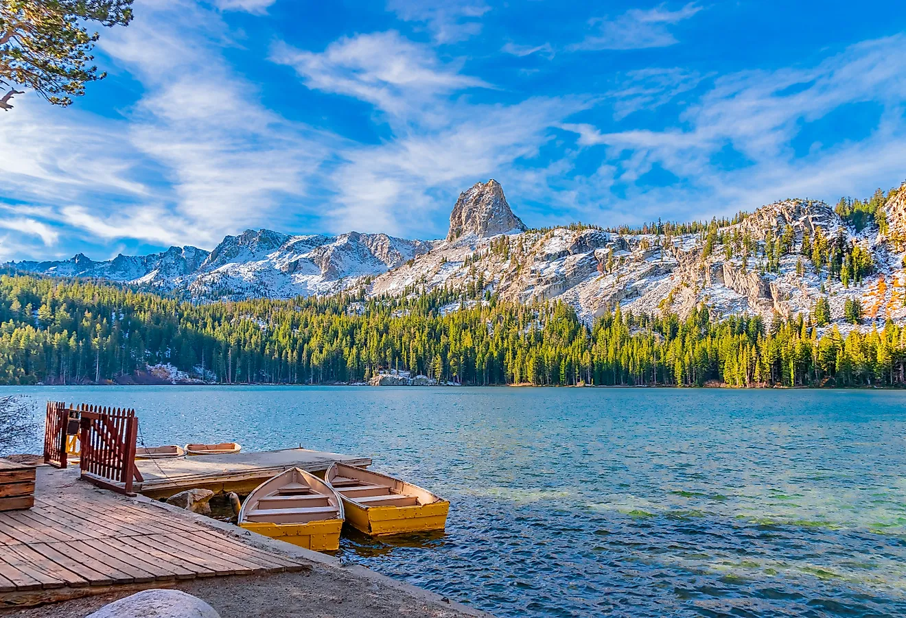
Eagle River

Eagle River is right at the headwaters of the Wisconsin River. The core draw is the Eagle River Chain of Lakes, a system of 28 interconnected lakes linked by navigable channels that allow continuous motorboat travel. Public boat landings within city limits connect directly into the chain, making it possible to cruise between lakes, stop at waterfront restaurants, fish multiple basins in one outing, or spend a full day boating without reloading equipment. That lake network also supports overnight use at Chain O’ Lakes Camping Resort, a large, privately operated campground with direct access to the chain. The resort combines RV and tent sites with on-site boat slips, rentals, and a small marina, allowing visitors to stay directly on the water rather than commuting to launch points.
A different side of Eagle River’s identity appears at the Eagle River Depot Museum, housed in the 1923 Chicago & North Western Railway depot. The site includes preserved rail cars and displays on rail-era tourism, alongside exhibits on the town’s famous ice castle tradition, large winter structures built from lake ice that once dominated seasonal festivals and drew visitors during the coldest months. For a contemporary cultural stop, the Northwoods Children’s Museum offers hands-on exhibits focused on regional ecology, logging history, and seasonal life in Wisconsin’s lake country, providing an indoor, community-run counterbalance to the town’s outdoor focus.
Alma

Alma occupies a narrow stretch of land along the Mississippi River in Buffalo County. The town’s most elevated access point is Buena Vista Park, a blufftop overlook rising more than 500 feet above the Mississippi River. The park provides a direct view of the river valley, backwaters, and barge traffic below, with a short access road leading to the summit rather than a long hike. At river level, Alma Marina is the town’s primary water entry, providing transient slips, a public boat launch, and immediate access to the main navigation channel used by recreational boaters and commercial traffic.
Movement through town is anchored by the Great River State Trail, a paved multi-use route that follows the Mississippi River for 24 miles between Trempealeau and Buffalo City. The trail runs directly through Alma, allowing cyclists and walkers to travel long distances along the river without road crossings or elevation changes. Lastly, Danzinger Vineyards is a unique 18-acre spot focusing on cold-climate varieties suited to western Wisconsin. The vineyard produces wines from grapes such as Frontenac, Marquette, Frontenac Gris, and La Crescent, offering dry and semi-sweet reds and whites that reflect the region’s shorter growing season.
Stockholm

With about 90 residents on the Wisconsin shore of Lake Pepin, Stockholm lines the Great River Road where the Mississippi River widens into open lake water. Maiden Rock Bluff State Natural Area protects a limestone cliff rising roughly 400 feet above Lake Pepin and extending nearly a mile along the shoreline. The 1.6-mile loop trail climbs through oak savanna and dry prairie, where grasses grow above head height beyond the marked path. Peregrine falcons nest on the cliff face, making it one of the few Mississippi River bluffs supporting natural rock nesting sites, alongside habitat used by bald and golden eagles. Red cedars estimated at 250 years old cling to the rock walls, joined by rare plants such as slender lip fern and smooth cliffbrake.
Stockholm Pie and General Store won USA Today's "Best Pie Shop in America" for the second consecutive year in 2025. The shop serves over 20 flavors on weekends, including lingonberry lemon and peanut butter fudge, alongside traditional apple and cherry. All pies use hand-peeled fruit with no canned ingredients, and the double-crust pies follow a family recipe passed down through generations. Stockholm also participates in the Fresh Art Tour, a twice-yearly, self-guided event across Pierce and Pepin counties that opens more than 30 studios and galleries featuring pottery, sculpture, jewelry, photography, textiles, and paintings, with a spring tour in June and a fall tour held the first weekend of October.
Lake Mills

Between Madison and Milwaukee on the eastern shore of Rock Lake, Lake Mills combines nationally significant archaeology with one of Wisconsin’s longest rail trails running directly through town. Aztalan State Park preserves a National Historic Landmark where Middle Mississippian people built platform mounds and a fortified settlement between 1000 and 1300 AD. A 2-mile loop trail crosses 172 acres of prairie and oak woodland, passing reconstructed stockade sections and two flat-topped pyramidal mounds. The park also provides access to the Crawfish River, where anglers fish for northern pike, catfish, and walleye.
From Lake Mills, the Glacial Drumlin State Trail extends 52 miles east to Waukesha along a former railroad corridor. The western trailhead is located at Lake Mills’ restored 1895 depot, which houses railroad artifacts and local history exhibits. The trail follows the north shore of Rock Lake before continuing through wetlands and forested drumlin terrain. Connected directly to the trail, Korth County Park spans 89 acres with 1.9 miles of hiking trails across prairie, woodland, and lakeshore atop a glacial drumlin overlooking Rock Lake. Downtown, Lewis Station Winery operates out of a converted early-20th-century gas station, producing small-batch wines, with its Grist Mill Red among the winery’s regular releases
Two Rivers

Where the East and West Twin Rivers meet Lake Michigan, the fishing port of Two Rivers maintains its maritime heritage 12 miles north of Manitowoc. Woodland Dunes Nature Center and Preserve protects more than 1,500 acres of ridge-and-swale terrain shaped by ancient Lake Michigan shorelines. Over 7 miles of trails cross hardwood forest, wetland, and prairie, including a boardwalk extending into marshland along the West Twin River and the Conifer Trail, which follows parallel beach ridges. The preserve supports more than 400 plant species and carries a segment of the Ice Age Trail.
North of town, Point Beach State Forest covers nearly 3,000 acres, offering 17 miles of hiking trails, 6 miles of sandy Lake Michigan shoreline, and 127 campsites, along with Rawley Point Lighthouse, the tallest lighthouse on the Great Lakes. Along the water, the Mariners Trail runs 7 miles between Two Rivers and Manitowoc as a paved lakeside path featuring 50 themed flower gardens and permanent outdoor sculptures. Inland, the Hamilton Wood Type and Printing Museum houses the world’s largest collection of wood type, with 1.5 million pieces and over 1,000 styles, alongside working equipment and hands-on workshops in letterpress printing and bookmaking.
Blue Mounds

Named for distant blue hills visible from across the prairie, Blue Mounds is at 1,076 feet, the highest point in southern Wisconsin. Blue Mound State Park guards the highest elevation in southern Wisconsin and maintains more than 20 miles of hiking, mountain biking, and cross-country ski trails. The John Minix Trail loops 3 miles through hardwood forest, while the Flintrock Nature Trail explains the area’s geology through interpretive signage. Two observation towers provide views extending across the countryside toward Madison on clear days. The park also operates Wisconsin’s only state-park swimming pool, open seasonally from Memorial Day through Labor Day.
Beneath the surrounding hills, Cave of the Mounds descends 80 feet into a National Natural Landmark, with guided tours lasting 45-60 minutes along paved walkways through large chambers filled with stalactites, stalagmites, and columns. The cave maintains a constant 50°F temperature and displays marine fossils from when the region lay beneath an ancient sea. Above ground, the Military Ridge State Trail passes through the area on its 40-mile route from Dodgeville to Verona, connecting to Brigham County Park, where prairie restoration and hiking trails cross karst terrain marked by sinkholes and exposed limestone.
Beyond the Usual Routes

Wisconsin’s geography leaves room for towns that never had to compete for attention. Along quiet river valleys, inland lakes, and less-traveled stretches of Lake Superior, small communities continue to revolve around fishing seasons, trail access, local food, and working landscapes. These off-the-beaten-path towns in Wisconsin include places like Cornucopia, Gays Mills, and Stockholm, each offering something specific that would stand out anywhere in the United States. Together, these 12 towns show how much depth exists beyond the usual routes.