11 Undisturbed Towns To Visit In California
California exports spectacle; the rarest luxury it makes is silence you can walk to. This article tracks 11 undisturbed towns that guard their quiet by ordinance, geography, or habit: a one-square-mile village without street addresses, a lighthouse that’s still on duty, a geyser that keeps time better than a wristwatch, a valley whose mountains turn rose at dusk. The noise stays elsewhere; the details do not.
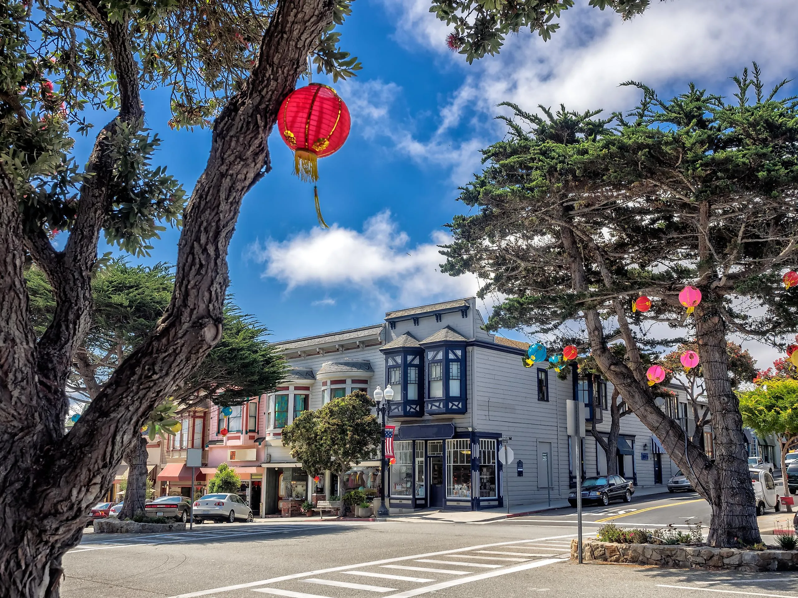
Pacific Grove

Bordered by craggy tidepools and windswept cypress trees, Pacific Grove is one of the few coastal towns in California where monarch butterflies outnumber people in winter. Known as “Butterfly Town, USA,” it protects its winged visitors with an official sanctuary and even a local law: disturbing a monarch can carry a fine. Tucked between Monterey and Pebble Beach, the town’s atmosphere is more residential than resort, quiet streets lined with turn-of-the-century cottages and Victorian homes give it a lived-in elegance. The Point Pinos Lighthouse, still in operation since 1855, is the oldest continuously operating lighthouse on the West Coast and anchors the town’s northern edge.
The main street, Lighthouse Avenue, offers a compact stretch of independent businesses. Bookworks, a bookstore-café hybrid, serves espresso alongside a small but serious collection of local history and fiction. Lovers Point Park features rocky shoreline access, a kayak launch, and panoramic views across Monterey Bay. Wild Fish, a seafood restaurant steps from the water, focuses on sustainably sourced, hyper-local catches, often with foraged ingredients. For a look at Pacific Grove’s past, the Pacific Grove Museum of Natural History offers exhibits on local geology, Native history, and seasonal wildlife migrations.
Carmel-by-the-Sea

Carmel-by-the-Sea has no street addresses, no mailboxes, and no chain restaurants, rules designed to preserve its 1-square-mile identity. Residents fetch mail from the local post office. Visitors navigate by memory and landmarks, not numbers. Founded as an artists’ colony in the early 1900s, the town still reflects that purpose-built charm: European-style alleyways, hand-carved signs, and cottages that look illustrated. Clint Eastwood once served as mayor and helped ease signage regulations, but the village atmosphere remains untouched by sprawl.
Ocean Avenue runs from Highway 1 straight to the beach and includes the town’s most visited businesses. The Cottage of Sweets, located in a 1920s fairytale-style building, sells imported British confections. La Bicyclette serves wood-fired dishes and has a rotating French-Italian menu that changes with local harvests. The Carmel Mission Basilica, established in 1771, sits just south of downtown and contains original adobe walls and relics from Fr. Junípero Serra’s burial site. Carmel Beach, at the foot of the avenue, is bordered by Monterey cypress trees and allows off-leash dogs, surfers, and sunset picnickers.
Cambria

Cambria is built on black volcanic rock and bisected by a pine-lined creek that once powered mercury and cinnabar mines. Its dual identity, split into East and West Villages, stems from the town’s 19th-century layout, where Welsh immigrants settled inland while maritime traders docked near Moonstone Beach. Despite being near Highway 1, Cambria resists drive-by tourism. No big-box stores, no neon signs. The architectural mix of saltbox houses, board-and-batten storefronts, and redwood cabins reflects its piecemeal, lived-in development.
Moonstone Beach Drive follows the bluff edge, with a boardwalk that runs past driftwood piles and native ice plant. Nearby, Sea Chest Oyster Bar has operated since 1975 and opens nightly at 5:30 with no reservations, locals queue early. On Main Street in the East Village, Linn’s Restaurant is known for olallieberry pie and still sources fruit from their family farm. The Cambria Historical Museum, located inside the 1870 Guthrie-Bianchini House, offers exhibits on the town’s ranching and mining eras. On the opposite side of town, Fiscalini Ranch Preserve stretches along a mile of coastal bluff, with trails that cut through native Monterey pine forest, one of only three remaining native stands in the world.
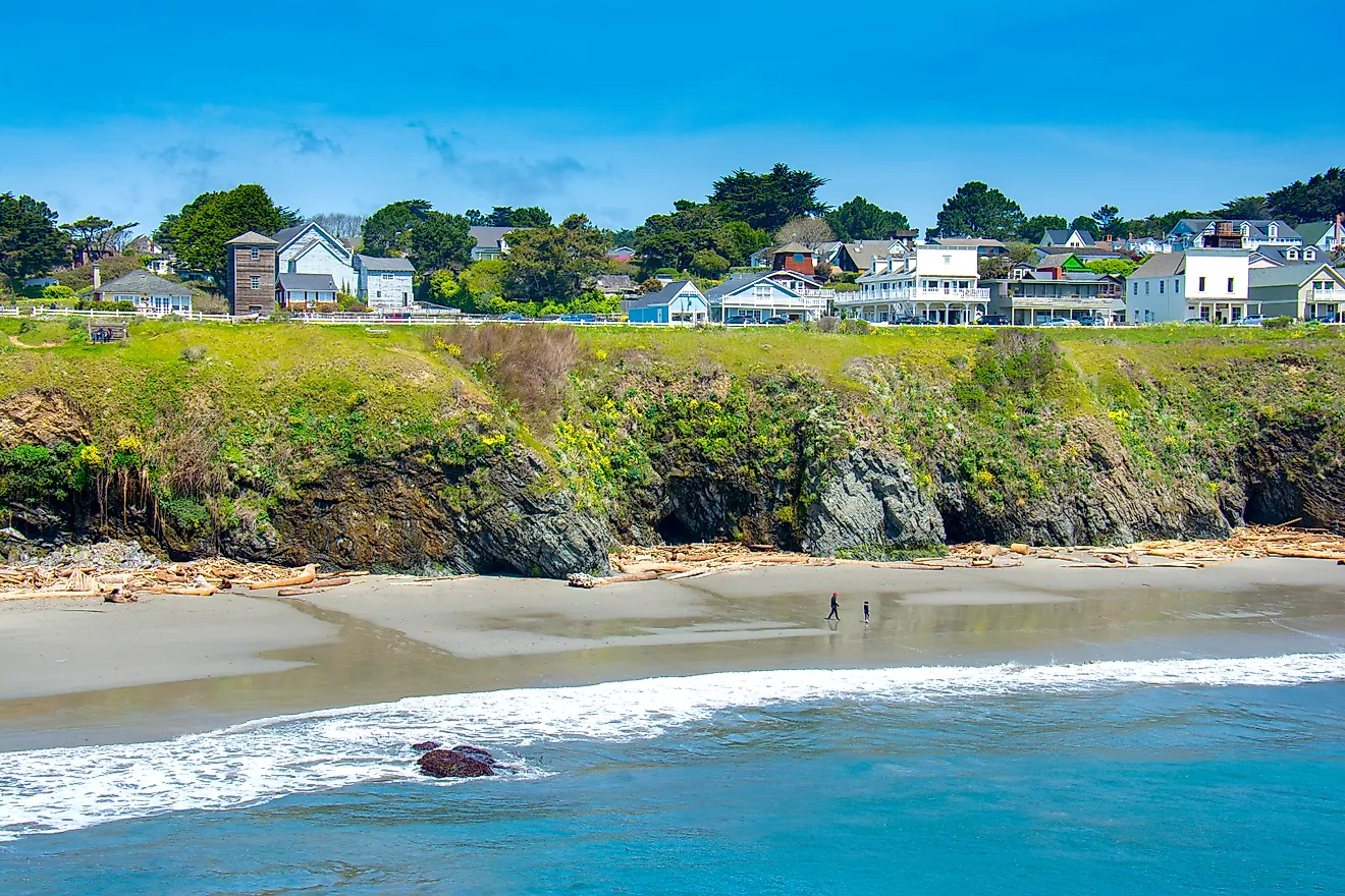
Mendocino

Mendocino sits on a coastal headland surrounded on three sides by the Pacific, with the town itself perched above sea caves and wave-carved cliffs. Originally settled by New Englanders in the 1850s, it remains architecturally consistent with its origins, saltbox cottages, white picket fences, and weathered water towers built to store rain. Many of the structures are preserved under historic status, and no building rises higher than the church steeples. Fog moves in like a curtain most evenings, isolating the town in a way that feels deliberate.
On Main Street, Gallery Bookshop operates inside a former general store and stocks titles with a focus on regional history and natural sciences. Across the street, Mendocino Headlands State Park offers direct access to coastal bluffs and hidden beaches via footpaths that begin at the edge of town. Café Beaujolais, housed in an 1893 farmhouse, sources vegetables from its own garden and serves fixed-menu dinners in a side cottage. The Kelley House Museum, overlooking the ocean, contains maps and records from Mendocino’s logging era, including original sketches of the now-vanished shipping chutes. The town has no traffic lights and few distractions.
Ferndale

Ferndale was built by dairy farmers but shaped by craftsmen. The town’s preserved 19th-century storefronts, called “Butterfat Palaces”, owe their detail to immigrant woodworkers who arrived when milk money was flush. Located in Humboldt County near the Eel River Delta, Ferndale is often used as a backdrop in period films. Its entire Main Street is listed on the National Register of Historic Places. The Ferndale Cemetery climbs the hillside just beyond the center of town, with moss-covered tombstones and panoramic views of the Victorian rooftops and farmland below.
On Main Street, Mind’s Eye Manufactory operates as a leather goods studio, performance venue, and espresso bar under one roof, inside a former Masonic temple. The Ferndale Museum, located one block off the main drag, houses exhibits on the 1906 earthquake’s impact and a working player piano. Golden Gait Mercantile, opened in 1975, replicates a late-1800s general store, with tin ceilings, local preserves, and antique packaging displays. The town leads directly into the Lost Coast via the steep Wildcat Avenue, one of the most isolated coastal stretches in the state.
Nevada City

Nevada City was built directly on top of its own gold deposits. Its brick buildings and false-front shops were reconstructed after fire leveled the town three times in the 1850s, and the current layout reflects both urgency and permanence. Located in the Sierra foothills at 2,500 feet, it has one of the most intact Gold Rush-era downtowns in California. The town banned chain stores in 1991 and enforces architectural preservation standards that keep modern fixtures invisible from street view.
Broad Street holds most of the action. The Nevada Theatre, built in 1865, is the oldest original-use theater in the state and still stages live performances and film screenings. Three Forks Bakery & Brewing Co. combines a small-batch brewery with a wood-fired pizza menu and a backroom performance space. The Firehouse No. 1 Museum, once an actual firehouse, displays Chinese-American mining tools, early photographs, and locally recovered artifacts. Just outside the town core, the Deer Creek Tribute Trail crosses a historic Chinese suspension bridge and loops through wooded canyon terrain.
Sutter Creek

Sutter Creek sits directly above the gold-bearing quartz veins that made it one of the first hard rock mining towns in the Sierra foothills. Unlike placer towns that vanished when rivers dried up, Sutter Creek evolved around underground shafts and stamp mills. The main vein ran beneath what is now Main Street, and portions of the original mining infrastructure still exist below the town’s surface. Today, the Kennedy Mine headframe stands just beyond the southern edge of town.
Main Street is fully walkable, with preserved 19th-century buildings housing independent businesses. The Hotel Sutter, originally opened in 1858, still operates with a saloon and street-facing balcony. Across the street, Bella Grace Tasting Room offers estate-grown Barbera and olive oils inside a stone cellar built in the 1860s. Gold Dust Pizza serves hand-tossed pies in what was once the Wells Fargo office. The Sutter Creek Visitor Center and Auditorium, located in the 1927 grammar school, includes exhibits on the Argonaut Mine disaster and local mining maps. Just uphill, the Knight Foundry, America’s last water-powered machine shop, opens monthly for demonstrations using original belts and lathes.
Calistoga

Calistoga was named by accident. Sam Brannan, a Gold Rush-era entrepreneur, meant to call it the “Saratoga of California” after the famous New York spa town but slurred it into “Calistoga of Sarifornia.” The name stuck, and so did the volcanic hot springs that first drew attention. The town sits at the top of Napa Valley, geologically active and edged by the Palisades and Mount St. Helena. Old Faithful Geyser of California erupts every 30 to 40 minutes on a ranch just north of town, one of only three “Old Faithful” geysers in the world.
Lincoln Avenue anchors the compact commercial district. The Calistoga Depot, built in 1868, has recently reopened after restoration and now houses the Calistoga Wine Stop in the old baggage room. Sam’s Social Club, located at the edge of town on the Indian Springs property, serves wood-fired meats and house-fermented pickles. Café Sarafornia, open since 1890, offers classic diner fare and keeps a wall of local photos. On the western edge, the Sharpsteen Museum details the town’s early resort economy and Brannan’s failed rail ventures, with a diorama of 1860s Calistoga lit by gaslamp replicas.
Point Reyes Station

Point Reyes Station was built around a rail stop that once carried butter, cheese, and oysters to San Francisco. The tracks are gone, but the creamery buildings remain, repurposed without being redesigned. The town is located just inland from Tomales Bay, where dairy farms still operate under multi-generational ownership. Cow horns are often mounted above shop doors. Because it borders the Point Reyes National Seashore, the town functions as the last supply outpost before 70,000 acres of undeveloped parkland.
Main Street includes the former train depot, now housing Toby’s Feed Barn, a working feed store that doubles as a gallery and community space. Around the corner, Bovine Bakery serves cornmeal scones and coffee under a mounted menu board unchanged since the 1990s. At the far end of town, the Tomales Bay Library branch hosts a weekly seed exchange and seasonal mushroom identification tables. Just beyond the town limits, the Earthquake Trail at the Bear Valley Visitor Center cuts across the San Andreas Fault line with interpretive signs showing how the ground shifted during the 1906 quake.
Ojai

Ojai is built within a narrow east-west valley, one of the few in California with that alignment. Because of this, it experiences a phenomenon known as the “Pink Moment,” when the fading sun reflects off the Topatopa Mountains and casts a rose hue over the entire landscape. The Chumash lived here for thousands of years and considered the area sacred; today, Ojai’s strict development limits and ban on chain stores preserve its sense of enclosure. The town remains a center for alternative education, spiritual retreats, and small-scale farming.
The central arcade along Ojai Avenue houses Bart’s Books, an open-air bookstore where paperbacks line exterior walls and transactions are done on the honor system after hours. Across the street, Ojai Coffee Roasting Co. has roasted in-house since 1995 and remains the local standard. Libbey Park contains the community bandstand and a post office tower designed by Frank Mead & Richard Requa, with bells cast in the same foundry as those at Mission San Buenaventura. The Ojai Valley Museum, located in a former Catholic church, holds exhibits on citrus cultivation, post-colonial land grants, and early photography of the valley. Surrounding the town are orange groves, olive ranches, and trailheads that begin without signage and end without fences.
Carpinteria

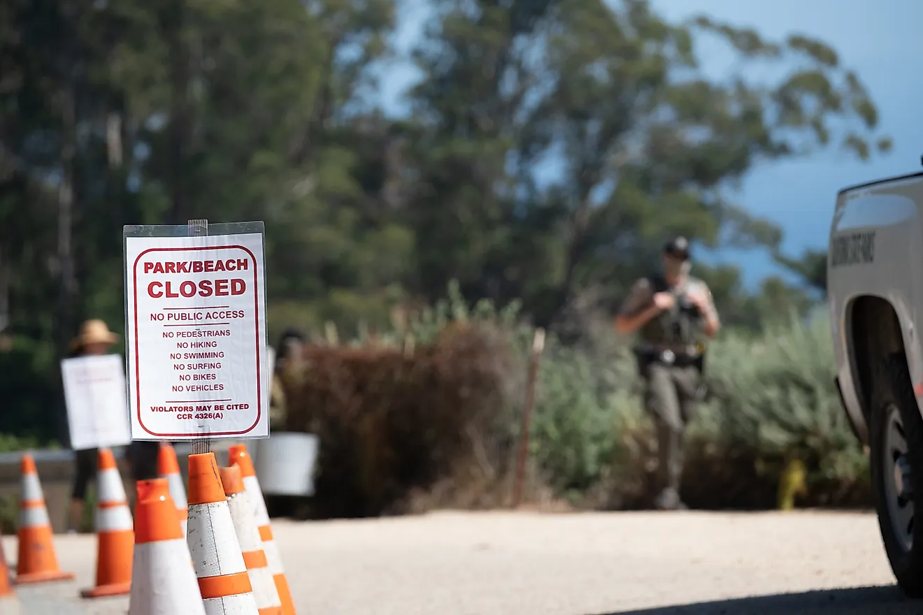
Carpinteria was named by Spanish explorers who found Chumash canoes under construction on the shore and called it “La Carpinteria” for its woodworking activity. Located between Ventura and Santa Barbara, it remains insulated from coastal overdevelopment by geography and zoning. The beach faces south, rare for the California coast, creating calm surf and longer daylight exposure. The Carpinteria Tar Pits, located within walking distance of downtown, bubble with asphalt pushed up from ancient oil seeps, still active and visible from a fenced path.
Linden Avenue runs directly to the beach and holds most of the town’s businesses. Lucky Llama Coffee, built into a former surf shack, serves organic espresso and açai bowls on a wood-plank patio shaded by pepper trees. Robitaille’s Fine Candies, founded in 1950, still makes ribbon mints on-site and ships them to the White House every holiday season. The Carpinteria Valley Museum of History includes blacksmithing tools, ranching equipment, and Chumash artifacts in a courtyard surrounded by citrus trees. At the end of the street, Carpinteria State Beach has tidepools, a lifeguard station, and a harbour lion rookery overlook just beyond the campground. Amtrak’s Pacific Surfliner stops one block from Main Street.
California’s quieter map lives in these towns where zoning, geography, and habit keep growth in check. Populations stay small; main streets still trade in books, tools, bread, and repair. Trails begin at curbs; tidepools and creeks sit within earshot of church bells and theater doors. Preservation isn’t branding here, it’s municipal code, ranch easements, and lighthouse maintenance logs. The result is calm: culture at arm’s length, wild edges within morning’s walk.