10 Coolest Nevada Towns For A Summer Vacation In 2026
Sand Harbor State Park in Incline Village has water clear enough to see the bottom from a kayak on a still morning. Wolf Creek Golf Club outside Mesquite drops fairways into desert canyons crossed by long cart bridges. The Nevada Northern Railway Museum in Ely lets adults take the throttle on a working steam locomotive through the surrounding mountains. The ten Nevada towns ahead all hold a summer feature distinct enough to be the point of the trip. None of them depend on the casino floor or the pool deck for the appeal.
Where to settle in beside the water
Find more recommendations in our list of best lakeside towns in Nevada.
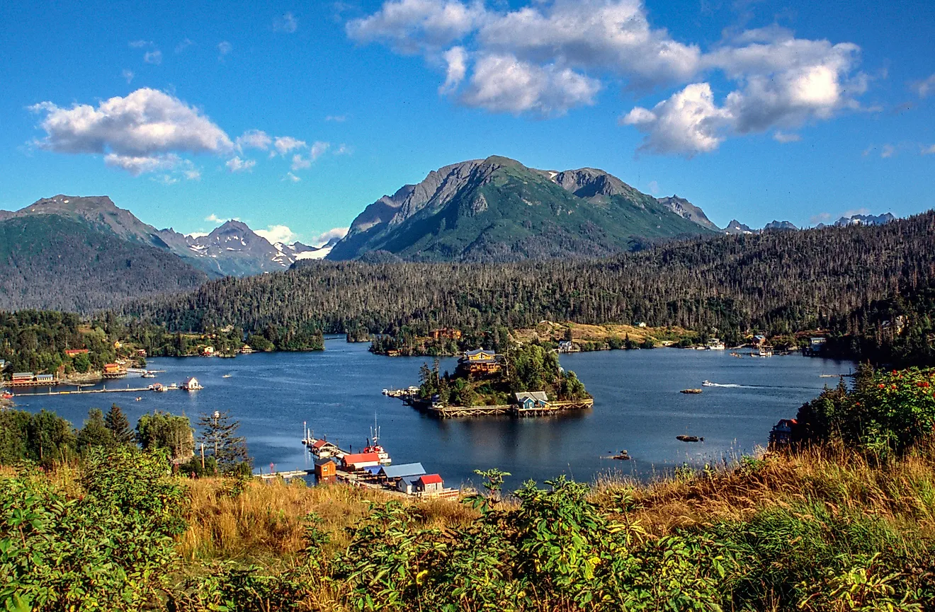
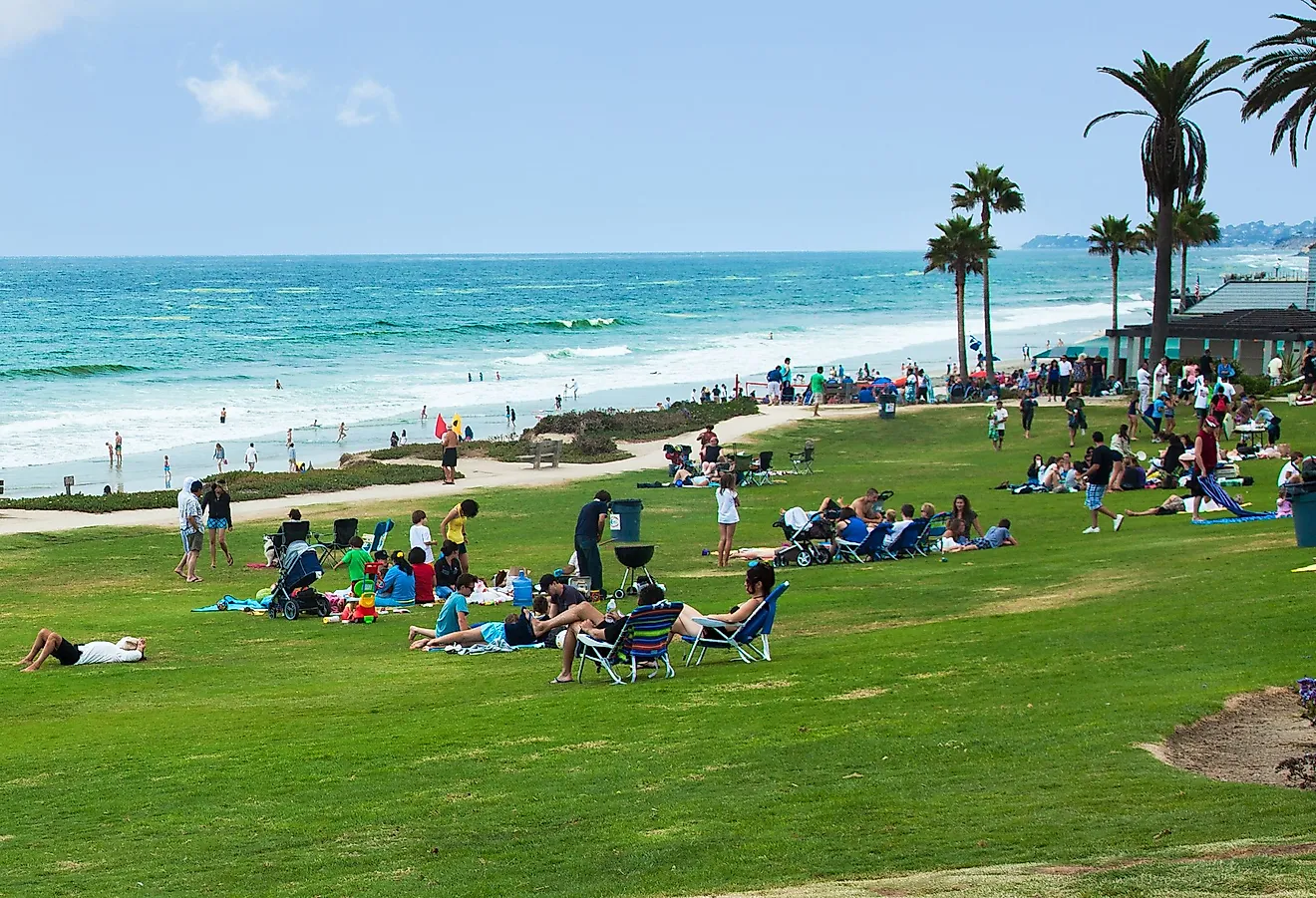
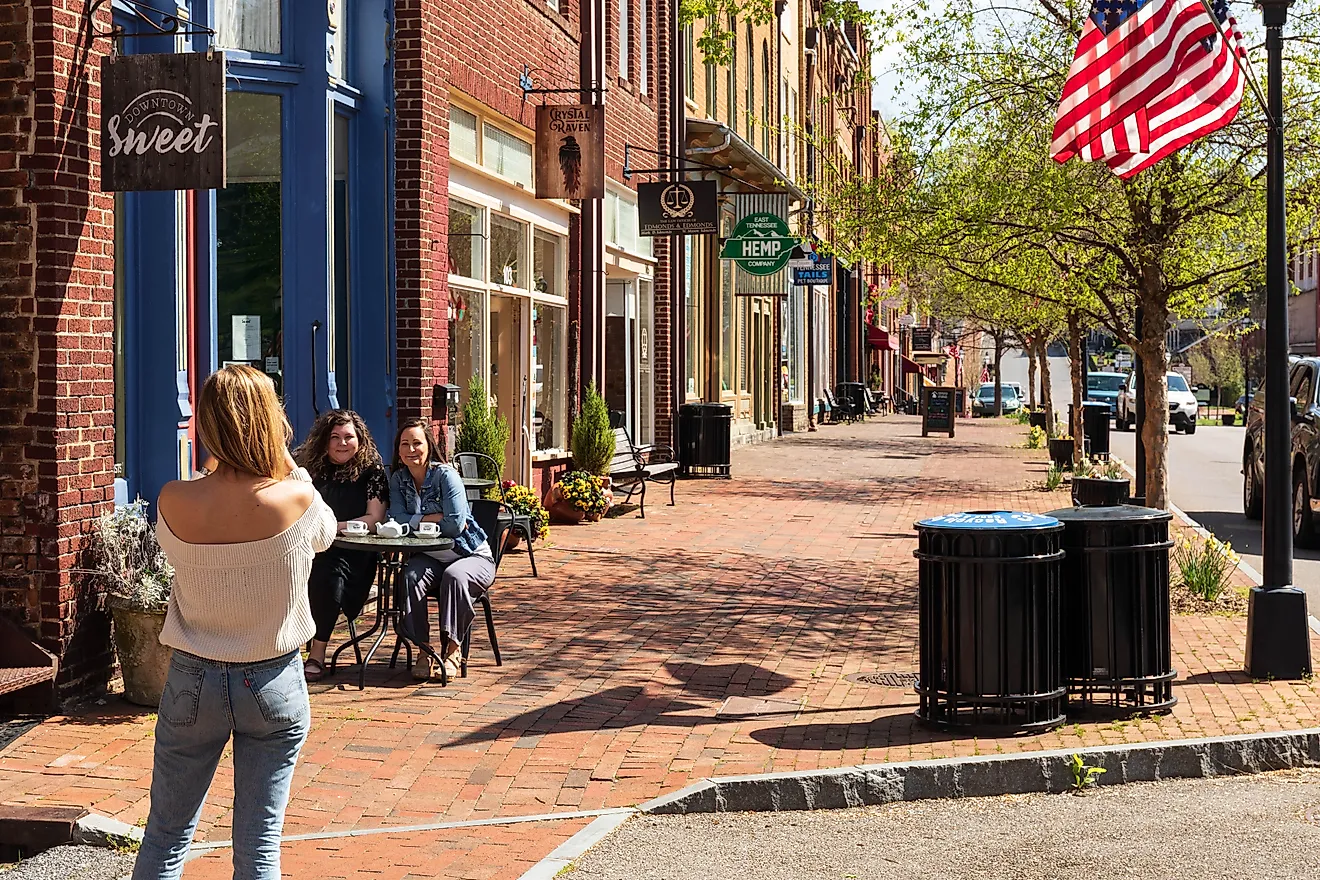
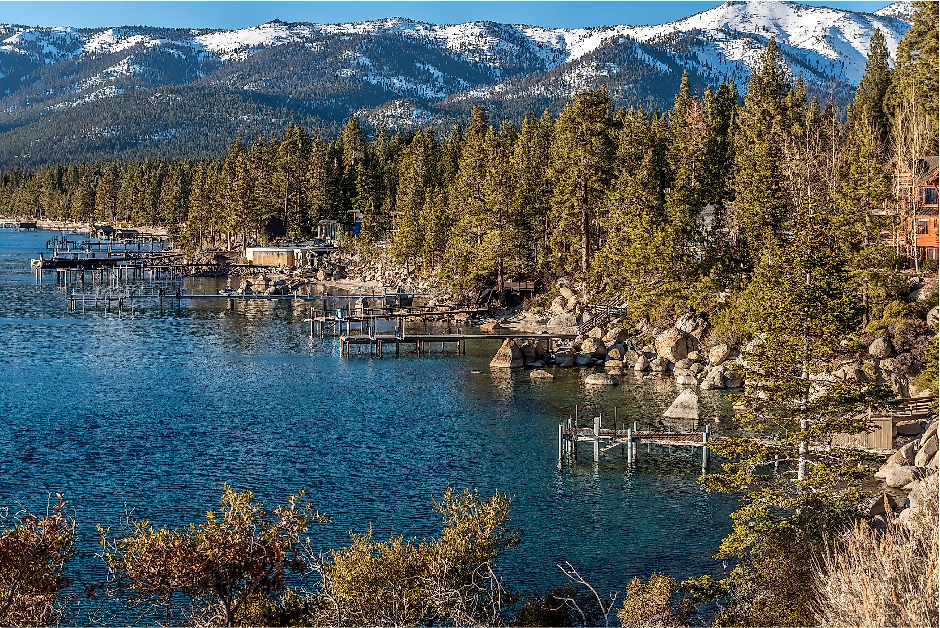
Incline Village

Sand Harbor State Park, a few minutes south of Incline Village on Route 28, holds the best swimming on Lake Tahoe's east shore. The beach is a long crescent of sand broken by granite outcrops, with shallow water close in and deep cold water beyond. The Lake Tahoe Shakespeare Festival uses the same beach in the evenings through July and August, with seating set on the sand and audiences bringing picnics for the run. The production faces the lake with a sunset backdrop most outdoor stages cannot replicate.
A paved three-mile bike-and-walking trail runs from the village south to the park entrance along the East Shore. The path ducks under Route 28 through a short tunnel and passes Hidden Beach on the way to Sand Harbor. Vista Trail Bikes rents cruisers at the village end. Incline Beach itself, in the heart of town, gives a flatter swimming area with volleyball nets and picnic tables that fill up by mid-morning on weekends. Early swims and after-seven walks are when the shoreline empties out.
Zephyr Cove

Zephyr Cove is less a town than a stretch of National Forest shoreline with a resort, a marina, and a public beach. The beach has volleyball courts, parasailing flights that launch directly off the shore, and rentals for kayaks and paddleboards. The M.S. Dixie II paddlewheeler runs out of the same marina on daytime and evening cruises across the lake toward Emerald Bay, with views of Fannette Island and Vikingsholm castle on the California side.
Clearly Tahoe runs guided kayak tours from Zephyr Cove using transparent boats that show the lake bottom through fifty feet of water on a clear morning. A swim stop is part of the route. Six miles north of the resort, Logan Shoals Vista Point sits above the water with a short paved path up to an overlook. The Sierra Nevada ridgeline lines the western horizon from up there. The lot is rarely full even in the second week of July.
Boulder City

Boulder City is the simplest access point to Lake Mead. The National Recreation Area covers more than 1.5 million acres of desert and water across the Nevada-Arizona border. Boulder Beach has the broadest swimming shoreline and a launch ramp for boats. Striped bass and catfish dominate the angling. Boulder Beach Campground keeps about 150 sites with picnic tables and grills, and the early-morning hours are the only time the temperature is comfortable for tent walking.
Robert L. Mendenhall Scenic Overlook sits above the dam without requiring a tour ticket. Hoover Dam's wall stands 726 feet tall. The Colorado River runs through Black Canyon below, and Lake Mead spreads out behind the dam to the east. Boulder Dam Brewing Co. on Arizona Street has poured house beer since 2007 and serves burgers, pizzas, and barbecue beside an outdoor patio that fills up after dark, when the heat off the lake finally drops.
Mount Charleston

The Mount Charleston Scenic Byway climbs Kyle Canyon out of the Mojave through pinyon, juniper, and ponderosa pine. Several pullouts open to canyon views and the higher peaks above. Mount Charleston itself sits at roughly 7,500 feet in the Spring Mountains, forty miles northwest of Las Vegas. The Spring Mountains Visitor Gateway is the right first stop on the way up. Rangers post current trail conditions and run summer interpretive programs from the center.
Deer Creek Picnic Area at about 8,000 feet is the most-used stop, with shaded tables under tall pines, grills, and short nature walks into the trees. The byway itself, more than any specific trailhead, is what most weekend visitors are after. The drop from the desert floor runs roughly thirty degrees on a typical July afternoon, which is the practical reason the Spring Mountains fill up between June and August. Snow can linger in the upper basins into early June, so check conditions if a high-country hike is the goal.
Elko

Cowboy poetry, Basque history, and mountain scenery all meet in Elko. The Western Folklife Center, year-round home of the National Cowboy Poetry Gathering, runs rotating exhibits on ranching culture across the American West and houses the Wiegand Gallery's Western art programming. Archival recordings document the storytelling tradition that put Elko on the cultural map. The California Trail Interpretive Center east of town uses life-sized dioramas to walk visitors through the wagon migration of the 1840s through 1870s, when an estimated 250,000 people moved west through the corridor.
Routes worth taking the long way
Plan a longer trip with our list of most scenic drives in Nevada.
Wild Horse State Recreation Area at Wild Horse Reservoir lies about 70 miles north of Elko on State Route 225. Trout, bass, and perch hold the angling. Boats and kayaks use the lake through the warmer months, and lakeside campgrounds support mule deer, antelope, and the wild horses that named the area. The first weekend of July brings the National Basque Festival to downtown Elko, with traditional music, dancing, wood-chopping competitions, rural sports, and Basque food. Elko has one of the largest Basque communities in the United States.
Mesquite

Wolf Creek Golf Club drops more than 400 feet from its highest tee to its lowest green on a par-72 layout that winds through steep desert canyons crossed by long cart bridges. The 2nd hole plunges into a canyon below the tee. Several back-nine holes play across rugged desert that the architects largely left alone. Summer tee times cluster in the early morning, before the heat builds, when the low sunlight lights up the surrounding red rock. Conestoga Golf Club, on the other side of town, lays a flatter routing across the Virgin River Valley and uses natural washes and elevated tees rather than reshaping the land. The par-3 8th plays over a desert ravine to a green ringed by sandstone.
CasaBlanca Resort is the standard base for a Mesquite golf weekend. The pool complex includes a lagoon-style main pool, hot tubs, cabanas, and a poolside bar that runs through the summer. A 30,000-square-foot spa handles the afternoon recovery. Eureka Casino Resort, a few minutes away, runs an oversized pool with waterfalls and palm-lined seating, hosts live music regularly, and sits within a short drive of both courses.
Caliente

Kershaw-Ryan State Park sits inside Rainbow Canyon's 700-foot walls. Natural springs emerge at the base and feed a garden of wild grapevines, oaks, fruit trees, and roses. The rose count gave Caliente its nickname, "Nevada's Rose City." A spring-fed wading pool runs in summer for families, and trails climb above the canyon floor for views over the desert mountains south of town. Barnes Canyon, on the other side of Caliente, carries 13.5 miles of BLM-managed singletrack across beginner, intermediate, and advanced loops. Upper sections open to views of the Clover Mountains. The trail network is the main reason mountain bikers travel to Caliente.
The Silver State Trail System, the first Congressionally designated off-highway-vehicle trail in the country, covers roughly 260 miles of Lincoln County backcountry with access points just outside Caliente. Riders climb through open valleys, volcanic terrain, and passes approaching 7,500 feet, with sightings of mule deer, elk, and golden eagles common along the way. Beaver Dam State Park, farther out, covers 2,000 acres of canyon country shaped by volcanic activity. Beaver Dam Wash holds stocked rainbow trout. Four hiking trails explore streams and springs across the park. The 1.2-mile Waterfall Trail follows a tributary upstream past warm springs to a small waterfall near the Utah line.
Spring Creek

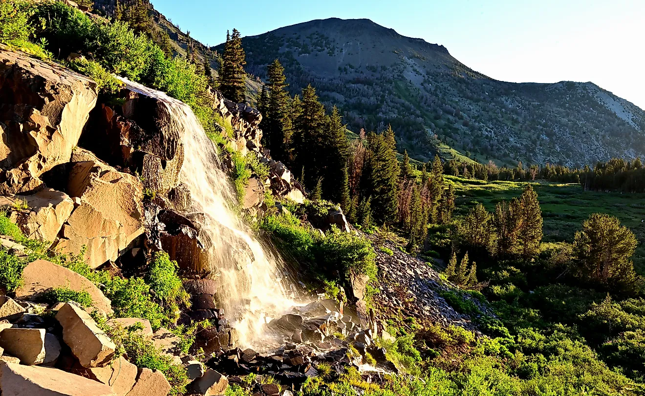
Spring Creek's biggest advantage is geography. The 12-mile Lamoille Canyon Scenic Byway opens about mid-May from the Spring Creek area and climbs through a glacially carved corridor in the Ruby Mountains to a trailhead lot at 8,800 feet. Snowmelt sends waterfalls down the canyon walls through June. Lupine, paintbrush, and Indian-blanket spread across the meadows by early July. Thomas Canyon Campground at 7,200 feet sits along Lamoille Creek partway up the byway with 39 sites managed by Humboldt-Toiyabe National Forest. The Thomas Canyon Trail leaves directly from the campground, passes a series of small waterfalls, and climbs into an alpine basin under the high peaks. Lamoille Creek itself holds brook and wild rainbow trout for fly fishers.
Down the hill, South Fork State Recreation Area at 5,200 feet holds a 1,650-acre reservoir against the Ruby Mountain front. Motorboating, wakeboarding, and water skiing happen in designated areas of the lake. H2Go Watersports rents kayaks and jet skis for visitors without their own gear. Spring Creek Marina, managed by the Spring Creek Association, has a swim area, a fishing dock, and kayak rentals at the reservoir's north end. Bass, catfish, and trout keep serious anglers occupied through peak summer heat.
Baker

Great Basin National Park gives Baker its summer profile. The park spans 77,180 acres with the valley floor at roughly 5,000 feet and Wheeler Peak topping out at 13,063 feet, with bristlecone pine groves on the upper slopes that include some of the oldest living trees on Earth. Wheeler Peak Scenic Drive is the spine of a summer visit. The 12-mile paved road covers about 3,000 feet of vertical climb to 9,890 feet, passing through sagebrush flats, pinyon-juniper woodland, mountain mahogany stands, and dense conifer forest along the way. The park receives fewer than 150,000 visitors a year, which means the trails stay quiet even in July.
The Baker Creek Loop Trail starts at 8,020 feet from the Baker Creek Trailhead. The 3.3-mile route winds through conifer forest and open meadow, gaining about 850 feet over the loop. Wildflowers line the trail through late June and early July. Continuing past the loop reaches Baker Lake at 10,630 feet, an alpine basin set under granite walls. Baker Creek Campground at 7,500 feet holds 37 sites in a pinyon-juniper forest. It stays quieter than Wheeler Peak Campground and connects directly to the Baker Creek trail network from the campsite. Lehman Caves on the lower park slopes adds an underground option, with ranger-led tours through limestone chambers full of shield formations.
Quiet Nevada towns to add to the list
Browse more in our list of cozy Nevada destinations to visit.
Ely

The Nevada Northern Railway Museum is the centerpiece of an Ely summer visit. The National Historic Landmark is widely recognized as the best-preserved standard-gauge short-line railroad in the country, and steam and diesel excursion trains run on scheduled summer dates through the same mining country that once supplied eastern Nevada's copper industry. The Be the Engineer program lets adults aged 18 and over take the throttle on a 14-mile round-trip run, after a few hours of basic railroad operation training, with a working locomotive of their own through sagebrush valleys and mountain foothills.
Cave Lake State Park, fifteen miles east of Ely at 7,300 feet in the Schell Creek Range, holds a 32-acre reservoir stocked with rainbow trout. Kayak, canoe, and paddleboat rentals run out of the marina. Four hiking trails of three to five miles each spread through the surrounding 4,000 acres of backcountry. Ward Charcoal Ovens State Historic Park, south of town, preserves six 30-foot stone kilns built in the 1870s. Visitors can walk inside the ovens, take the 0.9-mile Overlook Trail around Rocky Point Spur, or follow the 2-mile Riparian Loop along Willow Creek, which holds rainbow trout plus naturally reproducing brown and brook trout.
Trip-Planning Notes for Nevada Summer 2026
What links these ten towns is the specific feature each one carries, not a category and not a checklist. The east shore of Lake Tahoe covers swimming, paddlewheel cruises, and the Shakespeare festival on the sand. The Ruby Mountains and the Spring Mountains hold the alpine canyon byways. Lincoln County, the Schell Creek Range, and Great Basin's bristlecone slopes cover the quieter trail networks and OHV systems. Mesquite handles the golf rotation, and the Lake Mead corridor outside Boulder City handles the lake-recreation week. Sort the trip by feature first; the route follows.