Province of Hubei, China
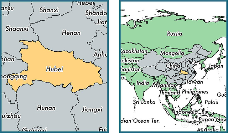
Hubei is a province found in the nation of China. Home to 57,237,740 people, it is the 9th largest division in China in terms of population.
Hubei gained its current status as a province in the year 1949. The government of Hubei is lead by Wang Guosheng and is based in the province capital of Wuhan (Population: 9,785,388).
The most populous cities in Hubei are: Wuhan (Population: 9,785,388), Shiyan (Population: 3,460,000), Huangshi (Population: 688,090), Shashi (Population: 498,780), Yichang (Population: 476,725).
Hubei Province - Quick Facts
| Country | China |
| Region Type | Province |
| ISO Code | CN_42 |
| Time Zone | HKT |
| Year of Establishment | 1949 |
| Capital | Wuhan (Population: 9,785,388) |
| Head of Government | Wang Guosheng |
| Total Population | 57,237,740 |
| Total Area | 185,673 sq km (71,689 sq miles) |
| Population Density | 308.3 sq km (798.4 sq miles) |
This page was last updated on July 24, 2015.