Which Countries Have A Coastline On The Gulf Of Venezuela?
The Gulf of Venezuela, which is also known as Golfo De Venezuela in Spanish, is a kidney-shaped embayment situated at the northwestern tip of South America. It is an inlet of the Caribbean Sea in Columbia and Venezuela. The Gulf of Venezuela separates the Guajira Peninsula to the west which is partly under Venezuelan Sovereignty and partly under Colombian Sovereignty, and the Paraguana Peninsula to the east which is under the sovereignty of Venezuela. It is at the northernmost boundary of both countries.
Geography of the Gulf
The Gulf extends 75 miles from north to south and reaches a maximum width from west to east of 150 miles. It is connected to Lake Maracaibo which is found to the south by the Tablazo Bay as well as a channel that is 35 feet deep near the city of Maracaibo. Little to no cultivation is carried out in the surrounding lowlands, and it mainly serves as a shipping route to the Lake Maracaibo petroleum-producing region.
The Caribbean Sea to the north brings saline water to the embayment while Lake Maracaibo receives fresh water from numerous rivers including the Catatumbo River which is situated close to the southern end of the lake. The water from Lake Maracaibo then flows into the Gulf of Venezuela carrying large loads of sediment. At the point where Catatumbo River meets Lake Maracaibo, environmental conditions allow the production of large quantities of ozone which consequently sparks lighting which lights up the sky for every evening for 160 days or more in a year.
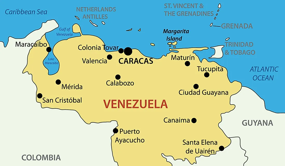
Venezuelan Coastline
Venezuela is roughly triangular and occupies an area of 353,841 square miles. The capital, Caracas, is the primary center for commerce, industry, tourism, and education. The nation is physiographically diverse with the Andean Mountains to the north, interior highlands, parts of Orinoco River Basin with that vast Llanos (plains), the spectacular Angel Falls (the highest waterfall in the world) and Lake Maracaibo.
Colombian Coastline
Colombia occupies an area of 440,831 square miles and has a coastline running 1,000 miles long on the Pacific Ocean and the Caribbean Sea. The majority of the nation's population is mainly concentrated in the mountainous interior. The nation's capital, Bogota, is located in the northern Andes Mountains. The landscape in the western part is dominated by the Andean Cordillera which is among the world’s most magnificent mountain ranges. The Colombian cordilleras are part of the great Andean mountain system.
Border Dispute
There has been a longstanding dispute between Venezuela and Columbia over the Gulf of Venezuela. The dispute resurfaced recently when President Nicolas Maduro established the area as an insular zone of constitutive defense through a decree. In 1987, the dispute nearly led to a military conflict between the two nations when Colombia positioned two Corvettes in the disputed waters, and Venezuela sent troops and F-16 warplanes to the area. The areas in dispute are relatively small in size, but the possibility of oil deposits in the area makes it an area of great importance to both countries.


