Where is the Aravalli Range?
The Aravalli Range is a mountain range located in northwestern India. The range has a length of 430 miles, and stretches from the northern parts of India, near Delhi, passing through Haryana, and ending in Gujarat. The range contains a series of ridges and peaks, which have widths between 6 miles and 60 miles, and elevations that vary between 1,000 ft and 3,000 ft.
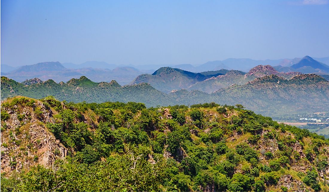
Features of the Aravalli Range
The Aravalli Range is the oldest fold mountain range in India, and its formation dates to when the Indian plate and Eurasian Plate were separated by the ocean. The range was formed during the Precambrian era, during an event known as the Aravalli-Delhi Orogen. Additionally, the Aravalli Range is the southwest-northeast trending orogen, which is situated in the northwestern region of the Indian Peninsula. The range merges two segments of the Earth's crust which make up the Indian craton: the Aravalli Craton and the Bundelkhand Craton. The northern part of the range, which is made up of rocky ridges and isolated hills, extends to Haryana and Delhi, while the southernmost end is located in Palanpur.
Delhi Ridge
The northern extension of the Aravalli Range, which is situated in Delhi, North India, is referred to as Delhi Ridge. This ridge, which is composed of quartzite rocks, stretches from Tughlaqabad to Wazirabad, and passes through South Delhi before terminating in Central Delhi. The ridge protects the city from the hot winds of the deserts in Rajasthan. Delhi Ridge has also made Delhi the world’s second most bird-rich capital city, after Nairobi, Kenya.
Stratigraphic Classification
Stratigraphically, the Aravalli Range is classified into various parts, including the Aravalli Supergroup, Delhi Supergroup, and Archean Bhilwara Gneissic Complex basement, among others. The Aravalli Supergroup divides the Indian state of Rajasthan into two parts: two-fifths of Rajasthan is located on the eastern side, and the remaining three-fifths is located on the western side. The Archean Bhilwara Gneissic Complex basement creates the rocky base for both the Aravalli and Delhi Supergroups.
Highest Peak
The highest peak in the range is Guru Shikhar, which is located on Mount Arbuda and has an elevation of 5,650 ft. The peak is situated in Rajasthan, about 9.3 miles from Mount Abu. Also known as the "peak of the guru," Guru Shikhar is named after Dattatreya, often considered to be a Hindu deity, and there is a cave located on the summit with a temple dedicated to him.
Rivers
Three main rivers flow through the Aravalli range: the Luni, Sahibi, and Chambal. The Luni River stretches from the Pushkar Valley to the Rann of Kutch, while the Sahibi and Chambal rivers are branches of the Yamuna. The north-south flowing rivers, like the Luni, start from the western slopes of the range in Rajasthan and flow to Gujarat, through the southeastern part of the Thar Desert. The west-northwest flowing rivers rise from Rajasthan and flow through the Shekhawati region before draining into southern Haryana. The Sahibi River originates near Manoharpur and passes through Haryana to Delhi, where it merges with the Yamuna. The west-northeast flowing rivers, like the Chambal, originate from the eastern side of the range, in Rajasthan, and stretch to the Yamuna.
Mining
The mining of metals like copper in the Aravalli range dates back to the 5th century during the Sothi-Siswal era. The ancient Kunal, Haryana, and Kalibangan settlements mined copper from the region.


