Cumberland Plateau
- The Cumberland Plateau is the world’s longest plateau of hardwood forest, measuring 40 to 50 miles long.
- Fifty eight of the species living the plateau are considered threatened or endangered.
- The plateau is mainly sandstone, and is underlain with limestone and coal deposits.
The Cumberland Plateau is located within the Appalachian Mountains - specifically in the Appalachian Plateau. This area is the world’s longest plateau of hardwood forest, measuring 65 to 80 kilometers wide, which is equal to 40 to 50 miles. It runs through a large portion of Kentucky and Tennessee, as well as smaller sections of northern Alabama and Georgia.
Geography

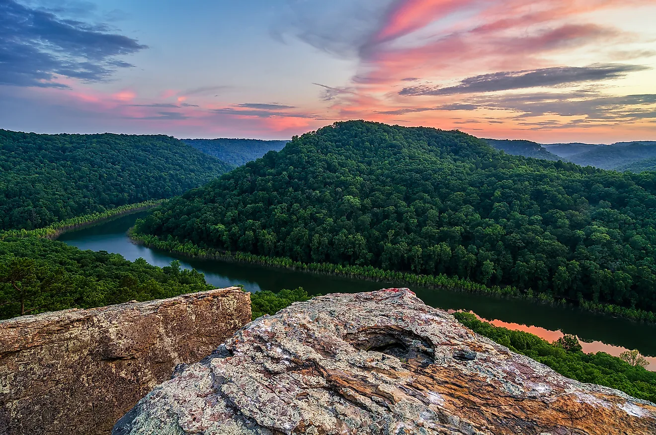
Though the region is a plateau, it is not all together flat, and is in fact a highly dissected area. The Cumberland and Kentucky rivers cut through much of the plateau, as well as tributaries from the Tennessee River. The dissections run throughout the plateau, cutting into the high ground with relief of approximately 120 meters, or 400 feet, on average. This river-erosion-based phenomenon means the region has many bluffs and sandstone outcroppings. Gorges, rock bridges and waterfalls are also common in the area, as the plateau rises to a ridge along the Pottsville Escarpment, Highland Rim and Walden Ridge.
The Cumberland Plateau is also cut by Sequatchie Valley, which runs mainly through Tennessee and into Alabama. On the other side of the valley is Sound Mountain, another sandstone plateau. While the plateau rises and falls with ridges and outcroppings, the highest portion of the plateau is the ridge along the eastern border, through Kentucky and Tennessee, which is known as the Cumberland Mountain. This ridge, or ‘mountain,’ is approximately 225 kilometers long, or 140 miles, and has a height ranging from 600 meters (2,000 feet), to 1,263 meters, or 4,145 feet at its highest peak which is referred to as Big Black Mountain.
Natural Resources

While the plateau itself is mainly sandstone, it is underlain with a number of other minerals like limestone and coal. All three of these natural resources are used for human industry and development. Limestone is most commonly used in the compound for concrete, while coal is mined for fuel.
Hardwood Forests
The area is also rich in hardwood trees, specifically within the Jefferson national forests of Kentucky, and the Daniel Boone. Due to the dissected nature of the plateau, forested areas are often cut off from one another, meaning pockets of different species occur in a similar area. The most common tree species in the area include oak, various types of pine trees, and hickory. All of these species thrive in the drier soils of the plateau.

Wildlife
A variety of different species call the Cumberland Plateau home. Unfortunately 58 of these species are considered threatened or endangered, and conservation efforts have been put in place to try and protect those animals at risk.
Some of the at risk species in the area include birds such as the red coackaded woodpecker and the vermillion darter - both listed as endangered species - as well as the pine warbler, and bob white quail. Other more common species include the wihte tailed deer, white-footed mouse, eastern cotton-tailed rabbit, and the southern flying squirrel. There are also a number of amphibious creatures like the black warrior waterdog, and the hellbender salamander.


