Maps of Michigan
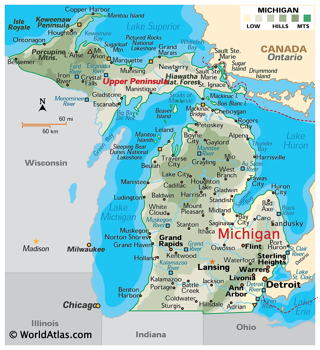
Michigan is situated in the East North Central region of the United States. It is unique among states for being divided into two peninsulas, the Upper and the Lower, connected by the five-mile Mackinac Bridge across the Straits of Mackinac. The state borders four of the five Great Lakes—Michigan, Erie, Huron, and Superior—and shares land borders with Ohio, Wisconsin, Indiana, and Ontario, Canada. Additionally, it has Great Lakes water boundaries with Minnesota and Illinois.
Michigan, known as the Wolverine State, the Great Lakes State, and the Mitten State, is governed from Lansing, its capital with approximately 114,000 residents. Detroit, the birthplace of the American auto industry, is the largest city, with about 645,000 inhabitants.
Area
Michigan covers approximately 96,713 sq mi (250,487 sq km), making it the 11th largest state by total area. However, this figure can be misleading because its land area alone would place it only 22nd among states. The difference is primarily due to the extensive Great Lakes waters within its jurisdiction. Michigan's size is about half that of Italy and five times that of Maryland. The state is divided into six main topographic regions, with two in the Upper Peninsula and four in the Lower Peninsula.
The Upper Peninsula
Superior Upland
Known as the Crystalline Upland, this region covers the western part of the Upper Peninsula. Its rugged terrain, composed of exposed crystalline rock, was formed by ancient lava flows and shaped further by glaciers. It also features Michigan's highest peak, Mount Arvon, standing at 1,979 ft (603 m).
Eastern Upper Peninsula Lowlands

The eastern part of the Upper Peninsula is generally flatter, featuring numerous wetlands, wildlife refuges, and forests managed by state and national authorities. Notable sights include Tahquamenon Falls, one of the largest waterfalls east of the Mississippi River, as well as Pictured Rocks National Lakeshore and the dunes at Grand Marais. Additionally, the St. Marys River serves as part of the border between the United States and Canada.
The Lower Peninsula
Eastern Lower Peninsula Lowlands
This region surrounds Saginaw Bay in the southeast, once shaped by glacial lakes and now featuring wetlands and flat, fertile plains. The Saginaw River runs through the area before draining into Lake Huron.
Hilly Moraines
The southernmost region of the state consists of a series of moraines—ridges of sediment left by retreating glaciers—spread 10 to 25 miles apart. This creates a rolling landscape of hills and flats that is extensively farmland.
High Plains and Moraines
At the northern tip of the Lower Peninsula, this area features sandier soils and larger, more prominent moraines than the southern parts. Its gently rolling hills attract visitors throughout the year for winter skiing and summer golf.
Beaches and Dunes

Along the Lake Michigan shore, strong winds have piled lake sand into towering dunes, most famously at Sleeping Bear Dunes National Lakeshore. Some stretches are cloaked in low forest, while others stand high and bare. Dune grass and trees anchor much of the sand, though erosion is cyclical and the dunes shift in size year by year.
Major Bodies of Water

Michigan is bordered by four of the Great Lakes, giving it the longest freshwater coastline in the U.S. at approximately 3,288 miles (5,292 km). Lake Superior, the largest and deepest of the Great Lakes, borders the northern Upper Peninsula; Lake Michigan lies west of the Lower Peninsula; Lake Huron is to the east; and Lake Erie touches the southeastern corner. The state is home to over 300 named rivers. The Detroit River provides drinking water to millions and handles substantial shipping traffic between the U.S. and Canada, while the St. Marys River in the Upper Peninsula serves as a key cargo route. The Grand River, at 252 miles (406 km), is Michigan’s longest, and the Tahquamenon River, which is shorter, feeds the falls sharing its name.
Counties Map
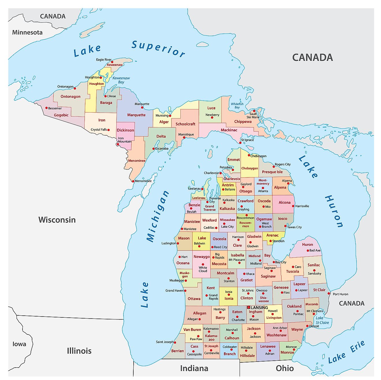
Michigan is divided into 83 counties. In alphabetical order, the counties are: Alcona, Alger, Allegan, Alpena, Antrim, Arenac, Baraga, Barry, Bay, Benzie, Berrien, Branch, Calhoun, Cass, Charlevoix, Cheboygan, Chippewa, Clare, Clinton, Crawford, Delta, Dickinson, Eaton, Emmet, Genesee, Gladwin, Gogebic, Grand Traverse, Gratiot, Hillsdale, Houghton, Huron, Ingham, Ionia, Iosco, Iron, Isabella, Jackson, Kalamazoo, Kalkaska, Kent, Keweenaw, Lake, Lapeer, Leelanau, Lenawee, Livingston, Luce, Mackinac, Macomb, Manistee, Marquette, Mason, Mecosta, Menominee, Midland, Missaukee, Monroe, Montcalm, Montmorency, Muskegon, Newaygo, Oakland, Oceana, Ogemaw, Ontonagon, Osceola, Oscoda, Otsego, Ottawa, Presque Isle, Roscommon, Saginaw, Saint Clair, Saint Joseph, Sanilac, Schoolcraft, Shiawassee, Tuscola, Van Buren, Washtenaw, Wayne, Wexford.
With an area of 250,493 sq. km, Michigan is the 11th largest and the 10th most populous state in the USA. Located in the south-central part of the state’s Lower Peninsula, at the meeting point of the Grand and Red Cedar Rivers is, Lansing – the capital city of Michigan. It serves as an industrial hub for the production of automobiles and associated parts as well as other industries like textiles, glass, and metal products. It also hosts the headquarters of several insurance companies and offices of various technology firms. Situated in the southeastern part of the state along the Detroit River is Detroit – the largest and the most populous city in Michigan. It also serves as the state’s major cultural center and its chief port.
Where is Michigan?
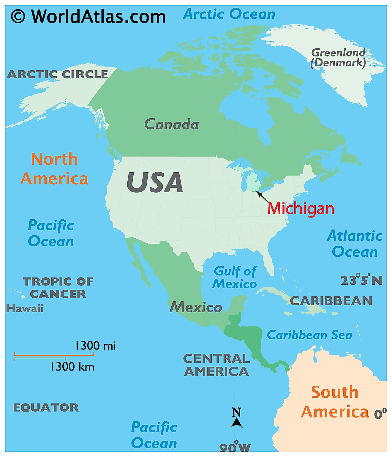
The State of Michigan is located in the Great Lakes and Midwest region of the United States. Michigan is bordered by the states of Ohio and Indiana in the south; by Illinois, Wisconsin, and Lake Michigan in the west; by Wisconsin, Minnesota, and Lake Superior in the northwest and by the Canadian province of Ontario, Lake Huron, and Lake Erie in the north and east.
Regional Maps: Map of North America
Outline Map of Michigan
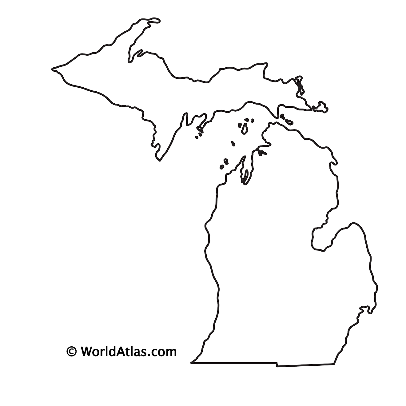
The above blank map represents the State of Michigan, located in the Great Lakes and Midwest region of the United States. The above map can be downloaded, printed and used for geography education purposes like map-pointing and coloring activities.
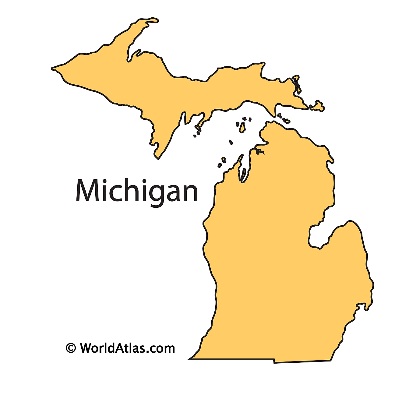
The above outline map represents the State of Michigan, located in the Great Lakes and Midwest region of the United States. Michigan has been nicknamed as the "Wolverine State" and it is the only U.S. State bordering four of the five Great Lakes.
Key Facts
| Legal Name | State of Michigan |
|---|---|
| ISO 3166 Code | US-MI |
| Capital City | Lansing |
| Major Cities |
|
This page was last updated on August 21, 2026


