Maps of South Africa

South Africa, a country located at the southernmost tip of Africa, shares its borders with six countries as well as the Indian and Atlantic Oceans. Namibia lies to the northwest, Botswana to the north, and Zimbabwe, Mozambique, and Eswatini (Swaziland) to the northeast. A completely enclosed sovereign state, Lesotho, lies within its interior. The total area of South Africa amounts to 1,221,037 km2 (471,445 mi2).
The country's coastal borders extend for more than 2,800 km (1,770 mi) along the southwestern edge of the African continent. The Indian Ocean lies to the southeast and the Atlantic Ocean to the southwest. Where these two oceans converge, the warm Agulhas current from the Indian Ocean mixes with the cool Benguela current from the Atlantic, along the ecologically rich, fluctuating, Agulhas Front.
Notable Landmarks: Table Mountain is a notable geographical landmark in South Africa. It is a flat-topped mountain that is part of the Table Mountain National Park. It overlooks the city of Cape Town on the southwestern coast and it attracts many visitors. Additionally, a notable example of South African terrain and wildlife is exhibited by Kruger National Park, a 19,623 km2 (7,576 mi2) game reserve in the northeastern corner of the country.The Highveld, a plateau region in the interior, sits at an elevation of about 1,200 m (3,937 ft). It tapers off to the Bushveld towards the north, which extends into the Limpopo River basin. The Lowveld, another major geographical area, rests to the northeast of the Highveld.
The Eastern Highlands run along the edge of the Highveld, featuring notable mountain ranges like the Drakensberg. These mountains include some of the highest peaks in Africa south of Kilimanjaro, with heights reaching up to 3,482 m (11.423 feet).
The Western Cape, meanwhile, has the Cape Fold Mountains, creating a series of parallel ranges that run east-west along the coast. This region features the Fynbos biome, which includes a large proportion of endemic plant species.Bodies of Water: In terms of water bodies, the country has few natural lakes, but an extensive system of reservoirs and dams, like the Gariep Dam on the Orange River, the largest in the country. Additionally, South Africa's eastern coast is dotted with estuaries, which play an essential role in local ecosystems, contributing to biodiversity and serving as nurseries for several species of fish.
Several significant rivers flow across the country's expanse. The largest, the Orange River, stretches about 2,200 km (1,367 mi), originating from the Drakensberg Mountains and meandering westwards to discharge into the Atlantic Ocean. Other crucial rivers include the Limpopo, serving as a border between South Africa and Zimbabwe, and the Vaal, a significant tributary of the Orange River and an essential water source for the densely populated Gauteng province.
South Africa is not typically known for its islands; however, it has a few of significance. Robben Island, just off the coast of Cape Town, holds immense historical value as the location where Nelson Mandela and other anti-apartheid activists were imprisoned; it is now a UNESCO World Heritage Site. The Prince Edward Islands, a pair of sub-Antarctic islands in the Indian Ocean, are another notable group. Marion Island, the larger of the two, is the site of a meteorological and biological research station.
Provinces of South Africa Map

South Africa is divided into nine provinces as shown on the political map above. These are Eastern Cape, Free State, Gauteng, KwaZulu-Natal, Limpopo, Mpumalanga, Northern Cape, North West, and Western Cape. The provinces are further divided into metropolitan and district municipalities. The latter is further sectioned into local municipalities. All municipalities are divided int still smaller units called wards.
With an area of 372,889 sq. km, Northern Cape is South Africa's largest province while Gauteng is the most populous one.
The country has three capital cities. Pretoria, Cape Town, and Bloemfontein served as the executive, legislative, and judicial capitals of the country respectively. Johannesburg is the country's largest city.
Where is South Africa?

Africa's southernmost country, South Africa, is located in the Southern and Eastern Hemispheres of the world. It is also the Eastern Hemisphere's southernmost mainland country. South Africa shares a border with six countries. It surrounds the enclaved country of Lesotho. Namibia, Zimbabwe, and Botswana border it to the north. Mozambique and Eswatini border it to the east and northeast, respectively. South Africa has coastlines on both the Atlantic Ocean and the Indian Ocean to the south.
South Africa Bordering Countries: Namibia, Mozambique, Zimbabwe, Botswana, Lesotho, Eswatini.
Regional Maps: Map of Africa
Outline Map of South Africa

The blank outline map represents mainland South Africa. The country also has several oceanic islands thats cannot be observed on this map. The above map can be downloaded for free, and used for educational purposes like map-pointing activities. The enclave of Lesotho can be marked on the blank map of the country.

The outline map represents the mainland territory of South Africa. The country also has several islands on the Atlantic and Indian Oceans.
Key Facts
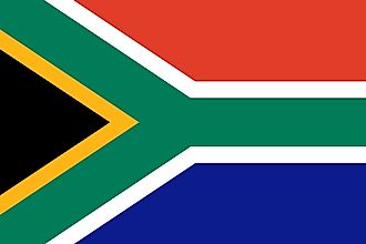
| Legal Name | Republic of South Africa |
|---|---|
| Flag |
|
| Capital City | Pretoria (administrative capital); Cape Town (legislative capital); Bloemfontein (judicial capital) |
| 25 42 S, 28 13 E | |
| Total Area | 1,219,090.00 km2 |
| Land Area | 1,214,470.00 km2 |
| Water Area | 4,620.00 km2 |
| Population | 58,558,270 |
| Major Cities |
|
| Currency | Rand (ZAR) |
| GDP | $351.43 Billion |
| GDP Per Capita | $6,001.40 |
This page was last updated on July 11, 2023