Hispaniola
The island of Hispaniola forms a part of the Greater Antilles group of islands in the Caribbean Sea. Covering a total area of about 76,192 km2, Hispaniola is the second-largest and the most populous island in the Caribbean region. The eastern portion of Hispaniola (about 48,445 km2) is occupied by the Dominican Republic, whereas the western portion of the island (about, 27,750 km2) is occupied by the Republic of Haiti.
Hispaniola is separated from the large island of Cuba in the northwest by the 80 km-wide Windward Passage. The 190 km-wide Jamaica Channel separates Hispaniola from the island nation of Jamaica in the southwest, while the 130 km-wide Mona Passage in the east separates the island from Puerto Rico. The Commonwealth of The Bahamas and the British Overseas Territory of Turks and Caicos is located to the north of the island of Hispaniola.
Geography

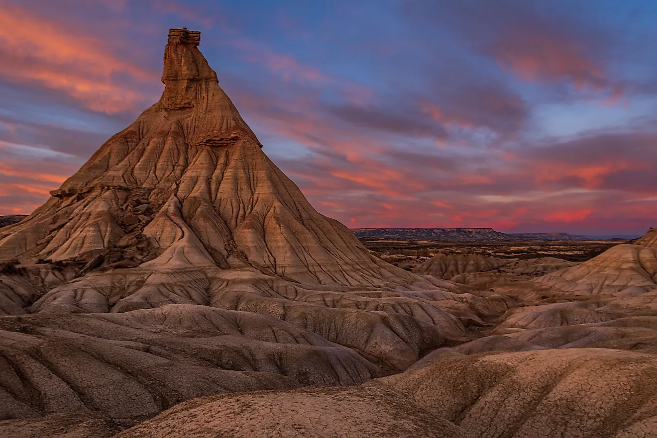
Hispaniola is about 650 km in length and has a maximum width of 241 km. There are five principal mountain ranges on the island beginning with the Cordillera Central or the Central Range which spans across the heart of Hispaniola Island. The Cordillera Central is also referred to as Massif du Nord in Haiti. Located in the Cordillera Central is Pico Duarte, which rises to an elevation of 3,098 m and is the highest point in the Dominican Republic as well as in the entire Caribbean region. Running parallelly to the Cordillera Central is the Cordillera Septentrional which extends into the Atlantic Ocean as the Samaná Peninsula. The two mountain ranges are separated by the Cibao Valley and the Atlantic coastal plains. The Cordillera Oriental is located in the eastern part of the Dominican Republic.
Running parallelly to the Cordillera Central is the Sierra de Neiba which rises in the southwestern part of the Dominican Republic and continues into Haiti as the Chaine des Matheux, Montagnes Noires and Montagnes du Trou d’Eau. Located between the Montagnes Noires and Massif du Nord is the Plateau Central, whereas the Plaine de l’Artibonite is situated between the Chaine des Matheux and the Montagnes Noires.
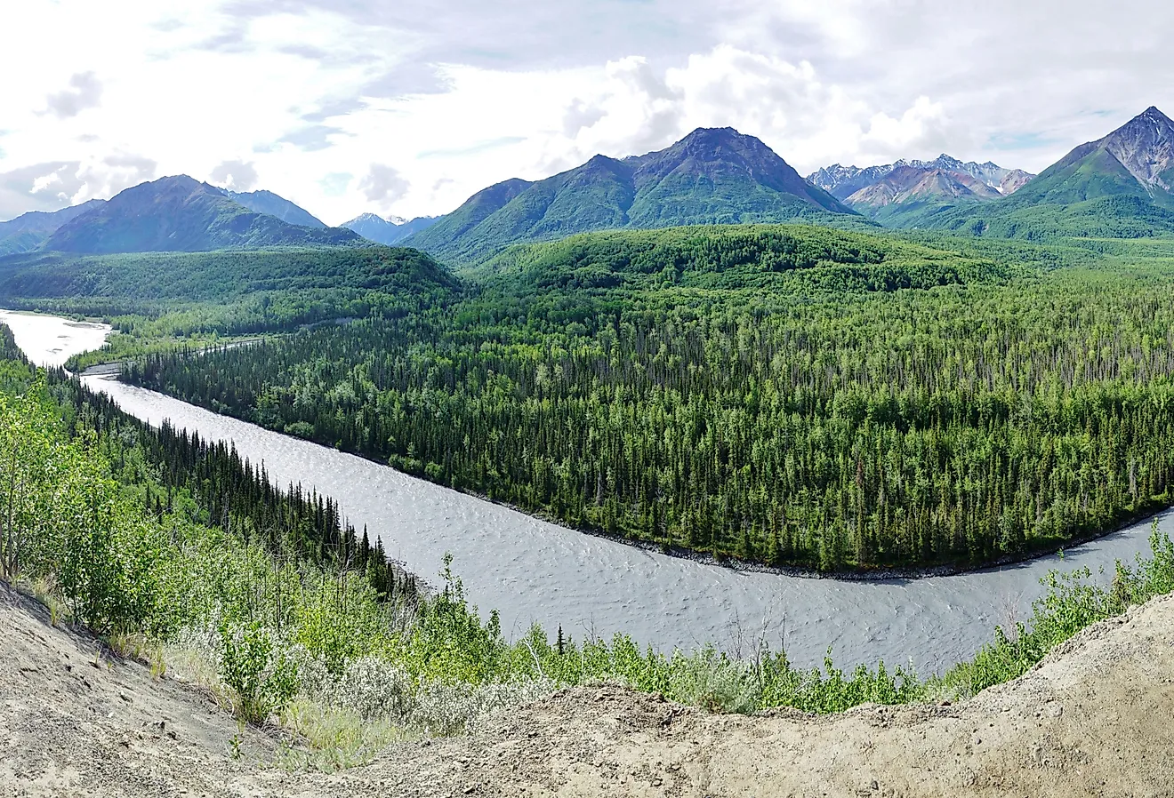
The southern mountain range known as the Sierra de Bahoruco in the Dominican Republic continues into Haiti as Massif de la Hotte and Massif de la Selle. Pic de la Selle, which rises to an elevation of 2,680 m, is the highest point in the Republic of Haiti and the third-highest point in the Antilles. Located between the southern range and Chaine des Matheux-Sierra de Neiba is a fertile lowland referred to as Plaine du Cul-de-Sac. Many salt lakes are located here including Lake Enriquillo in the Dominican Republic and Lake Azuei in the Republic of Haiti. The notable rivers on the Hispaniola island include the Artibonite in Haiti and the Yuna, Yaque del Sur, and the Yaque del Norte rivers in the Dominican Republic.
Wildlife

The island of Hispaniola features four distinct ecoregions. These are the Hispaniolan moist forests in the northern and eastern parts; the Hispaniolan dry forests in the central, southern, and western parts; the Hispaniolan pine forests in the mountainous areas; and the flooded grasslands and savannas in the south-central part of the island.
Numerous endemic species belong to different faunal groups including invertebrates, insects, amphibians, reptiles, birds, and mammals are found on Hispaniola island. The Hispaniolan hutia is a significant endemic mammal that is found on the island.
Brief History

It is believed that Hispaniola was originally inhabited by the Indigenous Taíno people who arrived on the island around 1200 CE. On December 6, 1492, the Italian explorer Christopher Columbus first landed on the Hispaniola island and named it La Isla Española, or "the Spanish Island." During the Spanish colonial times, the island’s strategic location in the northern part of the Caribbean Sea provided for a major launching base for the Spanish conquest of the Caribbean and the American mainland. In 1496, the city of Santo Domingo was founded by the Spanish on the eastern bank of the Ozama River. Subsequently, disease and slavery were introduced on the island by the Spanish conquerors and caused the eventual destruction of the indigenous inhabitants. In the 17th century, the French established a colony on the island and named it Saint-Domingue. Through the Treaty of Ryswick in 1697, Spain ceded the western third of Hispaniola to France. This part became the Republic of Haiti after gaining independence in 1804.
Through the Treaty of Basel in 1795, the eastern two-thirds of Hispaniola was handed over to France by Spain. After gaining complete independence in 1844, this part of the island became the Dominican Republic.