Maps of Macedonia

North Macedonia covers an area of 25,713 sq. km in Southeast Europe.
As observed on the physical map of the country above, Macedonia is an elevated plateau of large, rolling hills and deep valleys, completely dissected and surrounded by mountains like the Sar Mountains, Osogovski Mountains, Malesevski Mountains, Nidze Mountains and others.
The Dinaric Alps extend down into the country, and the highest point is in the Korab Mountain range, at 9,066 ft (2,764m). The yellow upright triangle marks the position of the highest peak on the map above.
Although a landlocked country, Macedonia is home to 1,100 considerably sized water sources. Major lakes include Ohrid, Prespa (both shared with Albania) and Doiran. Lake Ohrid is the deepest lake in the Balkans (935 ft.), and is regarded as the oldest in the world.
As shown on the map, the Vardar River divides the country, flowing on through Greece, and is a major river for Macedonia. Other rivers of note include the Bregalnica and Crna.
At 50 m above sea level, the Vardar River has the lowest point in the country.
Municipalities of North Macedonia Map

North Macedonia (officially, the Republic of North Macedonia) is divided into 80 municipalities (opstini, singular - opstina) and 1 city (grad).
Situated in the northern part of the country in the heart of the Balkan Peninsula is, Skopje – the capital, the largest and the most populous city of North Macedonia. It is also the chief administrative, cultural, educational and economic center of the country.
Where is Macedonia?

North Macedonia is a landlocked nation situated in the south eastern region of the European continent. It is positioned in the Northern and Eastern hemispheres of the earth. North Macedonia is bordered by 5 nations: by Serbia in the north; by Kosovo in the northwest; by Bulgaria in the east; by Albania in the west and by Greece in the south.
Macedonia Bordering Countries: Albania, Greece, Bulgaria, Serbia.
Regional Maps: Map of Europe
Outline Map of Macedonia


Key Facts
| Legal Name | Republic of North Macedonia |
|---|---|
| Flag |
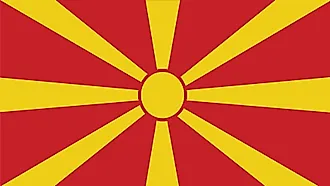
|
| Capital City | Skopje |
| 42 00 N, 21 26 E | |
| Total Area | 25,713.00 km2 |
| Land Area | 25,433.00 km2 |
| Water Area | 280.00 km2 |
| Population | 2,083,459 |
| Largest City |
Skopje (611,107) |
| Currency | Macedonian denars (MKD) |
| GDP | $12.69 Billion |
| GDP Per Capita | $6,093.15 |
This page was last updated on February 24, 2021