Canary Islands
The Atlantic Ocean has numerous islands and archipelagos spread across its waters. The Canary Islands is one of the Atlantic Ocean's island groups. The archipelago is a Spanish territory and is its southernmost autonomous community. It comprises the Santa Cruz de Tenerife and Las Palmas provinces, with Las Palmas de Gran Canaria and Santa Cruz de Tenerife cities as the islands’ capitals. Some of the largest islands in the archipelago are Lanzarote, Fuerteventura, Gran Canaria, and Tenerife.
Contents
Where Are The Canary Islands?

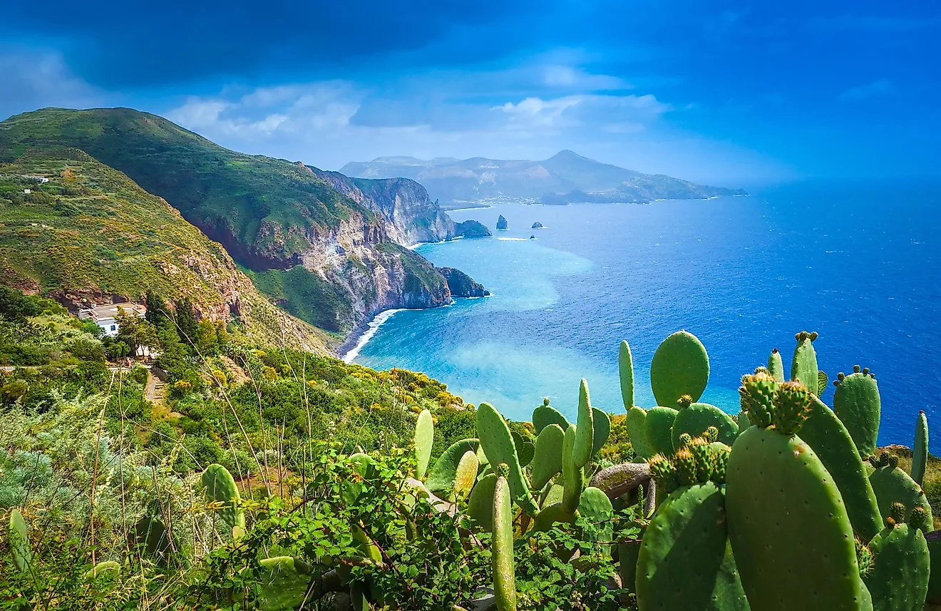
The Canary Islands are located in the Macaronesia region of the North Atlantic Ocean. The island group is on the west coast of continental Africa, approximately 100 km from Morocco and southwest of Spain. The archipelago is approximately 1,300 km southeast of Gibraltar. Geographically, the archipelago is part of continental Africa, but politically and economically it is part of Europe. The islands’ location in the Atlantic Ocean and their proximity to four continents (Africa, Europe, and the Americas) make them a popular tourist destination.
Geography

The Canary Islands is Macaronesia’s largest and most populated archipelago. The archipelago comprises seven major islands and numerous other minor islands or islets, divided into two groups depending on their geographical location. The western group consists of La Palma, Tenerife, La Gomera, Gran Canaria, and Ferro. This group is made up of mountain peaks rising directly from the deep seabed. The eastern island group comprises Fuerteventura, Lanzarote, and six islets (the Chinijo Archipelago) that all sit on an underwater plateau, the Canary Ridge. All the western islands are at least 1,200 m at their highest points. The highest point in Spain, Teide Peak, located on Tenerife, rises to 3,718 m.
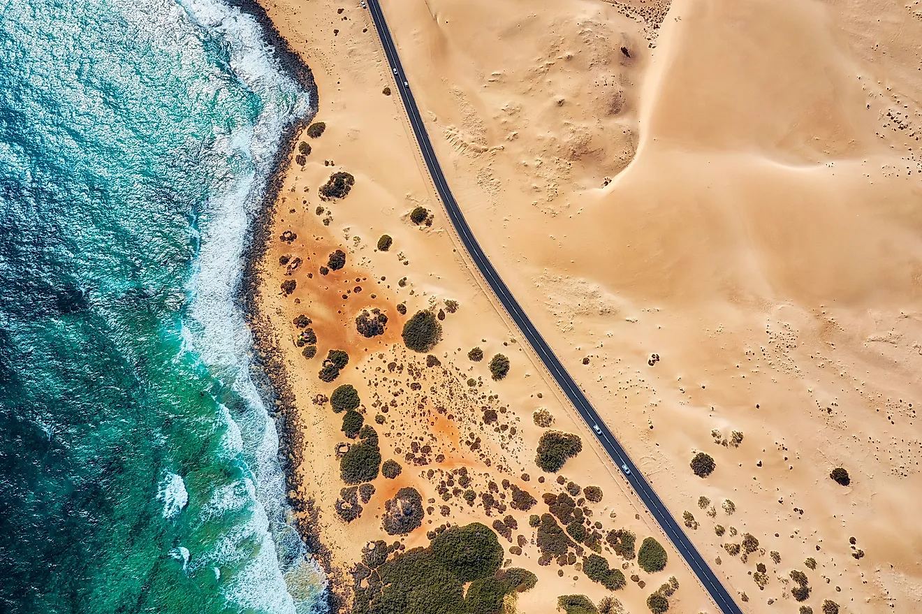
The Canary Islands formed millions of years ago through volcanic eruption, and some of the volcanoes are still active. The archipelago is the only Spanish region where a volcanic eruption has taken place in the modern era. Four islands, Tenerife, Lanzarote, El Hierro, and La Palma, have had eruptions since their European discovery. Most beaches along the Canaries have black sand due to their volcanic composition.
The Canary Islands’ climate is described as desertic and tropical, moderated by trade winds and the surrounding sea. Different regions also experience microclimates, but the archipelago mainly experiences a hot desert climate, characterized by warm temperatures, with little or no seasonal variations. The yearly average high is 25 °C (76 °F), with August as the hottest month and January as the coldest month. The region receives an average annual precipitation of 151 mm.
Major Islands

The Canary Archipelago comprises seven main islands, one smaller island, and several islets and rocks. La Graciosa is a small island located in the Chinijo Archipelago, approximately 2 km north of Lanzarote Island. It covers approximately 29 km2 and is home to over 700 people. The island is within the Chinijo Archipelago Natural Park.
Tenerife is the largest island of the Canary Archipelago, spanning 2,034 km2. It is the second-largest island in Spain after Mallorca Island in the Balearic Archipelago. It is also Spain’s most populated island, with close to 917,000 inhabitants. The Canary Islands’ capital, Santa Cruz de Tenerife, is located on the island. Tenerife also hosts Teide, Spain’s highest point.
Fuerteventura is the archipelago's second-largest island, spanning 1,659 km2. It is designated a UNESCO Biosphere Reserve, preserving one of only two surviving Canarian Egyptian vulture populations. The other Canarian Egyptian vulture population is on Lanzarote Island. Fuerteventura is home to about 117,000 people.
Gran Canaria is the third-largest island of the Canary Archipelago, covering 1,560 km2. It is also Spain’s third most populous island, with 851,000 inhabitants. Its capital, Las Palmas, is also Canary’s capital, alongside Santa Cruz de Tenerife. Gran Canaria is also home to some high peaks, including Roque Nublo and Pico de las Nieves.
The other major Canary Islands are Lanzarote (846 km2), La Palma (708 km2), La Gomera (370 km2), and El Hierro (269 km2). Some of the archipelago’s islets are Roque del Oeste, Roque del Este, Montaña Clara, and Alegranza.
Brief History

The islands were discovered for the Western world by King Juba II in the first century BCE, who is reported to have found the islands uninhabited but bearing traces of previous human settlement. In the late Middle Ages, the Europeans began exploring the islands, encountering several Indigenous peoples. The Guanche and Canario peoples that the Europeans encountered likely shared their origins with the Berber peoples of North Africa. In the 14th century, explorers from Portugal, Mallorca, and Genoa visited the islands frequently.
In the early 15th century, the Castilians began their conquest of the Canaries. Lanzarote was the first island to be conquered, followed by Fuerteventura. After the successful Castilian conquest, the Castilians imposed several measures, including single-crop cultivation. Several cities, such as Las Palmas and Santa Cruz de Tenerife were established as important stopovers for Spanish conquistadors heading to the New World. In the 17th and 18th centuries, Barbary pirates attacked and took captive several islanders, mostly in La Gomera and Lanzarote.
Today, the archipelago is home to close to 2.2 million people, representing about 4.5% of Spain’s population. The region has a population density of 290 people per km2. Tenerife is the most populated island, with 918,000 people, followed by Gran Canaria with 851,000 people. Lanzarote and Fuerteventura have at least 110,000 people each, while the other three islands have a combined population of about 115,000 people. About 383,000 people live in Las Palmas, while Santa Cruz de Tenerife is home to about 207,000 people.
Economy

The Canary Islands’ economy largely depends on tourism, which accounts for about 30% of the region’s GDP. About 12 million tourists visit the Canaries annually. The islands’ major attractions are the beaches and climate, while the chief attraction is Teide National Park. The main exports from the islands are tobacco and banana, with Europe and the Americas as the main market. The archipelago’s GDP was valued at €45.72 million in 2018 and has experienced tremendous growth since the 1980s, with the GDP having doubled between 1990 and 2018. Foreign direct investment, especially in tourist hotels, and European funds were the main economic drivers during this period.
There are eight airports on the Canary Archipelago, with Gran Canaria Airport as the largest airport. Two airports, Tenerife South and Tenerife North Airports, are located on Tenerife Island. Besides airports, two of Spain’s main ports are on the Canaries. Las Palmas port is a major freight port, while Santa Cruz port is a major fishing port. Tenerife Tram connects Santa Cruz de Tenerife and San Cristóbal.
Wildlife

Before the first inhabitants settled on the islands, endemic animals such as giant lizards, giant rats, and giant tortoises roamed freely on the islands. The archipelago has a wide range of habitats that support various animal species. Some of the endemic bird species on the islands include the black-bellied sandgrouse, Tenerife goldcrest, plain swift, and Bolle’s pigeon. Other terrestrial wildlife includes wall lizards, geckos, the El Hierro giant lizard, and Salmor giant lizard. Fish species include ray, shark, jack grunt, and triggerfish. There are at least five marine turtles, including the loggerhead sea turtle.